Illinois, Missouri and Indiana in the Bullseye Tuesday: Enhanced Risk Signals Potential for Tornadoes, Giant Hail and Destructive Winds
ILLINOIS — A potentially dangerous severe weather setup is taking shape for Tuesday across Illinois, eastern Missouri, and western Indiana, where forecasters warn that all severe hazards could be on the table.
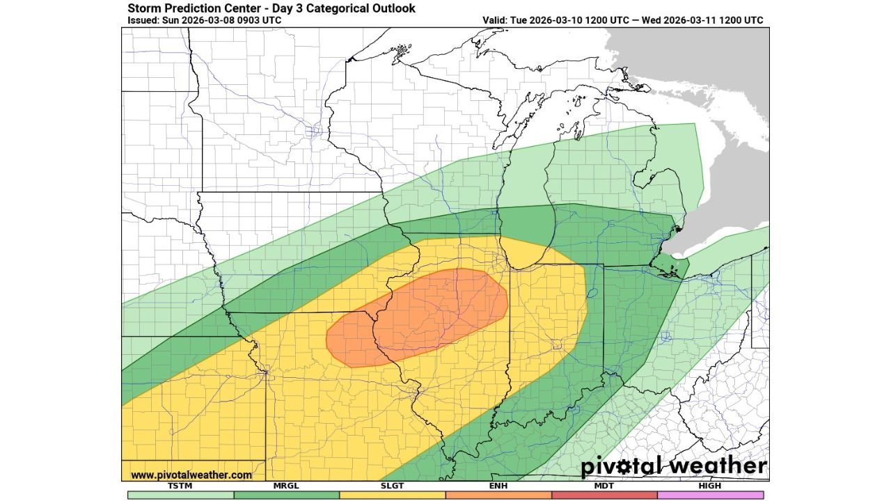
The Storm Prediction Center’s Day 3 outlook places a broad swath of the Midwest under a severe risk area, with an enhanced risk zone centered over central and eastern Missouri into much of Illinois, including areas near:
- St. Louis, Missouri
- Springfield, Illinois
- Peoria, Illinois
- Champaign, Illinois
- Decatur, Illinois
- Into western Indiana
Enhanced Risk Signals Higher-End Potential
The categorical outlook highlights an enhanced risk (Level 3 of 5) across much of Illinois and eastern Missouri. Surrounding this area is a larger slight risk extending into:
- Indiana
- Southern Wisconsin
- Lower Michigan
- Portions of Kentucky
Probability maps indicate a concentrated corridor where severe storms are more likely, suggesting a focused area where the atmosphere may become primed for organized, intense thunderstorms.
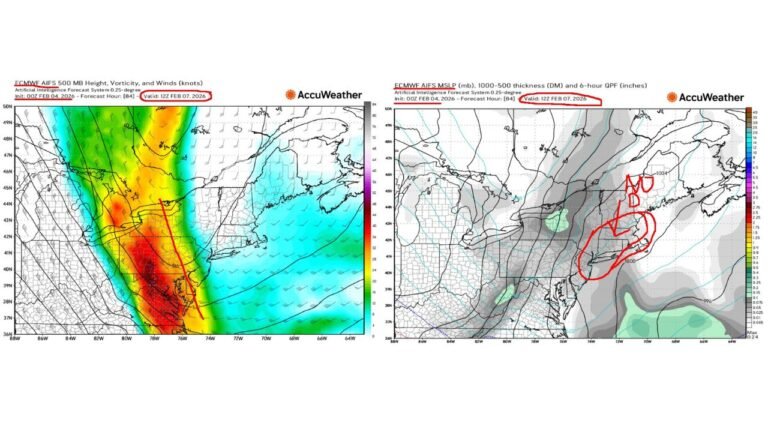
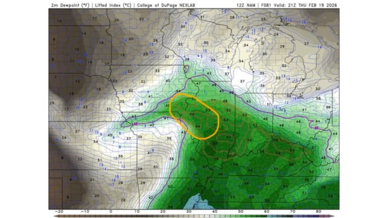
Ingredients Coming Together
Model data shows strong instability building across the region Tuesday afternoon, with high surface-based CAPE values expanding into:
- Central and southern Illinois
- Eastern Missouri
- Western Indiana
This surge of instability, combined with strong wind shear, supports the potential for rotating supercells.
Simulated reflectivity guidance shows discrete storms developing ahead of a broader line, particularly across Missouri into Illinois during the afternoon and early evening.
If storms remain isolated before merging into a line, the tornado threat could become more pronounced.
All Severe Hazards Possible
Forecasters caution that all modes of severe weather are possible, including:
- Tornadoes
- Very large hail
- Damaging straight-line winds
The enhanced probability zone suggests a corridor where stronger tornadoes cannot be ruled out if storm structure and timing align.
Timing and What to Expect
Storms are expected to develop Tuesday afternoon and intensify into the evening as they track northeast across Illinois and into Indiana and Michigan.
The highest risk window appears to be from mid-afternoon through the evening hours, when atmospheric instability peaks.
Residents across Illinois, particularly from the St. Louis metro northeast through central Illinois, should prepare for rapidly changing weather conditions.
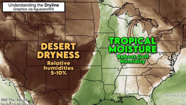
Why This Setup Stands Out
What makes this system notable is the overlap of:
- Strong instability
- Deep-layer wind shear
- A defined surface boundary
- Favorable storm mode signals
When these ingredients align across the Midwest in March, significant severe weather events can occur.
Bottom Line
Illinois appears to be in the bullseye Tuesday for a potentially high-impact severe weather event. Eastern Missouri and western Indiana are also in the zone for intense thunderstorms capable of producing tornadoes, large hail, and destructive winds.
While fine details will continue to evolve, this setup warrants close attention over the next 48 hours.
CabarrusWeekly.com will continue monitoring forecast updates as confidence increases and timing becomes clearer.