Texas, Oklahoma, Kansas, Missouri and Illinois Brace for Multi-Day Severe Weather Stretch as Jet Stream Powers Plains to Midwest Storm Track
UNITED STATES — Confidence is rapidly increasing in what could become a very active and prolonged stretch of severe weather across the Great Plains and Midwest, beginning as early as Thursday and continuing into next week.
New upper-level data shows a powerful jet stream setup developing across the central United States, signaling multiple opportunities for storm systems to organize and intensify over the same regions.
Jet Stream Alignment Signals Repeated Severe Weather Threats
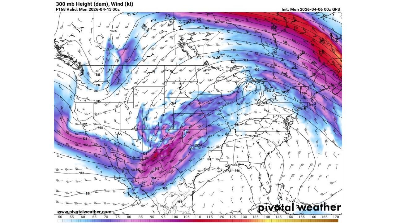
The latest atmospheric pattern highlights a strong 300 mb jet stream corridor stretching from the Southwest through Texas, Oklahoma, Kansas, and into the Midwest and Great Lakes.
This setup is critical because:
- It provides strong wind energy aloft, a key ingredient for severe storms
- It supports repeated storm development along the same track
- It enhances the potential for organized systems including supercells and squall lines
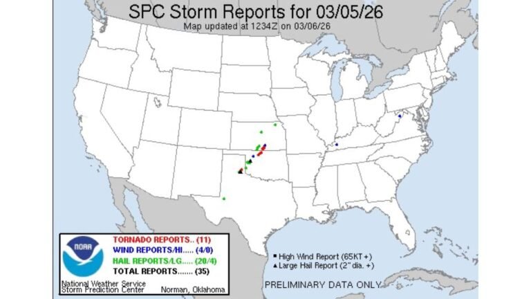
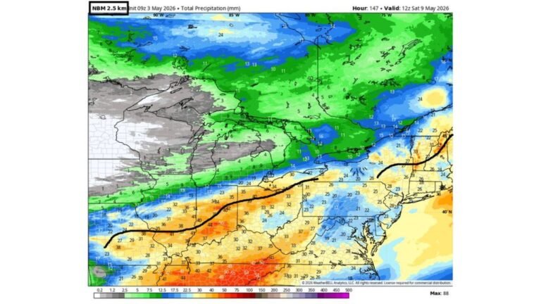
The jet core appears particularly strong from Texas into Missouri and Illinois, placing these areas in a favorable zone for severe weather outbreaks.
West Coast Trough Sets the Stage for Instability
At the same time, a trough developing along the West Coast is expected to play a major role in driving this pattern.
This trough will:
- Push energy eastward into the Plains
- Help pull warm, moist air northward from the Gulf of Mexico
- Create a repeated clash between warm and cool air masses
That combination is often the trigger for multiple rounds of thunderstorms over several days, rather than just a single event.
Great Plains to Midwest in the Bullseye
Based on the current setup, the most impacted regions include:
- Texas and Oklahoma: Early-stage storm development and severe potential
- Kansas and Nebraska: Central corridor for storm intensification
- Missouri, Iowa, and Illinois: Continued severe threat as systems track northeast
- Great Lakes region: Potential for strong storms later in the sequence
This corridor aligns closely with the strongest upper-level winds, meaning storms here could become more organized and longer-lasting.
Severe Weather Could Arrive in Waves
Rather than one isolated outbreak, this pattern favors multiple rounds of severe weather, potentially including:
- Damaging wind events
- Large hail
- Isolated tornadoes
- Heavy rainfall and localized flooding
Each passing system could reload the atmosphere, increasing the risk for repeated impacts across the same states.
Timing Window Extends Into Next Week
The first round of storms could begin as early as Thursday, but the broader pattern suggests activity may continue through the weekend and into early next week.
This extended window increases concern because:
- Communities may face back-to-back storm threats
- Ground conditions could become more saturated, raising flood risks
- Emergency response fatigue becomes a factor in prolonged events
Residents Urged to Stay Alert as Pattern Evolves
With a dynamic setup like this, conditions can change quickly. Residents across the Plains and Midwest should:
- Monitor daily forecast updates
- Prepare for potential severe weather warnings
- Stay aware of rapidly changing conditions
Stay With Cabarrus Weekly for Ongoing Severe Weather Coverage
This developing pattern has the potential to bring significant and repeated impacts across multiple states, and updates will continue as new data comes in.
Stay connected with Cabarrus Weekly for the latest tracking on severe weather threats, timing updates, and regional impacts across the United States.