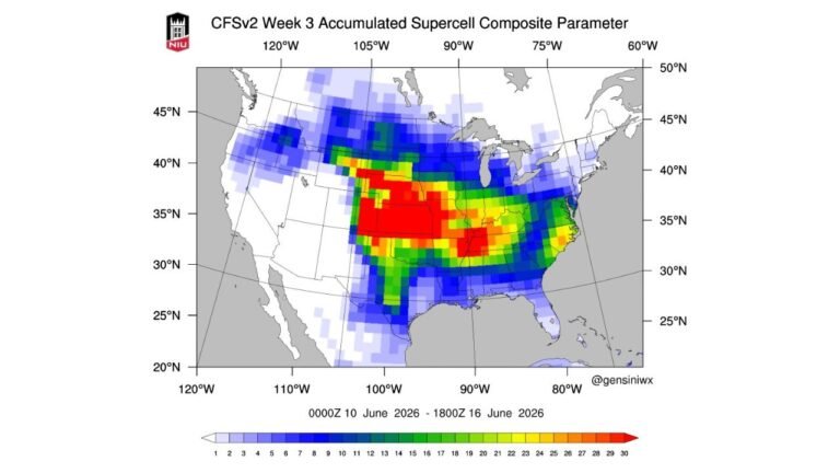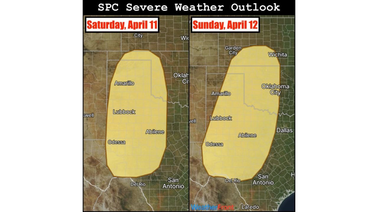
Texas and Oklahoma Including Amarillo, Lubbock, Abilene and Odessa Face Back-to-Back Severe Storm Risk April 11 and 12
UNITED STATES — A renewed severe weather threat is taking shape across the southern Plains, with the Storm Prediction Center outlining back-to-back risk areas for Saturday, April 11 and Sunday, April 12, signaling the beginning of a more active mid-April pattern.
The focus is squarely on West and North Texas into western Oklahoma, where atmospheric conditions are expected to align for organized thunderstorms and potential severe weather over consecutive days.
Primary Risk Zone Centers on West Texas and Western Oklahoma
The outlined risk area covers a large portion of:
- Amarillo
- Lubbock
- Abilene
- Odessa
- Extending toward western Oklahoma
This region sits in a favorable zone where dryline activity, returning Gulf moisture, and strengthening upper-level winds are expected to interact.
Saturday Setup Begins the Active Pattern
On Saturday, April 11, the initial round of storms is expected to develop across West Texas.
Key factors include:
- Increasing moisture return from the Gulf of Mexico
- Building instability during the afternoon
- Early influence of an approaching western U.S. trough
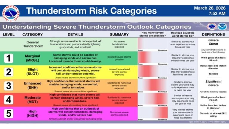
Storms that form could become strong to severe, especially during late afternoon and evening hours.
Sunday Brings Expanded and More Organized Threat
By Sunday, April 12, the risk area expands slightly north and east, including more of western Oklahoma and areas closer to central Texas.
This second day is expected to feature:
- Stronger upper-level support
- Better storm organization
- Higher confidence in widespread thunderstorm development
This increases the likelihood of:
- Damaging winds
- Large hail
- Potential for isolated tornado activity
Western U.S. Trough Drives Multi-Day Severe Potential
The broader setup is being driven by a persistent trough over the western United States, which is expected to remain in place through the weekend.
This pattern allows:
- Continuous energy moving into the Plains
- Sustained moisture transport northward
- Repeated opportunities for storm development
As a result, Saturday and Sunday are likely just the beginning of a longer stretch of active weather across the central U.S.
Confidence Highest for Weekend Storm Development
While additional severe weather days may develop before and after this window, current data shows the highest confidence for organized severe storms on April 11 and 12.
Residents in the highlighted areas should:
- Stay updated on daily forecasts
- Prepare for rapidly changing weather conditions
- Be ready for possible severe weather warnings
Southern Plains Entering Active Spring Storm Phase
This setup reflects a classic spring transition, where warm, moist air from the Gulf collides with incoming disturbances from the West, creating repeated storm chances.
With multiple ingredients aligning, the southern Plains—especially Texas and Oklahoma—are entering a period where severe weather risks could become more frequent and impactful.
Stay With Cabarrus Weekly for Severe Weather Updates
As this pattern evolves, more refined outlooks and risk areas will be issued in the coming days.
Stay connected with Cabarrus Weekly for continuous updates on storm timing, impacted cities, and severe weather developments across the United States.