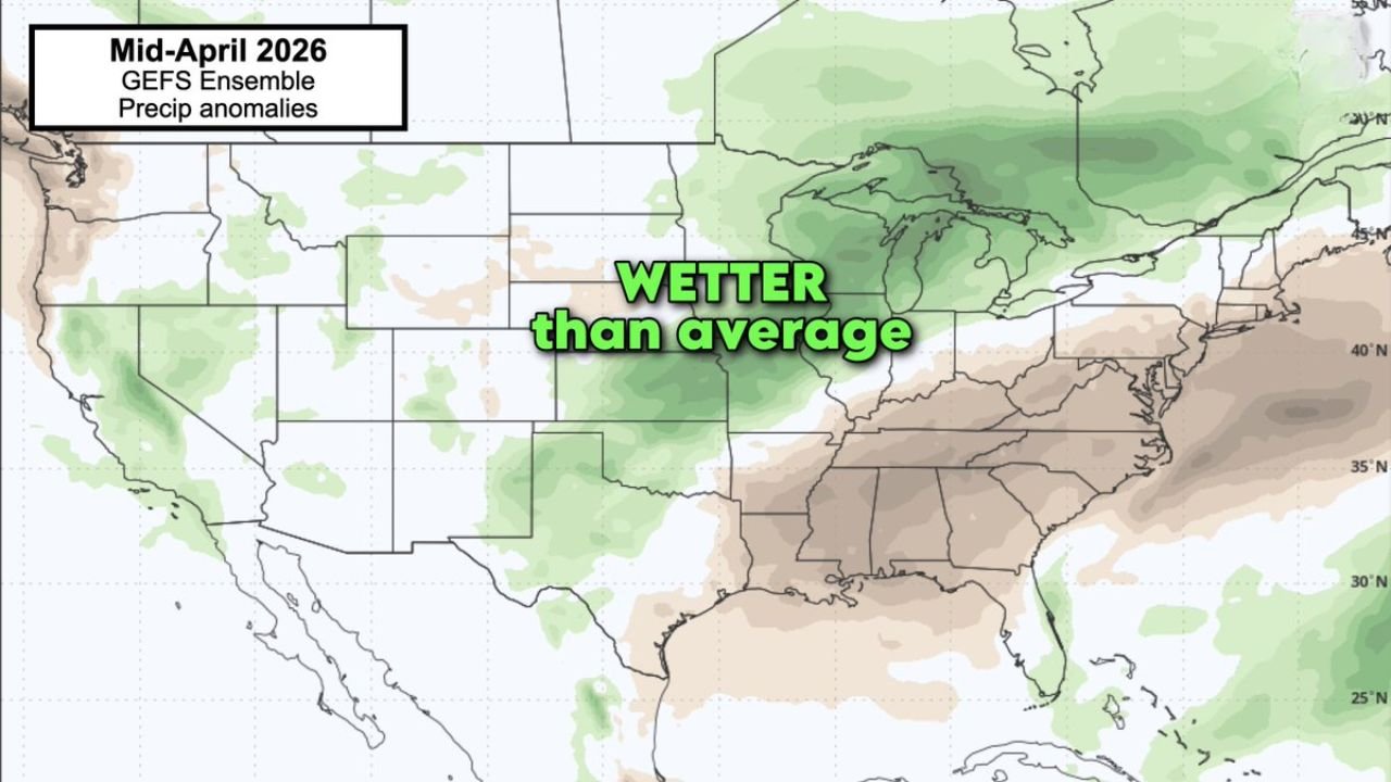
Arkansas, Missouri, Illinois and Great Lakes Region Turn Wetter Than Normal as Mid-April Storm Pattern Expands Beyond Plains
UNITED STATES — As a highly active severe weather pattern develops across the Plains in mid-April, new forecast data shows that rainfall is expected to expand north and east, bringing wetter-than-average conditions into Arkansas, Missouri, Illinois, and the Great Lakes region.
This shift signals that the pattern will not only produce severe storms but also prolonged periods of rainfall across the central and eastern United States.
Widespread Wet Pattern Establishing Across Central U.S.
Forecast precipitation outlooks indicate:
- A broad zone of above-average rainfall stretching from the central Plains into the Midwest and Great Lakes
- Core areas include Missouri, Illinois, Iowa, Wisconsin, Michigan, and surrounding states
- Rainfall anomalies suggest consistent storm activity rather than isolated events
This aligns with the developing pattern of:
- Frequent storm systems moving along the same corridor
- Repeated rounds of showers and thunderstorms tracking northeast
Arkansas May See Extended Wet Conditions
One of the key highlights in this setup is Arkansas, where:
- Wetter-than-average conditions may extend into mid-April
- Repeated storm complexes from the Plains could move into the state over multiple days
- Rainfall could become persistent rather than sporadic
This increases the potential for:
- Saturated ground conditions
- Localized flooding concerns if storms repeat over the same areas
- Disruptions from ongoing unsettled weather
Storm Systems Feeding the Rainfall Pattern
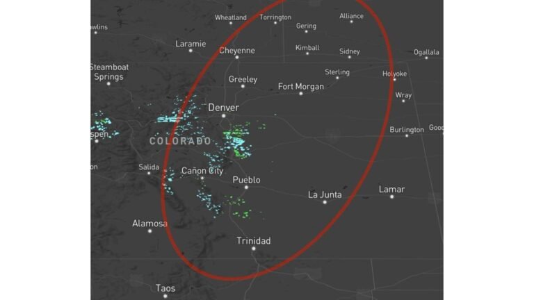
The wet pattern is directly tied to the broader severe weather setup:
- Storm systems forming near the Rockies move into the Plains
- These systems then track northeast into the Midwest and Great Lakes
- Each system carries moisture from the Gulf of Mexico, fueling rainfall
As a result:
- The same regions may see multiple rounds of rain within a short period
- Rainfall totals can quickly add up over time
Contrast Between Wet North and Drier South
While the central and northern regions trend wetter:
- Parts of the Southeast, including Alabama, Georgia, and the Carolinas, show signals of near or below-average rainfall
- This creates a clear contrast between active storm tracks to the north and quieter conditions farther south
This boundary between wet and dry zones will likely shift slightly depending on storm track, but the primary wet corridor remains focused farther north.
Great Lakes Region Also in the Wet Zone
The pattern extends into the Great Lakes region, including:
- Wisconsin, Michigan, and parts of northern Illinois and Indiana
- Increased chances of steady rainfall and passing storm systems
These areas may experience:
- Frequent cloud cover and cooler conditions
- Periodic rainfall events tied to passing low-pressure systems
What This Means Going Into Mid-April
The combination of severe weather and increased rainfall suggests:
- An active and potentially impactful stretch of weather across the central U.S.
- Not just isolated severe storms, but a longer-duration wet pattern
- Increased importance of monitoring rainfall totals and repeated storm tracks
This setup raises concerns for:
- Flooding in vulnerable areas
- Travel disruptions during active weather days
- Extended periods of unsettled conditions
Stay With Cabarrus Weekly for Continued Weather Coverage
As this expanding mid-April weather pattern unfolds, Cabarrus Weekly will continue tracking:
- Severe storm threats across the Plains
- Rainfall trends across the Midwest and Great Lakes
- Regional impacts as conditions evolve
Stay updated for the latest storm timing, rainfall forecasts, and severe weather alerts across the United States.