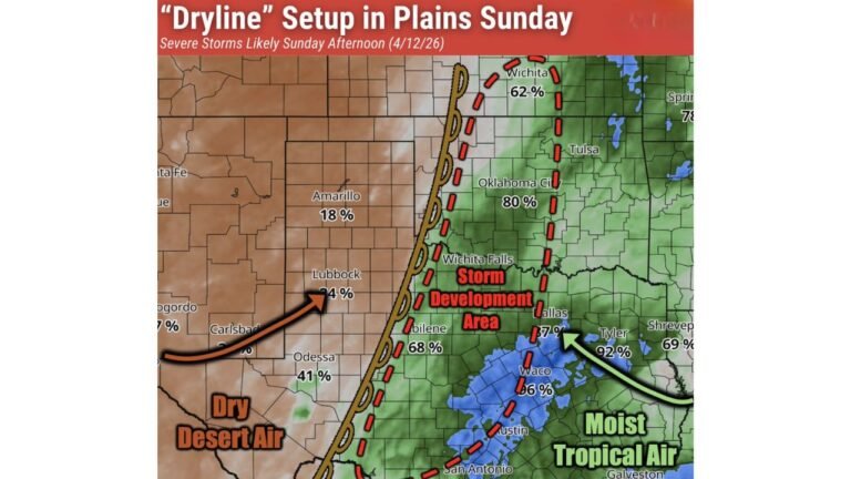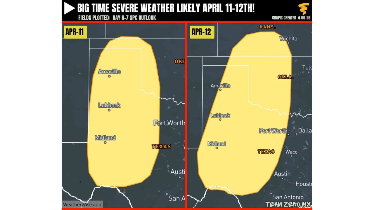
Texas, Oklahoma and Kansas Face April 11–12 Severe Weather Risk as Multi-Day Storm Pattern Signals Possible Extended Outbreak
UNITED STATES — A potentially dangerous severe weather pattern is taking shape across the southern Plains, with new outlook data highlighting April 11 and April 12 as key days for organized storms across Texas, Oklahoma, and Kansas.
Forecast signals point toward an increasingly active setup, with the possibility of repeated severe weather episodes stretching beyond just a single weekend event.
Slight Risk Areas Highlight Growing Confidence
The latest outlook identifies:
- Two separate severe weather risk areas for April 11 (Saturday) and April 12 (Sunday)
- A focused corridor across West Texas, the Texas Panhandle, western Oklahoma, and parts of Kansas
- Cities near or within the risk zone include Amarillo, Lubbock, Midland, and areas approaching Oklahoma and Kansas borders
These areas are currently under a 15% severe weather probability zone, signaling:
- Increasing confidence in organized thunderstorm development
- Potential for strong storm clusters rather than isolated activity
Weekend Could Mark the Start of a Larger Severe Weather Stretch
While April 11–12 are the immediate focus, the broader pattern suggests:
- Severe weather may not be limited to just these two days
- There is potential for multiple consecutive days of storm activity beginning around April 9 and extending toward April 20
This raises the possibility of:
- Daily or near-daily storm chances across the Plains
- Repeated impacts across the same regions
- A prolonged period of elevated severe weather risk
Storm Setup Favoring Organized and Repeated Development
The evolving pattern includes:
- Strong upper-level support moving out of the western United States
- Continued moisture return from the Gulf of Mexico
- Development of surface low-pressure systems across the Plains
This combination creates a classic environment for:
- Supercell thunderstorms
- Large hail and damaging wind events
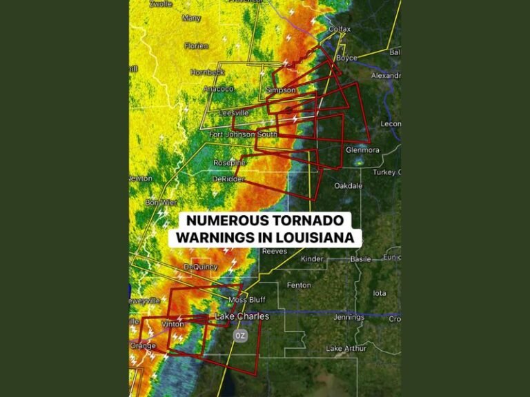
- Tornado potential depending on storm evolution
Because the pattern is expected to persist, storms may:
- Develop in multiple waves
- Track across similar areas repeatedly
- Increase cumulative impacts over time
Primary Impact Zone Across the Southern Plains
The core region of concern includes:
- West and North Texas
- Western and central Oklahoma
- Southern and central Kansas
This corridor is expected to remain the most active zone, though surrounding areas could also see storm development depending on system movement.
Preparedness Becomes Critical Ahead of Active Period
With a potentially long-duration severe weather setup:
- Residents are encouraged to review severe weather safety plans now
- Stay alert for forecast updates as timing and intensity become clearer
- Ensure readiness for multiple rounds of storms rather than a single event
Early awareness is especially important given the potential for:
- Rapidly changing conditions
- Nighttime storm risks
- Back-to-back severe weather days
Stay With Cabarrus Weekly for Ongoing Severe Weather Updates
As confidence continues to build in this high-impact mid-April weather pattern, Cabarrus Weekly will provide:
- Updates on storm timing and severity
- Expanded outlooks for additional risk days
- Regional breakdowns for impacted states
Stay connected for the latest developments as Texas, Oklahoma, and Kansas prepare for a potentially extended stretch of severe weather.