Northern Indiana Has Been Under More Severe Thunderstorm Watches Than Anywhere Else in the United States in 2026 as the Storm Prediction Center Tracks 43 Total Watches Across the Country
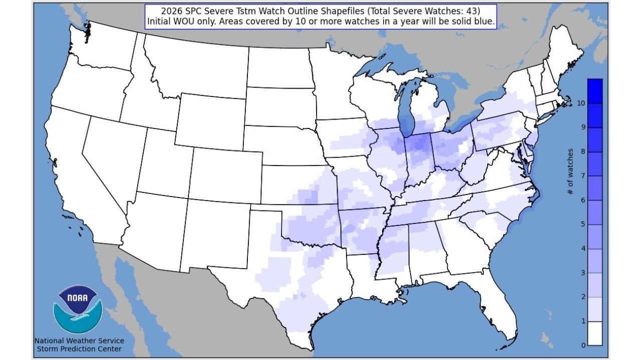
UNITED STATES — A striking and data-driven picture of 2026’s severe weather season is emerging from the Storm Prediction Center. With 43 total severe thunderstorm watches issued across the United States so far this year, one region stands out above all others — northern Indiana has been under more severe thunderstorm watches than anywhere else in the entire country in 2026, reaching the threshold of 10 or more watches that earns the darkest designation on the SPC’s annual watch coverage map.
This is not just a local curiosity. It is a direct reflection of how historically active the severe weather pattern across the Great Lakes and Ohio Valley has been in the opening months of 2026.
Northern Indiana Leads the Nation
The SPC severe thunderstorm watch outline map for 2026 tells a clear and visually striking story. While the western half of the United States sits almost entirely blank — with zero to minimal severe thunderstorm watch coverage from the Rockies to the Pacific — the eastern half is increasingly shaded in blue, with the darkest concentration centered directly over northern Indiana.
Areas covered by 10 or more severe thunderstorm watches in a single year are shown in solid blue on the SPC map — a threshold that northern Indiana has already crossed with months still remaining in the active severe weather season. That means communities across northern Indiana have been placed under organized severe thunderstorm watch conditions at least 10 separate times since January 1 — more frequently than any other location in the country.
The high-frequency watch zone extends outward from northern Indiana into:
- Ohio — particularly the northwest and central portions
- Michigan — lower peninsula
- Pennsylvania — western and central regions
- New York — western and central regions
- New Jersey and the Mid-Atlantic coast
- Illinois — northern and central portions
- Kentucky and Tennessee — northern corridors
Why the Great Lakes and Ohio Valley Have Dominated
The concentration of severe thunderstorm watch activity across the Great Lakes and Ohio Valley in 2026 is not random. It reflects a specific and persistent atmospheric pattern that has favored repeated severe weather events across this corridor during the opening months of the year.
Several factors have contributed to northern Indiana’s position at the top of the national watch frequency list:
Geographic positioning. Northern Indiana sits at the intersection of multiple atmospheric boundaries — cold air from Canada, warm moist air from the Gulf, and the influence of the Great Lakes all converge repeatedly across this corridor during active severe weather patterns. When storm systems track across the Midwest, northern Indiana is frequently positioned in the most favorable zone for severe thunderstorm development.
The 2026 active pattern. This year’s severe weather season has been historically active across the Great Lakes and Ohio Valley — with repeated rounds of organized severe thunderstorms tracking through the same general corridor week after week. Northern Indiana’s position in the most frequently impacted zone of this pattern has resulted in watch after watch accumulating over the course of just a few months.
Proximity to the surface low track. Many of 2026’s storm systems have tracked their surface low pressure centers directly across or just north of Indiana — placing northern Indiana in the warm sector where the ingredients for severe thunderstorms are most concentrated and persistent.
43 Watches — What That Number Means
The 43 total severe thunderstorm watches issued across the United States so far in 2026 reflects the sustained and broadly active nature of this year’s severe weather season.
A severe thunderstorm watch is issued by the Storm Prediction Center when atmospheric conditions are favorable for the development of severe thunderstorms — defined as storms producing winds of 58 mph or greater, hail of one inch or larger, or tornadoes — across a defined geographic area, typically for a period of several hours.
Issuing 43 watches in the first few months of the year signals a severe weather season that has been running well above the pace of a typical year — consistent with the historic active patterns that have defined 2026’s weather across the central and eastern United States.
Where Watch Coverage Is Concentrated — 2026
| Region | Watch Frequency |
|---|---|
| Northern Indiana | 10+ watches — leads the nation |
| Northwest Ohio / Southwest Michigan | 8-10 watches |
| Western Pennsylvania | 7-9 watches |
| Western New York / New Jersey | 7-9 watches |
| Northern Illinois / Southern Wisconsin | 5-7 watches |
| Kentucky / Tennessee | 5-7 watches |
| Mid-Atlantic coast | 5-8 watches |
| Southern Plains | 1-4 watches |
| Gulf Coast states | 1-3 watches |
| Western United States | 0-1 watches |
The Season Is Far From Over
Perhaps the most significant context for these statistics is what lies ahead. The peak of severe weather season across the United States typically runs from April through June — meaning the 43 watches already issued in 2026 represent only the opening chapter of what is historically the most active period of the year.
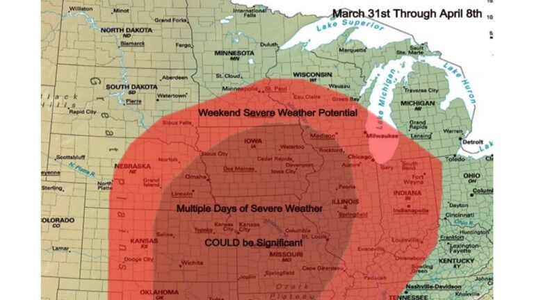
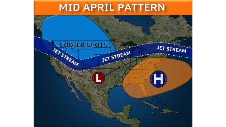
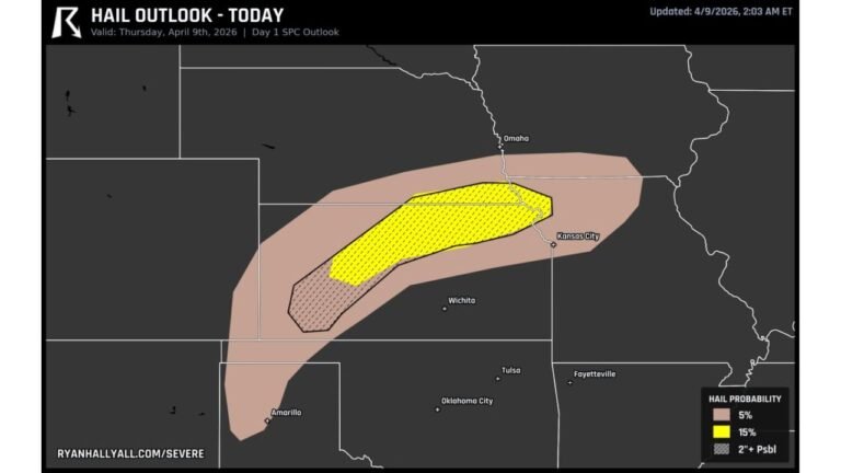
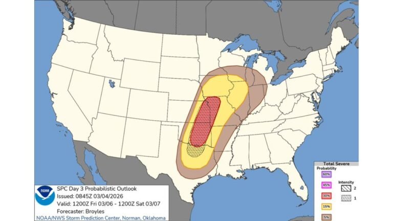
With four consecutive days of organized severe weather already forecast across the Plains and Midwest for the coming week, and an extended-range outbreak signal emerging for April 11 through 14, the watch count for 2026 is virtually certain to climb significantly in the weeks ahead.
Northern Indiana’s lead at the top of the national watch frequency list may hold — or communities across Oklahoma, Kansas, Texas, and Missouri may close the gap as the southern Plains enters its peak tornado season window. Either way, 2026 is shaping up to be one of the more active severe weather seasons on record across the central and eastern United States.
What This Means for Residents in High-Watch Areas
Northern Indiana residents have already demonstrated resilience through 10 or more severe weather watch periods in 2026 — but the data also serves as a reminder that the threat is not diminishing. With the active pattern continuing into April and beyond, residents across the region should maintain the same level of preparedness that has carried them through the first months of the year.
Residents across all high-frequency watch areas should:
- Keep severe weather alert systems active and charged at all times through the spring season
- Maintain a stocked severe weather kit — water, food, medications, flashlights, and a battery-powered weather radio
- Know your shelter location and make sure all household members know it as well
- Stay informed about the evolving severe weather pattern — the coming weeks carry significant additional threat potential across the Great Lakes, Ohio Valley, and southern Plains
Cabarrus Weekly Perspective
The northern Indiana statistic is more than a data point — it is a window into how unusual 2026’s severe weather season has already been. Reaching the 10-watch threshold before April is even half over reflects a pattern of sustained atmospheric activity across the Great Lakes that is genuinely historic in its frequency and organization.
As the peak severe weather months of April, May, and June unfold, the watch count map will continue to evolve. But the story it is already telling — about the relentless nature of 2026’s severe weather season and its particular focus on the Great Lakes and Ohio Valley — is one that residents across every shaded county on that map have been living through in real time.
The season is not slowing down. Stay prepared.
Stay ahead of dangerous weather before it reaches your door. Visit cabarrusweekly.com for daily severe weather coverage, watch and warning updates, and storm alerts from across the United States — because knowing early is the difference that matters.