Already Underwater and More Flooding Coming: Saturated Ground and Friday Severe Weather Create a Dangerous Crisis Across the Plains and Midwest
PLAINS AND MIDWEST, UNITED STATES — The situation across the Plains and Midwest is deteriorating fast. Forecasters are sounding the alarm with blunt language: “This is not looking good. We are already beyond saturated. Many areas are already under water.” And Friday afternoon and evening is bringing more severe weather and more flooding on top of ground that simply cannot absorb anything more.
What the Data Shows for Friday April 17
Forecast radar valid 23Z Friday April 17, 2026 shows a long and intense squall line stretching from the southern Plains northeast through the Midwest — with the most intense returns showing deep red and purple cores indicating extremely heavy rainfall and strong rotation embedded within the line.
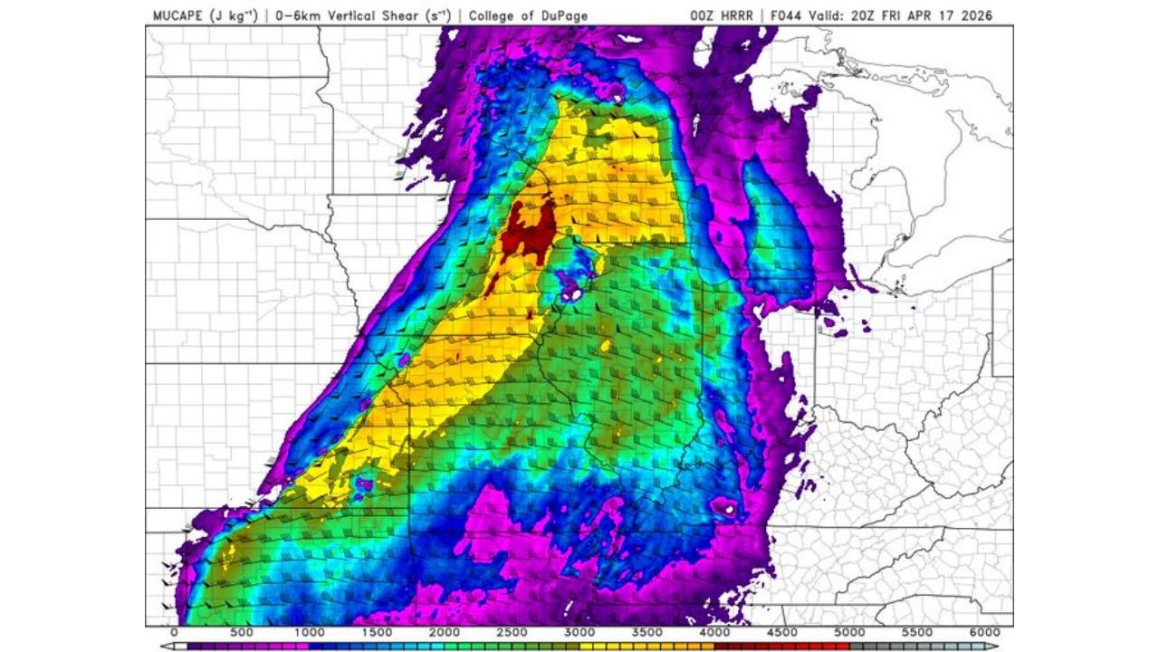
The atmospheric environment supporting this system is extreme. MUCAPE values valid 20Z Friday April 17 show the highest instability concentrated in a defined corridor running from Kansas and Missouri north through Iowa and into the Great Lakes — with the deepest dark red values indicating instability above 4000 J/kg in the core zone. The Significant Tornado Parameter map valid 21Z Friday April 17 shows elevated STP values across the same corridor with the highest values in purple and magenta reaching 5 to 10 or greater — a very dangerous tornado environment on top of already flooded ground.
The Flooding Crisis Is the Defining Problem
| Situation | Status |
|---|---|
| Ground saturation | Beyond saturated — cannot absorb more rain |
| Current flooding | Many areas already under water |
| Friday additional rain | Heavy rain incoming with the squall line |
| Flood risk | Rapidly worsening through Friday evening |
When saturated ground gets hit by another round of heavy rain from an intense squall line, flash flooding becomes immediate and life-threatening. Roads that look passable can be underwater within minutes. Do not drive through any flooded roadway Friday evening. Turn around, do not drown.
Stay with CabarrusWeekly.com for live Friday flood and severe weather updates across the Plains and Midwest.