Southern Wisconsin and Northern Illinois Face EF2 Tornado Outbreak Friday Starting at 1 PM
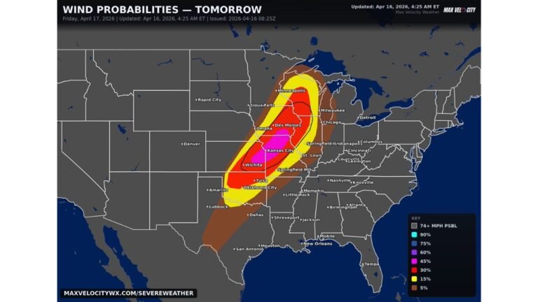
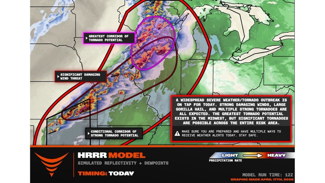
MADISON, WISCONSIN — A widespread severe weather and tornado outbreak is on tap across the Midwest this Friday, with multiple strong tornadoes, large gorilla hail, and significant damaging winds all expected. The greatest tornado corridor is focused on southern Wisconsin, northern Illinois, and eastern Iowa, with supercells capable of producing EF2 or stronger tornadoes.
EF2 Tornado Potential Maximized in the Greatest Corridor
The highest concentration of tornado potential is circled across southern Wisconsin into northern Illinois and eastern Iowa. This corridor represents where supercell storms are expected to be most organized and most dangerous. Supercells could begin maturing as early as 1 PM, giving little afternoon warning before the threat escalates rapidly.
A Second Threat Zone Stretches South to Oklahoma
A separate but significant severe weather corridor extends south from the primary outbreak zone all the way to Oklahoma, carrying a conditional strong tornado threat along with a significant damaging wind footprint. The full risk area spans from Oklahoma north to Lake Superior — a multi-state outbreak environment.
What Is Expected Across the Full Risk Area
| Hazard | Status |
|---|---|
| Multiple strong tornadoes | Expected — greatest corridor in southern Wisconsin and northern Illinois |
| EF2 or stronger tornadoes | Possible within greatest corridor |
| Gorilla hail | Expected |
| Significant damaging winds | Widespread across full risk zone |
Have Multiple Ways to Receive Alerts Right Now
Do not rely on a single alert method today. Have a weather radio, phone alerts, and a local broadcast source ready before 1 PM. Know your shelter location in advance. This is an active, life-threatening outbreak setup from Oklahoma to Lake Superior.
Stay with CabarrusWeekly.com for live tornado outbreak updates across the Midwest.