Kansas City and Wichita Face Level 4 Moderate Risk With 80 MPH Winds and 3.5 Inch Giant Hail Friday Evening
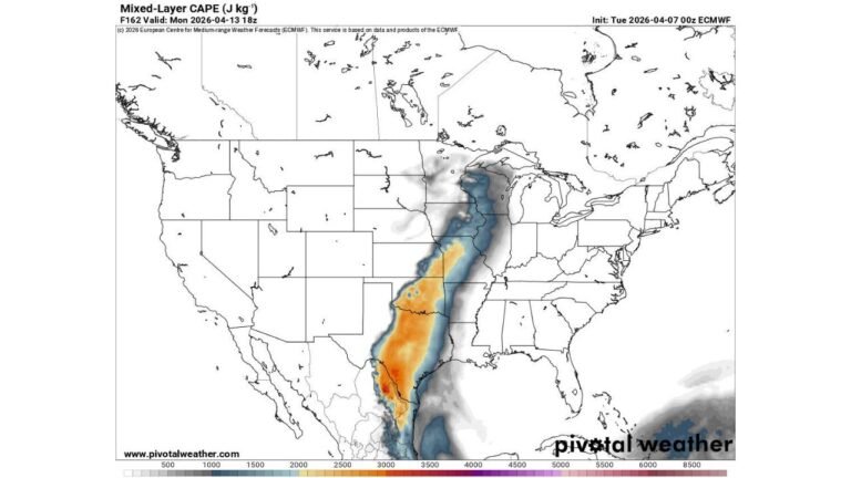
WICHITA, KANSAS — The Storm Prediction Center has upgraded northwest Oklahoma, southern and eastern Kansas, and western Missouri to a Level 4 out of 5 Moderate Risk for severe weather today, with supercells capable of producing giant hail exceeding 3.5 inches in diameter and damaging wind gusts of 80 MPH or greater expected this evening.
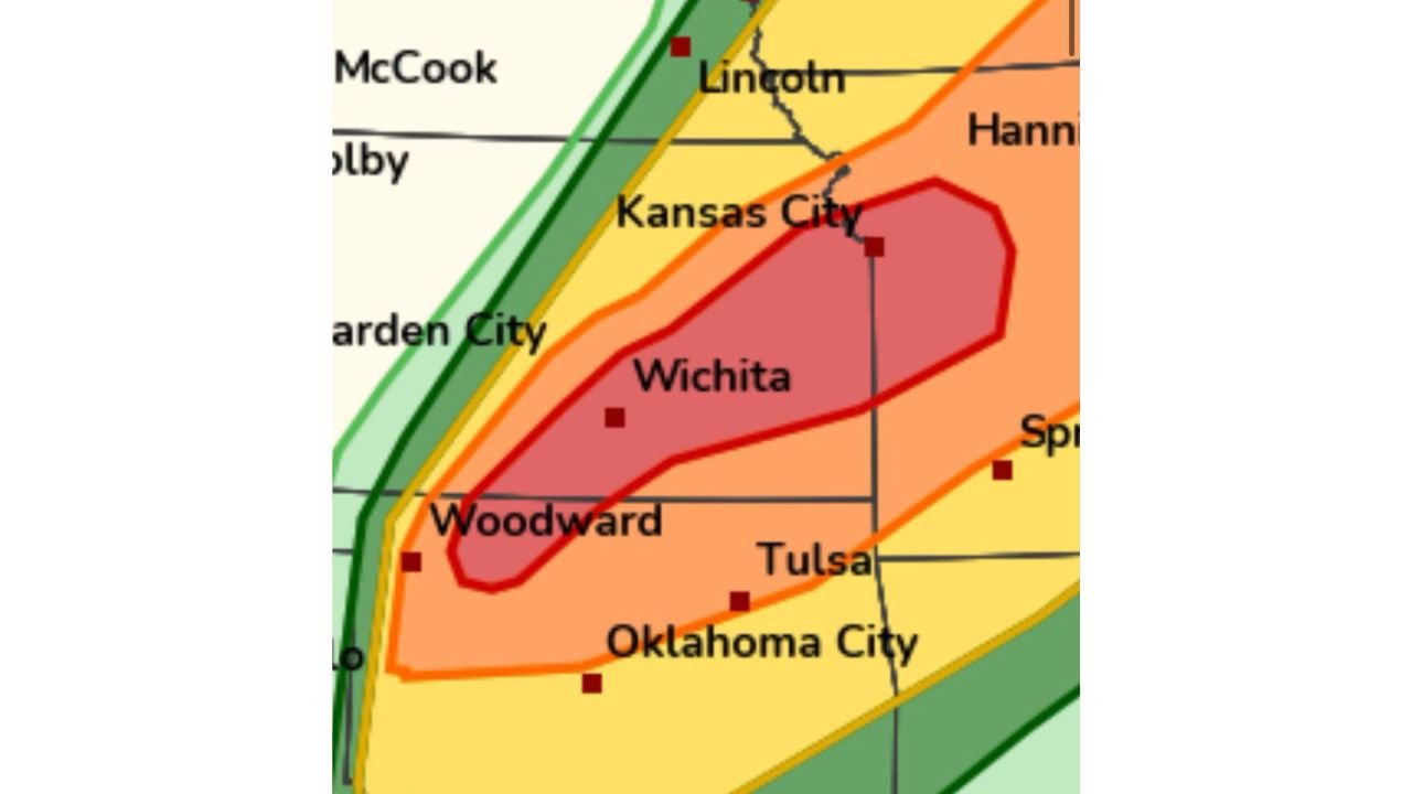
Level 4 Moderate Risk Corridor Centered on Wichita and Kansas City
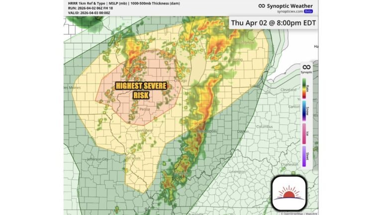
The highest risk zone on today’s map is drawn tightly across a corridor stretching from Woodward, Oklahoma northeast through Wichita and up to Kansas City. This is the area where supercell storms are expected to be most intense before a cold frontal line sweeps through and organizes the threat into a broader wind-producing system this evening.
What Is Expected Inside the Level 4 Zone
| Hazard | Threshold |
|---|---|
| Hail diameter | Greater than 3.5 inches |
| Wind gusts | 80 MPH or greater |
| Storm mode | Initial supercells transitioning to line |
The Evening Hours Bring the Most Dangerous Window
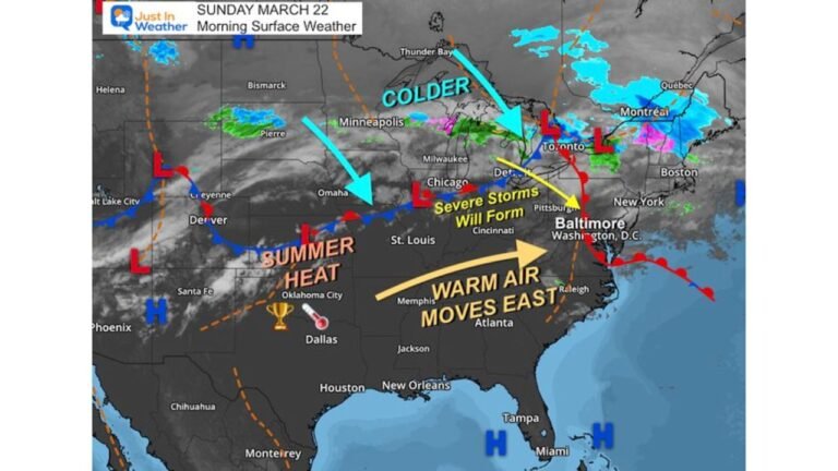
Initial supercells will carry the giant hail and tornado threat early. As the cold front pushes through, storms are expected to organize into a squall line producing intense damaging wind gusts across the full corridor from northwest Oklahoma through eastern Kansas and into western Missouri. Wichita, Kansas City, Tulsa, and surrounding communities all fall within or near the elevated risk footprint.
Do not wait for warnings to seek shelter. Have alerts active and a plan ready before this evening.
Stay with CabarrusWeekly.com for live severe weather updates across Kansas, Oklahoma, and Missouri.