Washington D.C. Soaked for 9 Straight Days as Mid-Atlantic Rain Streak Nears Historic Territory
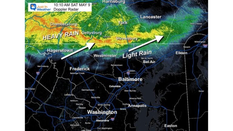
WASHINGTON, D.C. — The nation’s capital has now gone nine consecutive days with measurable rainfall, a stretch running since May 19 that has deposited nearly 2 inches in D.C. proper — with significantly higher totals recorded across surrounding areas. The streak may be winding down, but the damage to “dry” is already done.
Nine Days Straight: How Rare Is This?
A 9-day rain streak is not an everyday occurrence in D.C. Since the year 2000, only four years have recorded longer continuous stretches. The most recent was 2024, which saw an 11-day run. Before that, 2016 stands out with a remarkable 15-day streak — yet that year finished 10 inches below its annual average, proving that consecutive rainy days do not always add up to a wet year overall.
Even more striking: 2018, which holds the record as D.C.’s wettest year ever, only managed an 8-day consecutive rain streak at its longest. Wet years and long streaks, it turns out, don’t always go hand in hand.
What the Anomaly Map Reveals Across the East
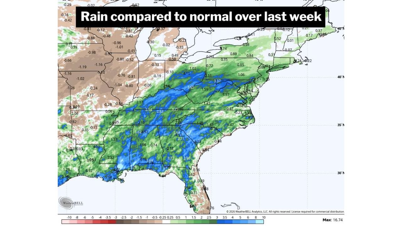
The precipitation anomaly map covering rain compared to normal over the last week paints a vivid picture of where the moisture has concentrated.
The deepest surpluses are anchored across the central Appalachians, the Tennessee Valley, and the Gulf Coast corridor. Notable values on the map include:
- 4.10 inches above normal in parts of the central mid-Atlantic
- 3.64 to 4.57 inches above normal across portions of the Southeast interior
- 4.19 to 5.98 inches above normal along the Gulf Coast region
- 3.65 to 3.77 inches above normal in parts of the Tennessee and lower Mississippi valleys
Where Deficits Are Holding On
Not all of the East is wet. A clear band of below-normal precipitation stretches across the Great Lakes region and interior Northeast, with values ranging from -0.48 to -1.26 inches below normal in parts of Ohio, Michigan, and western Pennsylvania. Portions of New England and upstate New York also show modest deficits in the -0.29 to -0.96 inch range.
This contrast reflects the pattern locked in place for the better part of the past week.
The Mid-Atlantic Surplus Zone Up Close
For the D.C. metro and surrounding states, the past nine days have delivered well above-normal rainfall at nearly every recording point. The map confirms surpluses of 1.02 to 3.37 inches above normal across a broad swath running from the central Virginia piedmont northward through Maryland and into southern Pennsylvania — consistent with what residents have experienced: persistent, repeated rounds of rain with little dry relief between them.
What Comes Next for the Streak
Today marks what forecasters are watching as potentially the final day of this run. Whether the streak officially ends or extends to double digits will depend on whether any additional moisture reaches D.C. before the pattern shifts. For context, a 10th consecutive day would push this into historically rare territory for the post-2000 record.
Stay with CabarrusWeekly.com for continuing coverage as the pattern evolves and updated rainfall totals come in.