Texas, Oklahoma, Arkansas, Louisiana, Mississippi, and Alabama Show Strengthening Severe Weather Signal as Mid-February Pattern Turns More Active
UNITED STATES — Medium-range guidance is increasingly pointing toward a more active severe weather pattern developing during the second half of February, with signals strengthening around February 17 across portions of the southern Plains and lower Mississippi Valley.
Severe Weather Signal Emerges Around February 17
Multiple ensemble systems now indicate a noticeable uptick in severe weather potential beginning in the middle of the month. While the setup remains several days away, the consistency across guidance suggests the pattern is worth monitoring closely as February progresses.
The focus of this signal extends from Texas and Oklahoma eastward into Arkansas, Louisiana, Mississippi, and Alabama, regions that climatologically respond quickly when instability and wind shear overlap this time of year.
Large-Scale Pattern Supports Storm Development
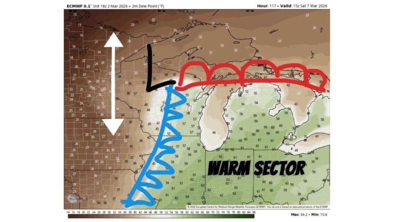
Forecast height anomaly data shows a broad trough developing across the western United States, with downstream ridging over the eastern half of the country. This configuration promotes strong southwesterly flow aloft, a classic ingredient for organized storm systems across the central and southern U.S.
At the same time, temperature anomaly guidance favors above-normal warmth across the South and Midwest, helping establish a reservoir of low-level instability once Gulf moisture returns northward.
Increasing Wind Shear and Moisture Return
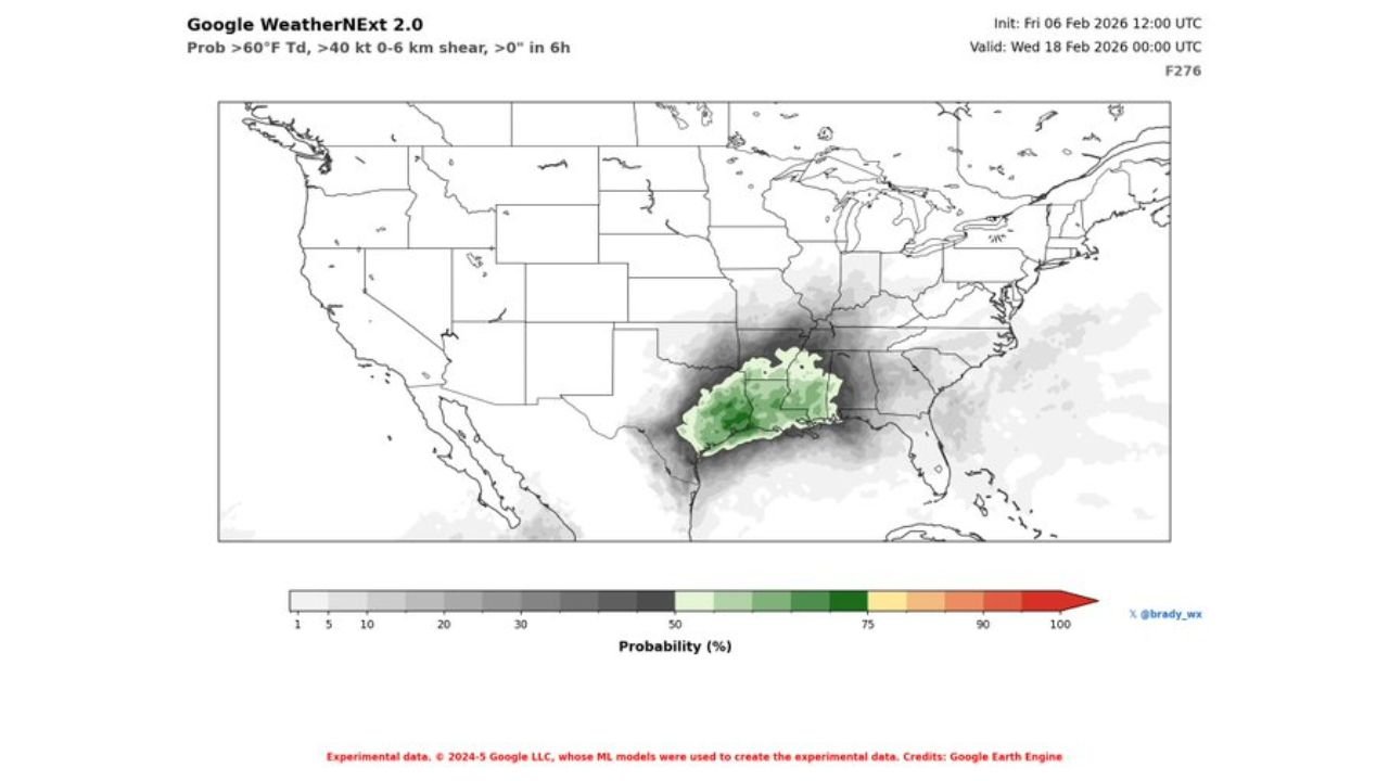
Wind field projections indicate strengthening mid-level and low-level flow across the southern Plains and lower Mississippi Valley near the February 17 timeframe. When paired with increasing moisture, this setup becomes favorable for organized thunderstorms, including the potential for severe storms if instability materializes as expected.
This overlap of warmth, moisture, and shear is one of the key reasons forecasters are paying close attention to this period, even at a longer lead time.
Model Agreement Raises Confidence, Not Certainty
Both AI-assisted ensemble guidance and traditional ensemble systems are showing supportive signals for an active pattern. While this does not guarantee severe weather on any specific day or location, agreement across independent modeling approaches increases confidence that the background environment may become more favorable.
Ensemble guidance at this range is best used to identify patterns, not precise impacts, and details such as storm mode, timing, and severity will need refinement closer to mid-month.
What to Watch in the Coming Days
As February 17 approaches, forecasters will be watching for:
- Continued consistency in ensemble trends
- Strength of Gulf moisture return
- Placement of surface boundaries and upper-level disturbances
If the current pattern holds, parts of the southern Plains and Deep South could see their first notable severe weather window of the late winter season.
Residents across these regions are encouraged to stay weather-aware as confidence improves. Share what you’re seeing locally and follow continued updates at CabarrusWeekly.com.