Early Signals Point to Possible Miller B Snowstorm Late Next Weekend Across the Northeast, but Forecast Confidence Remains Low at This Range
NORTHEASTERN UNITED STATES — Long-range ensemble guidance is beginning to hint at the potential for a Miller B–type winter storm late next weekend, with several model suites showing a developing snow signal across parts of the Mid-Atlantic and Northeast, though meteorologists stress that confidence remains low this far out.
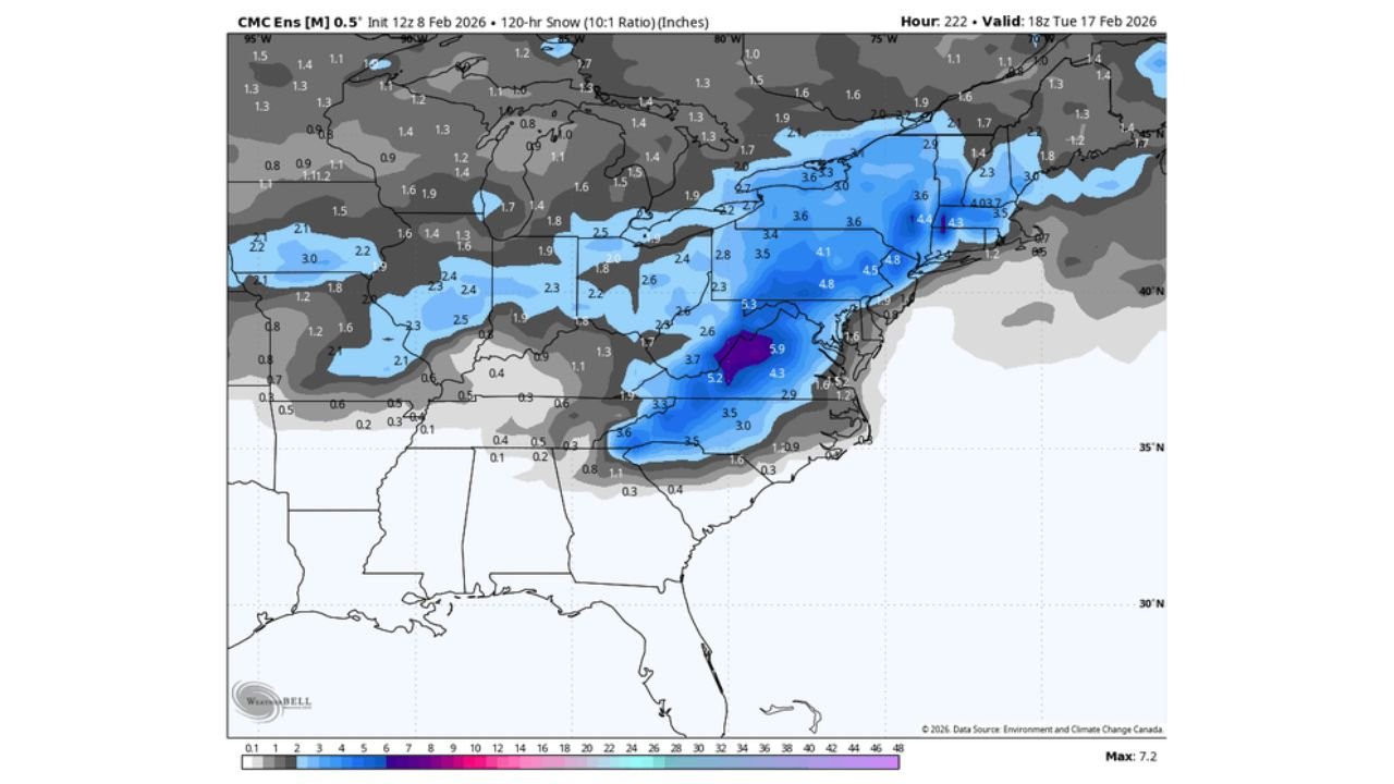
Ensemble Guidance Shows a Consistent Snow Signal
Multiple ensemble datasets, particularly from European-based guidance, are showing a broad swath of potential snowfall stretching from the central Appalachians into Pennsylvania, New York, and New England. The signal appears most consistent across interior locations, where colder air would be more readily available if the storm were to materialize.
Snowfall output varies considerably between models and individual ensemble members, underscoring the uncertainty. Some solutions depict a modest advisory-level event, while others suggest the potential for a more impactful storm if key features align.
Classic Miller B Setup Begins to Appear
The pattern being hinted at resembles a Miller B evolution, where an initial low pressure system tracks inland before transferring energy to a secondary coastal low. This type of setup often produces a west-to-east oriented snow band across the interior Northeast, followed by enhanced snowfall farther north and east as the coastal system strengthens.
While this evolution can support significant snow, it is also highly sensitive to timing, track, and temperature profiles, making confidence difficult at longer lead times.
Model Spread Highlights Low Confidence at This Stage
Despite the emerging signal, forecast confidence remains limited. The GEFS continues to show weaker or less consistent support compared to other ensemble guidance, and even among stronger signals, storm track and intensity vary notably.
Small shifts in the inland low, coastal redevelopment, or available cold air could dramatically change precipitation type and snowfall totals, particularly near the rain-snow line.
Interior Northeast Currently Most Favored
Based on current guidance, interior portions of the Mid-Atlantic and Northeast appear to have the best chance of snow should the system develop. Areas closer to the coast remain more vulnerable to mixing or rain, depending on how quickly the coastal low intensifies and how much cold air is able to hold in place.
This favors locations across parts of western and central Pennsylvania, interior New York, and portions of New England, though exact placement remains far from locked in.
Plenty of Time for Major Changes
Meteorologists emphasize that this signal is still several days out, and significant changes are likely as the pattern comes into better focus. At this range, the presence of a signal is notable, but it does not guarantee a storm will ultimately impact the region.
If ensemble trends remain consistent, deeper analysis will follow later in the week as higher-resolution guidance begins to resolve critical details.
If you’re tracking winter weather potential where you live, we’d like to hear from you. Share your local expectations and stay tuned for updated forecasts at CabarrusWeekly.com.