Kentucky and Tennessee Face 10–12 Hour Window of Gusty Thunderstorms Feb. 10–11 With Downpours, Lightning and Isolated Severe Risk
KENTUCKY AND TENNESSEE — A band of gusty thunderstorms is expected to sweep across parts of Kentucky and Tennessee during a 10–12 hour window, bringing heavy downpours, frequent lightning, and gusty winds, with any severe-level storm expected to be isolated if it occurs.
Timing Focus Centers on Tuesday Evening Into Early Wednesday
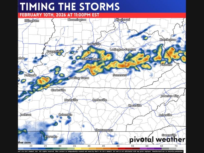
The storm timeline shown focuses on Tuesday, February 10, 2026, with activity increasing through the evening hours and continuing into the early overnight period. The progression highlights storms organizing and moving east across Kentucky, with multiple snapshots at 8:00 PM, 9:00 PM, 10:00 PM, and 11:00 PM EST, followed by lingering activity into 12:00 AM EST on February 11.
This supports the idea of a prolonged but moving storm window rather than a quick 1–2 hour burst.
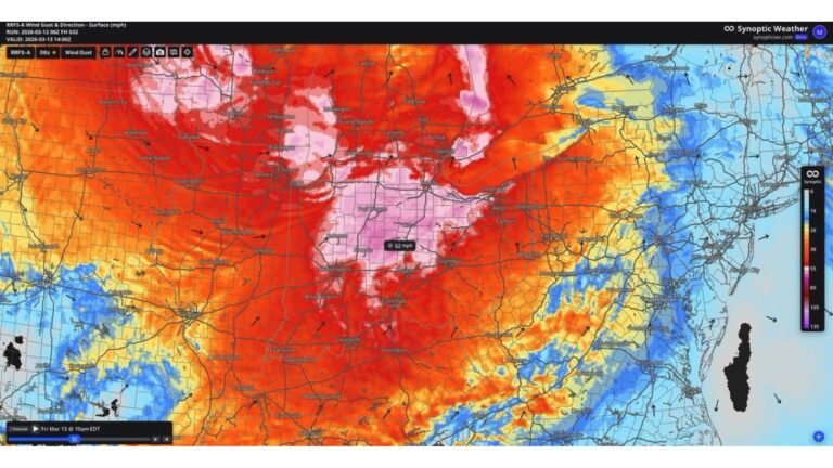
Most Active Corridor Runs Across Kentucky With Impacts Near Major Cities
The heaviest and most continuous thunderstorm coverage is shown across a broad corridor of Kentucky, including areas near Paducah, Elizabethtown, Lexington-Fayette, and Louisville, then extending farther east toward the Appalachians. The storm band also brushes nearby parts of Tennessee, with Nashville positioned south of the more concentrated activity but still close enough to see scattered storms and heavier pockets at times.
Main Threats Are Downpours, Gusty Winds and Lightning
Based on the forecast discussion included with the maps, the primary impacts are expected to be brief heavy rain, gusty winds, and lightning. The note emphasizes that if any storm “pops” to severe criteria, it would likely be an isolated case, not a widespread severe outbreak.
That means most areas should prepare for typical strong-thunderstorm impacts such as reduced visibility in heavier rain, quick bursts of wind, and occasional stronger cells within the broader line.
Why Some Spots Could See Briefly Higher Impacts
Even when the overall severe risk is limited, stronger pockets can form within a line of storms. Areas that line up with the most persistent cores could see short-lived bursts of heavier rainfall and wind, especially during the late evening hours as storms consolidate.
CabarrusWeekly.com will continue tracking notable storm setups across the country and how evolving patterns may influence future weather farther east. If you’re in Kentucky or Tennessee and experience strong storms or heavy rain during this window, share what you saw and when it hit your area at CabarrusWeekly.com.