Augusta, Georgia and Myrtle Beach, South Carolina Outpace Salt Lake City, Utah in Snowfall So Far This Winter 2025–2026
UNITED STATES — A striking snowfall pattern has emerged during Winter 2025–2026, with parts of the Southeast recording more snow than areas typically known for heavy winter accumulation in the West.
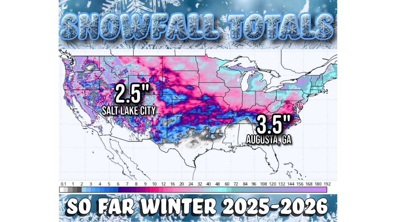
Current season-to-date snowfall totals show Augusta, Georgia with 3.5 inches and Myrtle Beach, South Carolina with measurable snowfall exceeding Salt Lake City, Utah, which has recorded just 2.5 inches so far.
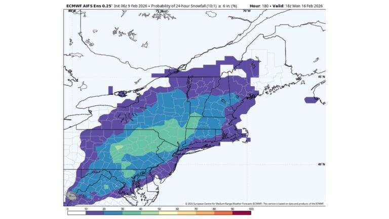
Southeast Snow Surprises Georgia and South Carolina
The snowfall map indicates a corridor of wintry accumulation stretching across portions of:
- Georgia
- South Carolina
- North Carolina
- Parts of the Deep South
Augusta, GA’s 3.5-inch seasonal total stands out given the city’s typically mild winters. Meanwhile, Myrtle Beach — a coastal South Carolina community better known for beaches than snow — has also recorded more accumulation than Salt Lake City to this point in the season.
These totals are the result of multiple southern-stream systems tracking across the Gulf Coast and Southeast earlier this winter.
Salt Lake City Running Below Normal
Salt Lake City, Utah — historically one of the snowier metropolitan areas in the United States — has seen only 2.5 inches so far this season according to the map.
The broader snowfall distribution across the western United States shows:
- Heavier totals confined mainly to parts of the Pacific Northwest mountains
- Pockets of snow across the Rockies
- Lighter accumulations in portions of Utah’s lower elevations
This suggests a pattern that has favored southern storm tracks over sustained western troughing.
Snow Belt Active Across the Central U.S.
The map also highlights a band of moderate snowfall extending from:
- New Mexico and Texas Panhandle
- Across Oklahoma and Arkansas
- Into parts of Tennessee and the Mid-South
- Northeast toward sections of the Mid-Atlantic
This central corridor appears more active than portions of the interior West at lower elevations.
What It Means for the Southeast
For communities across Georgia and South Carolina, this winter has already delivered measurable snow events that exceeded expectations. While totals remain modest compared to traditional snow climates, the comparison to Salt Lake City underscores how unusual this seasonal distribution has been.
Such patterns can occur when:
- Storm systems frequently track along the Gulf Coast
- Cold air is entrenched across the Southeast
- The West experiences more ridging or milder lower-elevation conditions
Cabarrus County and the Carolinas
For North Carolina residents, especially in and around Cabarrus County, the broader regional snowfall pattern reflects an active southern jet stream this winter. While totals locally vary, the Southeast’s relative snowfall advantage over parts of Utah is notable.
As Winter 2025–2026 continues, seasonal totals may still shift depending on late-season storm tracks.
CabarrusWeekly.com will continue monitoring winter weather trends and provide updates as snowfall patterns evolve across North Carolina and the Southeast.