Brutal Arctic Cold Locks In Across Pennsylvania With Subzero Wind Chills and a Weak Snow Clipper Lurking Midweek
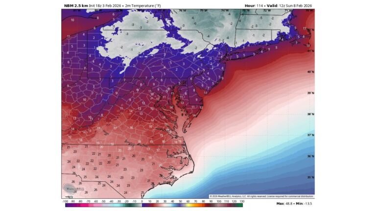
UNITED STATES — A deep Arctic air mass remains firmly entrenched across Pennsylvania, delivering dangerous subzero wind chills early Tuesday, bitter daytime cold, and a continued risk of light snow later in the week as a weak clipper system approaches from the west.
Subzero Wind Chills Create Dangerous Start to Tuesday
Pennsylvania woke up to one of the coldest mornings of the season, with wind chills well below zero statewide. In these conditions, frostbite can occur on exposed skin in as little as 15 to 30 minutes, especially during the early morning hours when winds are strongest.
Although winds gradually weaken through the day, the cold air itself remains locked in, keeping conditions harsh even under mostly sunny skies.
High Temperatures Struggle in the Teens and Low 20s
Despite sunshine across much of the state, high temperatures remain brutally cold, ranging from the single digits in northern and higher-elevation communities to the upper teens and low 20s in southern Pennsylvania. Even areas that see calmer winds later today will feel little relief due to the persistent Arctic airmass.
This is a classic January cold setup where clear skies do not equal warmth, and the lack of cloud cover allows the cold to remain firmly in place.
Clear Skies Offer Sun but No Meaningful Warmth
Much of central and eastern Pennsylvania experiences abundant sunshine, while parts of western and northern Pennsylvania see passing clouds. However, the sun angle in late January is too low to offset the depth of the cold air, keeping temperatures suppressed throughout the day.
Overnight lows are expected to fall back into the single digits and teens, reinforcing the ongoing cold stretch.
Weak Clipper Brings Next Snow Chance Wednesday
Attention then turns to a weak clipper system expected to approach Wednesday, primarily impacting western Pennsylvania. This system lacks deep moisture, but snow showers are possible, with light accumulations in favored areas.
While this is not a major snow threat, even minor snowfall could create localized slick spots, especially given the cold ground temperatures that allow snow to stick quickly.
Cold Pattern Shows Little Sign of Breaking
The larger pattern across the eastern United States remains dominated by Arctic air, meaning below-normal temperatures persist beyond midweek. Any snow that falls will be slow to melt, and icy conditions may linger on untreated roads and sidewalks.
Residents should continue to bundle up, limit prolonged outdoor exposure, and stay alert for updated forecasts as the midweek clipper moves closer.
If you’re experiencing extreme cold or seeing snow showers where you live, share your local conditions with fellow readers at CabarrusWeekly.com and help keep your community informed.


