California, Nevada, Arizona, Texas, Oklahoma, Arkansas, Louisiana, Mississippi, Alabama, Georgia and North Carolina Heat Surge Builds as Polar Vortex Retreat Fuels Super El Niño Concerns for Summer 2026
NORTH CAROLINA — A major shift in the global weather pattern is now underway, with warmer air expanding across the western, central, and southeastern United States as the polar vortex begins retreating northward.
Polar Vortex Retreat Triggers Nationwide Temperature Contrast
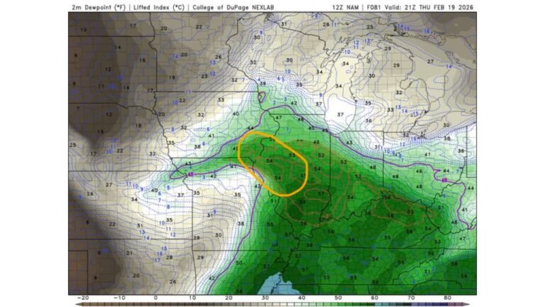
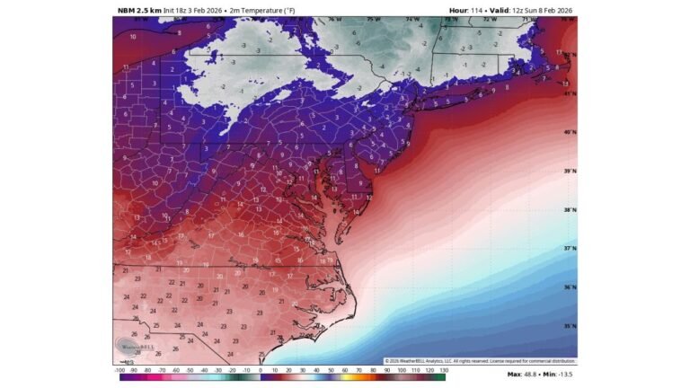
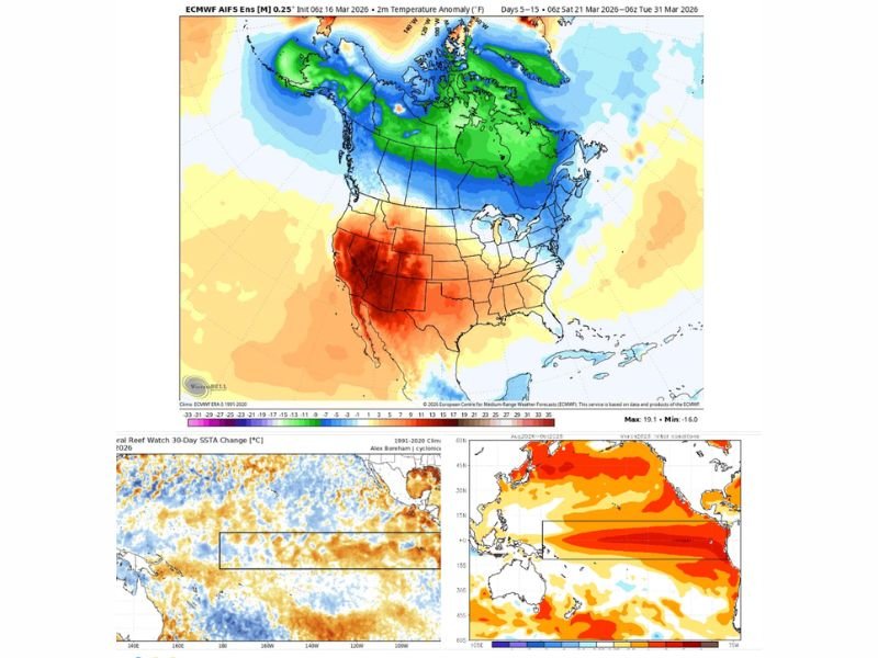
Recent model guidance shows a significant northward retreat of the polar vortex core, allowing warmer air to surge across much of the United States. The latest temperature anomaly projections highlight above-normal warmth spreading from the West into the Central Plains and Southeast, while colder air remains locked across Canada and parts of the northern U.S.
This contrast is creating a sharp divide in conditions. Areas such as the Midwest and Northeast may still experience below-normal temperatures, but regions farther south and west are seeing a clear warming trend take hold heading into late March.
Western and Southern States See Expanding Warmth
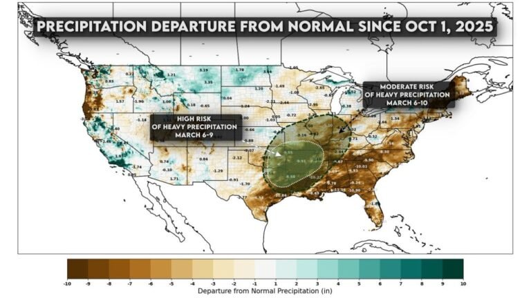
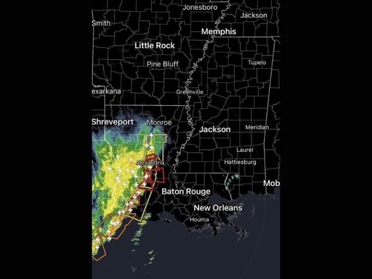
Forecast data indicates that states across the western U.S., including California, Nevada, Arizona, and New Mexico, are expected to see the most intense warming. This warmth extends into the central U.S. and continues into the Southeast, impacting states like Texas, Oklahoma, Arkansas, Louisiana, Mississippi, Alabama, Georgia, and North Carolina.
For North Carolina, this means a transition toward milder and more spring-like conditions, with temperatures gradually climbing above seasonal averages. This warming trend is being reinforced by large-scale atmospheric changes tied to shifting global patterns.
Cold Air Remains Locked Over Canada and Northern U.S.
Despite the warming trend, a large pool of cold air remains entrenched beneath the polar vortex over Canada. This lingering cold is expected to continue influencing northern-tier states and the Northeast, where temperatures may remain cooler than average at times.
This setup creates a classic transitional pattern where warm and cold air masses coexist, increasing the potential for volatility in weather conditions across different regions.
Pacific Ocean Warming Signals Potential Super El Niño
One of the most important developments comes from the Pacific Ocean, where sea surface temperatures are rapidly warming along the equatorial region. This warming is a key signal pointing toward the development of a possible Super El Niño event later in 2026.
A Super El Niño differs from a typical El Niño by producing stronger ocean warming, which can significantly disrupt global weather patterns. This often leads to more extreme weather events, including heavy rainfall in some regions and severe drought conditions in others.
What a Super El Niño Could Mean for the United States
If current trends continue, the U.S. could experience highly amplified weather extremes this summer and beyond. This includes the potential for:
Increased drought risk in certain regions, especially areas already experiencing dryness
Heavier rainfall and flooding events in others, particularly along storm tracks
Altered hurricane activity, as stronger wind shear over the Atlantic may suppress storm development
While reduced hurricane activity can be seen as a benefit, it also disrupts the natural balance of atmospheric circulation. Hurricanes play a role in redistributing heat, and their absence can contribute to prolonged heat patterns in some regions.
North Carolina Outlook as Spring Pattern Evolves
For North Carolina and the broader Southeast, the immediate outlook points toward warming temperatures and a more favorable environment for early planting and outdoor activities. However, this warming trend should be viewed within the broader context of a changing global pattern.
As the atmosphere continues to adjust, weather variability is expected to increase, especially heading into late spring and summer. Residents should remain aware that while conditions may feel stable now, the larger pattern supports more extreme swings ahead.
A Season of Extreme Weather May Be Ahead
Meteorological indicators strongly suggest that the coming months could bring heightened weather extremes across multiple regions of the U.S.. The combination of a retreating polar vortex and a strengthening El Niño pattern creates the potential for significant atmospheric shifts.
As noted in the evolving forecast analysis , this pattern transition is not just seasonal—it may signal a broader global shift that could shape weather outcomes for much of 2026.
This may ultimately lead to a summer defined by unusual heat, shifting storm tracks, and increased climate variability. Stay with CabarrusWeekly.com for the latest updates on this developing weather pattern, and share what conditions you’re seeing in your area as this major shift continues to unfold.