Carolinas, Georgia, and Tennessee Trend Toward Warmer, Rain-Dominant Weekend Storm as Severe Weather Potential Moves North
NORTH CAROLINA — Forecast guidance for the upcoming weekend storm continues to trend warmer overall, reducing the likelihood that winter weather will be the primary headline across much of the Southeast. While some wintry impacts remain possible in colder locations, the dominant concern is shifting toward widespread rainfall and a conditional severe weather setup.
Storm System Trends Away From Widespread Winter Weather
Over the past 24 hours, model trends have steadily pulled colder air farther north, limiting the extent of snow and ice potential. Current guidance suggests that winter weather may still occur on the northwestern fringe of the system, but rain is expected to be the main precipitation type for most areas, including North Carolina, South Carolina, Georgia, and much of Tennessee.
This marks a notable shift from earlier projections that hinted at a broader wintry scenario.
European Model Highlights Stronger, More Aggressive Solution
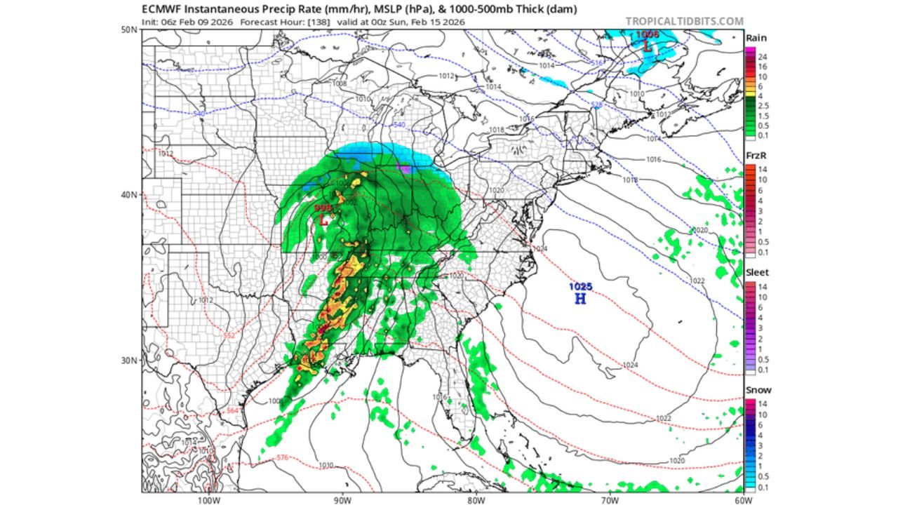
The overnight European model remains the most aggressive with the system, depicting an earlier upper-level cutoff and stronger surface low. This solution pulls overlapping ingredients — including moisture, lift, and wind shear — farther north, opening the door for severe storm potential across parts of the Southeast.
Other guidance, including Euro AI solutions, maintains a more zonal and flatter track, which would reduce the severe risk while still producing widespread rain.
Severe Weather Potential Still Conditional
At this stage, severe weather is not a guarantee, but the setup bears watching. If the stronger European solution verifies, portions of Georgia, South Carolina, and southern North Carolina could find themselves within a more favorable environment for strong to possibly severe thunderstorms.
The degree of severe risk will depend heavily on:
- How far north instability can advance
- The strength of the upper-level system
- How much cold air remains involved
Small shifts will have large impacts on the final outcome.
Heavy Rain Looks Likely Regardless of Track
One aspect of the forecast showing increasing confidence is rainfall. Ensemble guidance supports a widespread rain event across the Southeast, with several areas potentially receiving over an inch of rain, especially from Georgia into the Carolinas.
Even if severe weather remains limited, the system is shaping up to be a significant rain producer, with implications for localized flooding in poor-drainage areas.
What to Watch Over the Next 48 Hours
Forecast confidence is increasing that this system will be warmer and wetter, but questions remain about:
- Whether the European model backs off its stronger solution
- If other guidance trends toward a more aggressive storm
- How much instability can overlap with the rain shield
Residents across the Carolinas should prepare for a rain-heavy weekend and stay alert for potential updates if the severe weather signal strengthens.
If you’re tracking conditions where you live, share your observations and stay connected with ongoing coverage at CabarrusWeekly.com.