Carolinas, Virginia, Maryland and Coastal Northeast Under Marginal Severe Storm Risk as System Tracks Up the East Coast Sunday
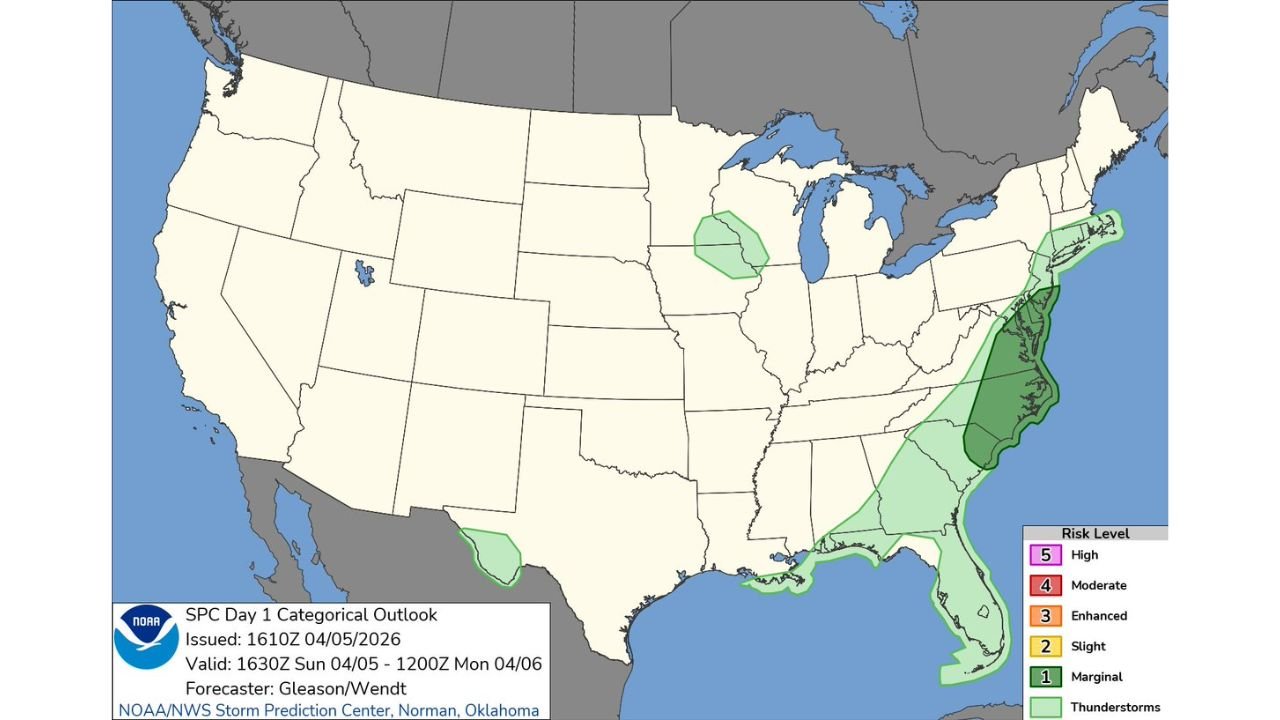
UNITED STATES — A developing line of storms is expected to move north along the East Coast today, placing parts of the eastern Carolinas, Virginia, Maryland, Delaware, New Jersey, and coastal Northeast under a marginal risk for severe weather through early Monday morning.
The latest outlook highlights a narrow but active corridor where storms could briefly intensify as they track northeastward along the coastline.
Storm Line Targets Coastal Corridor From the Carolinas to New England
The primary zone of concern stretches from:
- Eastern North Carolina and South Carolina
- Through Virginia and Maryland, including areas near Washington D.C. and Baltimore
- Into Delaware, New Jersey, and parts of New York and southern New England
This system is expected to follow a coastal track, keeping the strongest activity closer to the Atlantic side rather than pushing far inland.
What “Marginal Risk” Means Today
The current setup is classified as a Level 1 (Marginal Risk), which indicates:
- Isolated strong storms possible
- Brief damaging wind gusts are the main concern
- Low but non-zero chance of localized impacts
While this is not a widespread severe outbreak, conditions are favorable enough for pockets of stronger storms to develop within the larger rain shield.
Timing and Movement of the Storms
Storms are expected to:
- Develop and organize along the Southeast coast during the day
- Move northward into the Mid-Atlantic by afternoon and evening
- Continue into the Northeast overnight into early Monday
This progressive movement means impacts at any one location should be relatively brief, but multiple regions will see passing rounds of rain and gusty storms.
Additional Areas of Isolated Activity
Outside the East Coast corridor, a few isolated marginal zones are also noted:
- Parts of the Upper Midwest near Wisconsin
- A small area in South Texas
These regions could see spotty thunderstorm activity, though coverage and intensity are expected to remain limited.
Main Threat: Gusty Winds With Passing Storms
The biggest concern with today’s setup is:
- Localized damaging wind gusts
- Brief heavy rain reducing visibility
- Occasional lightning with stronger cells
There is no indication of a widespread tornado or high-end severe threat, but quick bursts of wind could still lead to minor damage in isolated spots.
Stay Alert as Storms Move North
Even with a lower-end risk level, residents along the East Coast should stay aware as storms pass through.
Conditions can change quickly within a marginal setup, especially along coastal boundaries where wind energy and moisture are slightly enhanced.
Stay With Cabarrus Weekly for Updates
For continued tracking of East Coast storms, severe weather alerts, and daily forecast breakdowns, stay connected with Cabarrus Weekly for reliable and timely coverage.