Central U.S. Dry Pattern Intensifies as Texas, Oklahoma, Kansas and Midwest Face Below-Normal Rainfall and Worsening Soil Moisture Into Early April
NORTH CAROLINA — A concerning dry weather pattern is strengthening across the central United States, with little rainfall expected and soil moisture rapidly declining heading into early April.
Widespread Dryness Expands Across the Plains and Midwest
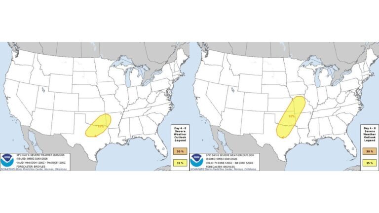
New forecast data shows a large region of below-normal precipitation developing across Texas, Oklahoma, Kansas, Nebraska, Missouri, and Iowa, with dry conditions expected to persist over the next 10 to 15 days.
The precipitation outlook indicates significantly reduced rainfall totals, with many areas expected to receive well below seasonal averages, reinforcing an already dry pattern. This includes:
- Texas and Oklahoma: Minimal rainfall expected with ongoing dryness
- Kansas and Nebraska: Continued lack of meaningful precipitation
- Missouri and Iowa: Increasing rainfall deficits despite early spring transition
This dry stretch comes at a critical time when spring systems typically begin increasing moisture across the central U.S.
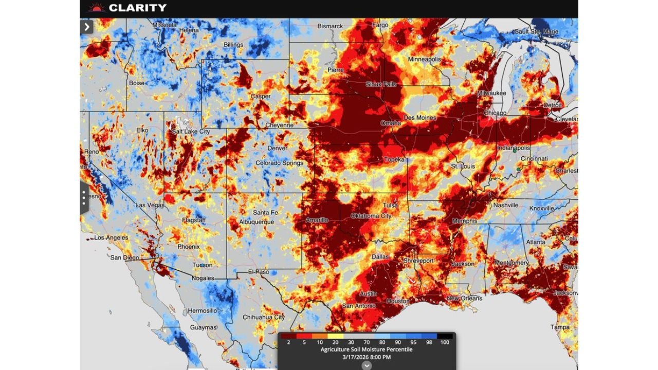
Soil Moisture Levels Dropping Rapidly
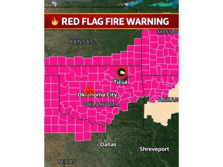
Soil moisture data reveals alarming trends, especially across the southern Plains and parts of the Midwest, where values are falling into the lowest percentiles (below 10–20%) in several locations.
Areas most impacted include:
- Oklahoma and Kansas: Large zones showing critically low soil moisture
- North Texas: Expanding pockets of extreme dryness
- Missouri and Illinois: Drying soils beginning to spread eastward
These conditions indicate that ground moisture is not being replenished, which can stress agriculture and increase vulnerability to heat.
El Niño Not Providing Immediate Relief
Despite expectations that El Niño patterns may eventually influence weather, current projections suggest that no immediate rainfall relief is likely across the central U.S.
Forecast guidance shows that dry conditions could dominate through at least early April, meaning that any meaningful shift toward wetter conditions may still be weeks away.
This delay is critical, as spring typically serves as a key recharge period for soil moisture before the hotter summer months.
Combined Heat and Dryness Raising Concerns
This developing dry pattern is occurring alongside unseasonably warm temperatures across the Plains, further accelerating soil moisture loss.
The combination of above-normal heat and lack of rainfall creates a high-risk setup for:
- Early-season drought development
- Increased wildfire potential
- Agricultural stress heading into planting season
States like Texas, Oklahoma, Kansas, and Nebraska are particularly vulnerable if this pattern continues.
What This Means for the Weeks Ahead
The persistence of this dry pattern suggests that water deficits could deepen quickly across the central U.S., especially if rainfall remains limited into April.
For now, the central Plains and Midwest remain a key area to watch throughout spring, as any delay in rainfall could have long-term impacts on agriculture and regional water supply.
While North Carolina and the Southeast are not currently in the core dry zone, shifting weather patterns later in spring could influence conditions farther east.
As outlined in the official CabarrusWeekly.com format guidelines , this evolving situation will be closely monitored for both rainfall trends and drought development.
Stay connected with CabarrusWeekly.com and share what conditions you’re seeing in your area as this dry pattern continues to evolve across the United States.