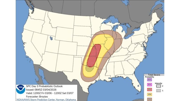
Central U.S. Severe Weather Escalates March 5–8: Level 2 Slight Risk Spans Texas, Oklahoma, Arkansas, Missouri and Tennessee with Friday Night Carrying Highest-End Potential
TEXAS — Severe weather is set to return to the central United States this week, with Wednesday through Saturday all currently under a Level 2 out of 5 Slight Risk, and forecasters signaling that Friday into Friday night may carry the highest-end severe potential.
The evolving setup centers over the heart of the country, stretching from Texas northward and eastward into the Mid-South and lower Midwest.
Wednesday, March 5: Initial Storm Development from Texas to Missouri
By Thursday morning into Thursday evening (valid March 5), forecast instability values increase across a corridor extending from north and central Texas into eastern Oklahoma, Arkansas and southern Missouri.
The most concentrated severe parameters appear across:
Dallas–Fort Worth and North Texas
Central and eastern Oklahoma including Oklahoma City and Tulsa
Western and central Arkansas including Little Rock
Southern Missouri
Model guidance shows a pronounced axis of elevated instability (K-Index values in the 30s and near 40), indicating an environment supportive of organized thunderstorms.
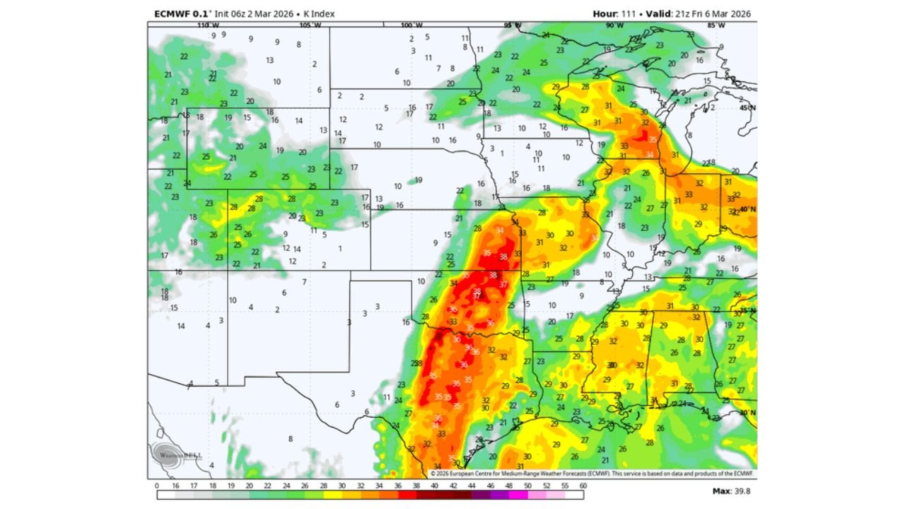
Friday, March 6: Higher-End Potential Emerging
Friday into Friday night shows a broader and more intense instability field expanding from central Texas north through Oklahoma and Kansas, then east into Arkansas, Missouri, Tennessee and Kentucky.
The corridor of strongest values stretches from:
Central and eastern Texas
Through Oklahoma and southern Kansas
Across Arkansas and southern Missouri
Into western Tennessee and Kentucky
This day stands out as having the most favorable overlap of moisture, lift and wind dynamics. Forecast guidance suggests this period could support a more widespread severe threat compared to earlier days.
While all four days carry a Slight Risk designation, Friday’s environment appears most supportive of stronger storm organization, particularly during the evening and overnight hours.
Saturday, March 7: Threat Shifts East but Remains Active
By Saturday evening, the focus shifts eastward into the Lower Mississippi Valley and Tennessee Valley, including:
Eastern Arkansas
Western and central Tennessee including Memphis and Nashville
Northern Mississippi
Western Kentucky
Instability remains sufficient to sustain severe weather potential, though the axis gradually migrates east of Texas and Oklahoma.
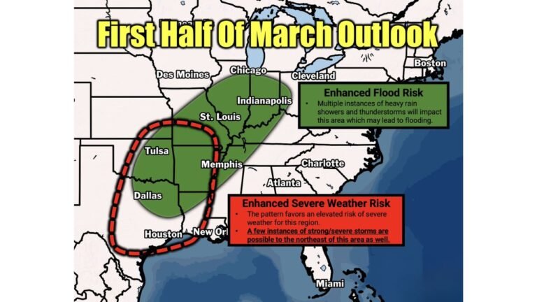
Multi-Day Pattern Signals Sustained Activity
The extended sequence from Wednesday through Saturday reflects a progressive trough pattern crossing the central United States. Each day features a Slight Risk designation, underscoring repeated daily storm chances rather than a single-event outbreak.
This type of setup commonly supports:
Damaging wind events along squall lines
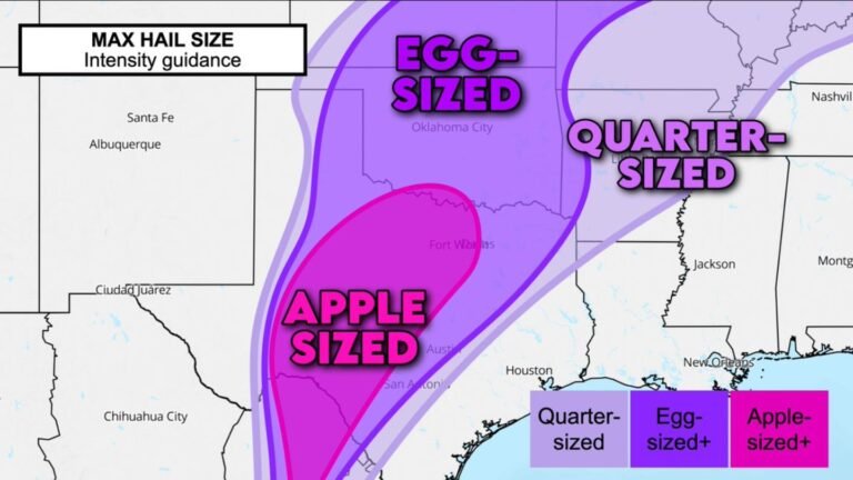
Large hail within discrete or semi-discrete storms
Localized tornado potential where wind shear strengthens
The most concentrated instability values consistently align from central Texas through Oklahoma and into Arkansas and Missouri, reinforcing the central U.S. focus.
What This Means for Affected States
Residents across:
Texas
Oklahoma
Arkansas
Missouri
Kansas
Tennessee
Kentucky
should monitor forecasts closely throughout the week.
While all days carry a Level 2 Slight Risk, Friday into Friday night currently appears to hold the highest-end severe potential, especially across Texas, Oklahoma and Arkansas before shifting east.
The multi-day nature of this setup increases the importance of staying weather-aware, as repeated rounds can compound impacts.
If you live in any of the central U.S. states highlighted and begin noticing changing weather conditions this week, share your local reports with CabarrusWeekly.com as we continue tracking this active early-March severe weather pattern.