Eastern Ohio and Pennsylvania Under Enhanced Risk as Powerful Storms Threaten Large Hail and Damaging Winds Today
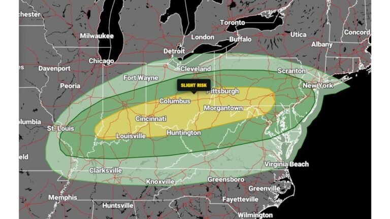
OHIO, PENNSYLVANIA — Severe weather concerns are escalating across the region as forecasters have upgraded parts of eastern Ohio and central to southern Pennsylvania to an Enhanced Risk (Level 3 of 5) for today, signaling a higher likelihood of dangerous storms developing this afternoon and evening.
This upgrade reflects increasing confidence in the development of intense supercell thunderstorms, capable of producing significant impacts across a densely populated corridor.
Enhanced Risk Zone Expands Across Key Population Centers
The highest threat area now stretches across:
- Eastern Ohio, including areas near Cleveland and eastward
- Central and southern Pennsylvania, including regions near Pittsburgh, State College, and Harrisburg
Surrounding areas, including parts of West Virginia, New York, and western Pennsylvania, remain under a lower but still notable risk.
Supercells Expected to Drive Severe Threat
Meteorologists are closely watching for supercell thunderstorms, which are among the most dangerous storm types.
These storms are expected to develop in an environment featuring:
- Strong atmospheric instability
- Favorable wind shear for storm rotation
- Adequate moisture to sustain storm intensity
If storms organize as expected, they could quickly become severe.
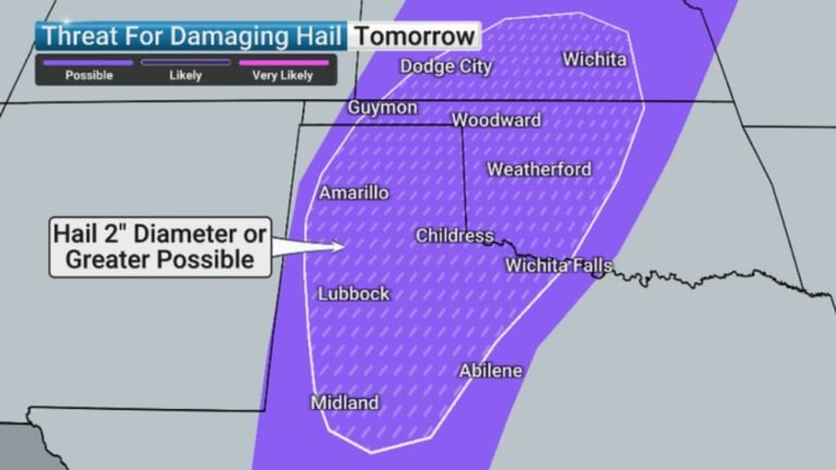
Large to Very Large Hail a Primary Concern
One of the biggest threats with today’s setup is large hail, with some storms potentially producing:
- Hailstones larger than golf balls
- Significant damage to vehicles, roofs, and crops
Forecast guidance highlights a concentrated corridor where hail risk is particularly elevated across eastern Ohio into Pennsylvania.
Damaging Winds Could Turn Destructive
In addition to hail, damaging wind gusts are a major concern:
- Winds could exceed 60 to 70 mph in stronger storms
- Some gusts may approach hurricane-force levels in isolated cases
These winds could lead to:
- Downed trees and power lines
- Scattered power outages
- Structural damage in the hardest-hit areas
Timing: Afternoon Into Evening Window
The most active period is expected:
- Late afternoon through the evening hours
- Storms may develop rapidly and intensify quickly
Residents are urged to remain alert during this window, as conditions can deteriorate fast once storms begin forming.
Tornado Risk Remains Secondary but Possible
While hail and wind are the primary threats, the setup does include:
- Some potential for isolated tornadoes, especially if storms remain discrete
- Enhanced rotation within stronger supercells
Even a brief tornado could cause localized damage, making it important to monitor warnings closely.
Why Confidence Has Increased
The upgrade to Enhanced Risk is based on:
- Improved model agreement on storm development
- Stronger signals for organized severe weather
- Increasing overlap of key ingredients like shear and instability
This indicates a more organized and widespread severe weather event compared to lower risk levels.
Final Outlook
Today’s setup across Ohio and Pennsylvania has the potential to produce dangerous thunderstorms capable of large hail and damaging winds, with the highest risk centered over eastern Ohio into central and southern Pennsylvania.
Residents should stay weather-aware, have multiple ways to receive warnings, and be prepared to act quickly if severe storms approach.
Stay tuned to CabarrusWeekly.com for continued updates as this severe weather event unfolds.