Eastern U.S. Cold Pattern Reasserts Itself for Late February as Brief Presidents Day Warm-Up Fades and Below-Normal Temperatures Dominate Into March
EASTERN UNITED STATES — Forecast confidence continues to grow that a colder-than-normal weather pattern will dominate much of the Eastern U.S. during the second half of February, with only a brief and short-lived warm-up around Presidents Day before colder air quickly reasserts itself.
Presidents Day Warm Spell Expected to Be Brief
Ensemble and long-range guidance indicate that the much-discussed “blowtorch” warm-up expected around Presidents Day week will be short-lived, lasting only a few days before colder air moves back into the eastern half of the country. While temperatures may briefly spike above seasonal averages, model trends show this warmth retreating quickly as larger-scale atmospheric patterns shift back toward colder conditions.
This means any mid-winter thaw will likely have limited impact on the overall temperature outlook for February, especially across the Midwest and Great Lakes.
Cold Pattern Locks In for the Second Half of February
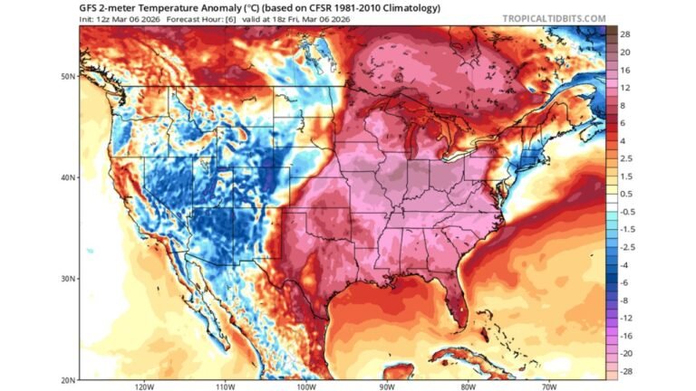
Multiple ensemble models are in strong agreement that cold air will return and persist across the Eastern U.S. following the brief warm period. Temperature anomaly maps consistently show below-normal readings from the Midwest through the Ohio Valley, Great Lakes, Appalachians, and Northeast during the latter half of the month.
Indiana stands out as a notable example, currently tracking around 8 degrees below average through this point in February. With colder air projected to continue, the state remains on course to finish the month well below normal despite any short-term moderation.
Atmospheric Signals Favor Sustained Cold
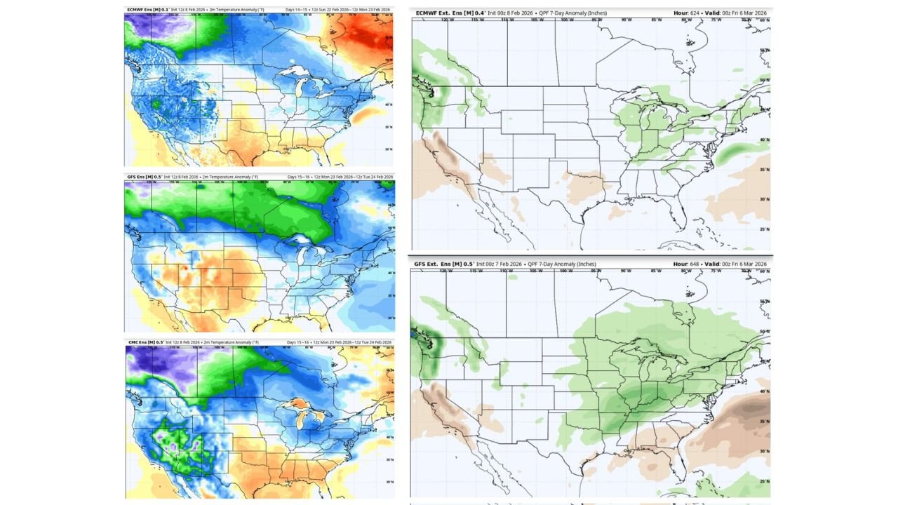
Large-scale pattern indicators, including ensemble trends tied to the North Atlantic Oscillation, suggest a setup favorable for sustained cold across the eastern half of the country. This pattern supports continued intrusions of cold air rather than prolonged warmth, reinforcing the idea that February will not finish as mild as some earlier outlooks suggested.
At the same time, the western U.S. is expected to remain comparatively milder, creating a sharp east-to-west temperature contrast across the country.
Active Weather Possible as Cold Persists Into March
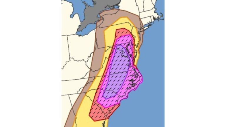
In addition to colder temperatures, guidance hints that periods of more active weather could develop late February into early March, particularly where cold air interacts with storm systems tracking through the central and eastern U.S. While exact details remain uncertain at this range, the setup supports the potential for wintry precipitation episodes in colder regions.
Forecasters caution that February is far from over, and the overall pattern strongly favors a colder finish rather than a widespread early spring feel.
February Likely to End Below Normal Across Much of the East
Taken as a whole, the data does not support the idea of a super warm February for much of the Eastern U.S. Instead, the combination of ensemble agreement, temperature anomalies, and large-scale pattern signals point toward a colder-than-normal end to the month, with impacts potentially extending into early March.
If you’re noticing colder conditions lingering longer than expected where you live, we’d like to hear from you. Share your local temperatures and winter observations with us at CabarrusWeekly.com, and stay tuned for continued updates as this late-winter pattern evolves.