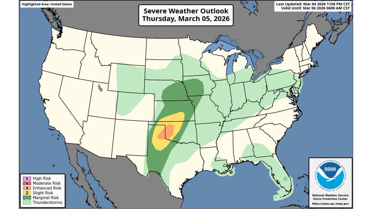
Enhanced Risk Issued for Texas and Oklahoma as Tornadoes, Very Large Hail and Damaging Winds Threaten Amarillo, Childress and Oklahoma City Thursday
TEXAS & OKLAHOMA — An Enhanced Risk (Level 3 of 5) for severe weather has been issued across portions of Texas and Oklahoma for Thursday, placing communities from the Texas Panhandle into western and central Oklahoma under a heightened threat for dangerous storms this afternoon and evening.
The highlighted Enhanced Risk zone includes areas near:
- Amarillo, TX
- Childress, TX
- The eastern Texas Panhandle
- Western into central Oklahoma, including areas near Oklahoma City
What “Enhanced Risk” Means
An Enhanced Risk signals a greater concentration of severe storms capable of producing:
- Damaging winds
- Very large hail
- A few tornadoes, possibly strong
While not the highest category issued by the Storm Prediction Center, Level 3 indicates storms are expected to be more widespread and intense than a typical marginal or slight risk day.
Core Threat Area: Texas Panhandle Into Western Oklahoma
The most concerning corridor stretches from the central and eastern Texas Panhandle northeast into western Oklahoma.
This includes counties surrounding:
- Amarillo
- Canyon
- Childress
- Into parts of western Oklahoma
Storms developing in this region will have access to:
- Increasing low-level moisture
- Strong wind shear
- Favorable instability
If discrete supercells form before storms merge, tornado development becomes more likely.
Tornado and Hail Potential
Forecasters warn that a few tornadoes are possible this afternoon and evening, with at least isolated potential for stronger tornadoes if storms remain organized.
Very large hail — potentially larger than golf balls — is also possible with the strongest supercells. These hailstones could cause damage to vehicles, roofs and windows.
Damaging Winds Could Become Widespread
As storms mature and possibly grow into clusters or lines, the primary hazard may shift toward damaging straight-line winds.
Wind gusts capable of downing trees and power lines are possible, especially during the evening hours.
Timing
- Afternoon: Storm development begins across the Texas Panhandle
- Late Afternoon to Evening: Storms intensify and spread into Oklahoma
- Night: Severe threat gradually shifts east
Residents across the Enhanced Risk area should stay weather-aware throughout the afternoon and evening.
Broader Risk Area
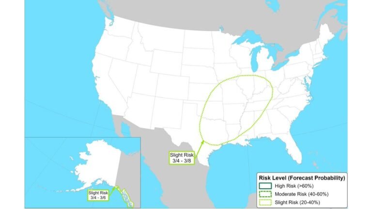
A broader Slight and Marginal Risk extends farther north and east into portions of the central Plains and Midwest, but the most concentrated severe threat remains centered over Texas and Oklahoma.
CabarrusWeekly.com will continue providing updates as storms develop. Residents in the highlighted corridor should have multiple ways to receive warnings and be prepared to act quickly if severe weather alerts are issued.