Flash Flood Threat Expands Across Indiana and Ohio as Training Thunderstorms Could Dump 2+ Inches in Hours
INDIANA, OHIO — While severe storms capable of hail and damaging winds dominate headlines today, a serious flash flood threat is quietly developing across central and northern Indiana into much of Ohio, where repeated rounds of thunderstorms could quickly overwhelm local areas.
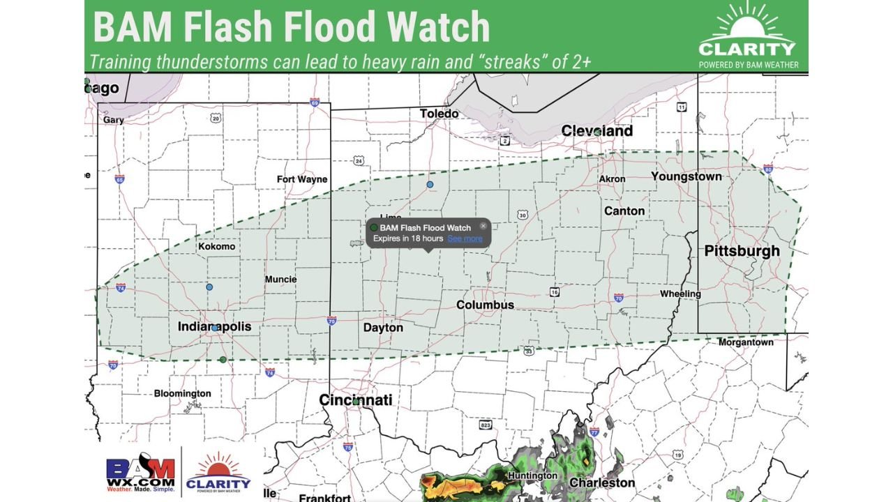
A newly issued **flash flood watch highlights the growing concern for “training thunderstorms” — storms that repeatedly move over the same locations — potentially leading to localized rainfall totals exceeding 2 inches in a short period of time.
What Is Causing the Flash Flood Risk
The primary concern is not just heavy rain, but how the storms behave.
Instead of moving quickly through, storms are expected to:
- Track repeatedly over the same areas
- Form in lines or clusters that “train” across counties
- Produce persistent, heavy downpours over several hours
This setup significantly increases the risk of rapid water accumulation, especially in urban areas, low-lying regions, and places with poor drainage.
Areas Most at Risk
The flash flood threat zone includes:
- Central and northern Indiana, including Indianapolis, Kokomo, and Muncie
- Much of Ohio, including Dayton, Columbus, and extending toward Cleveland
- Nearby regions that could see spillover effects depending on storm tracks
Cities within this corridor could experience quickly changing conditions, with streets and small streams flooding in a matter of hours if storms repeatedly pass overhead.
Rainfall Totals Could Add Up Quickly
Forecast guidance suggests:
- 2+ inches of rain possible in streaks where storms train
- Locally higher amounts if multiple storm cells track over the same location
- Intense rainfall rates capable of overwhelming drainage systems
Even if surrounding areas see less rain, these narrow “corridors” of heavy rainfall can create isolated but dangerous flooding situations.
Severe Weather and Flooding Combo Raises Concern
This flash flood risk is developing alongside an already volatile severe weather setup, which includes:
- Large hail
- Damaging winds
- Possible tornadoes
The overlap of these threats means some communities could face both severe storms and flooding at the same time, complicating response and increasing overall danger.
Timing of the Flood Threat
- Afternoon: Initial storms begin developing and spreading
- Late afternoon into evening: Highest risk for training storms and heavy rain
- Overnight: Flood threat may continue in areas where storms persist
Because the heaviest rain depends on storm positioning, impacts will vary significantly from one location to another.
Residents Should Stay Alert
Flash flooding can develop quickly, often with little warning once storms begin training over an area.
Residents across Indiana and Ohio should:
- Monitor weather alerts closely
- Avoid driving through flooded roadways
- Be prepared for rapidly changing conditions this evening
With 2+ inches of rain possible in concentrated zones, even areas not typically prone to flooding could experience issues today.
Stay with CabarrusWeekly.com for continued updates as both severe storms and flash flooding threats unfold across Indiana and Ohio.