Florida’s Temperature Whiplash: 90s This Weekend Before GFS Projects 20s and 30s by Tuesday Morning
FLORIDA — A dramatic temperature swing is shaping up across the state as summer-like heat surges in for the weekend, followed by a sharp cold front that could send readings tumbling back toward winter levels early next week.
Forecasters indicate parts of Florida may approach the lower 90s on Saturday, delivering a brief but intense warm spell. However, this warm-up will be short-lived as a strong cold front pushes through, setting the stage for a significant cooldown.
Summer-Like Heat Peaks Saturday
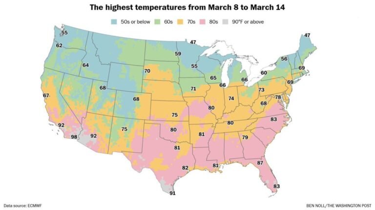
Ahead of the incoming front, warm southerly flow will allow temperatures to spike across much of the peninsula. Some locations could see highs near 90 degrees, particularly in interior and southern sections.
This surge of warmth will create a stark contrast compared to what is projected just days later. The atmosphere will feel more like late spring or early summer before the cold air returns. Humidity levels may also increase temporarily, adding to the summer-like feel.
Cold Front Arrives Early Next Week
A sharp cold front is forecast to sweep across Florida late Sunday into Monday, ushering in a much colder air mass.
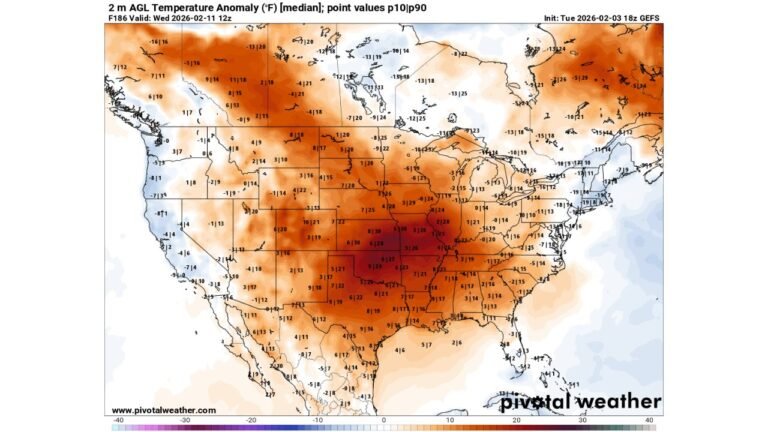
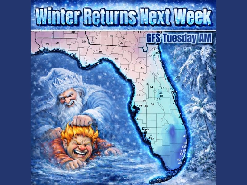
By Tuesday morning, model guidance — particularly the GFS — is projecting temperatures dropping into the 20s and 30s across parts of northern Florida, with 30s extending into portions of central Florida. While there remains some uncertainty in exact temperature placement, the signal for a notable drop is strong.
GFS Signals Aggressive Temperature Drop
The latest GFS model run shows a pronounced cold push, with morning lows in the upper 20s across the Panhandle and northern counties, and widespread 30s across central sections.
Farther south, temperatures appear likely to settle in the 40s and lower 50s, still a dramatic change from weekend highs pushing toward 90. There is some wiggle room in the exact numbers, but the broader pattern supports a significant cooldown statewide.
Impacts and Temperature Whiplash
This type of rapid shift — from near 90 degrees to potential 20s and 30s within days — highlights the ongoing winter weather volatility.
Northern Florida could face concerns related to sensitive vegetation, pets, and even exposed pipes if temperatures drop as projected. Meanwhile, central and southern regions will notice a pronounced chill compared to the weekend warmth. The dramatic reversal underscores how quickly Florida’s weather pattern can pivot this time of year.
If you’re in Florida, prepare for a quick wardrobe change and monitor updated forecasts as the cold front approaches. Share your local temperature readings and conditions with CabarrusWeekly.com as this major temperature swing unfolds.