Illinois and Eastern Iowa Severe Threat May Shift Toward Giant Hail Tuesday Night if Storms Ride North of Warm Front, New RRFS Model Suggests
IOWA — A new high-resolution RRFS model run is adding a layer of complexity to Tuesday’s severe weather forecast across Illinois and eastern Iowa.
While simulated radar reflectivity shows intense storms developing Tuesday evening, a deeper look at the environment suggests a possible “fail mode” for the tornado threat — with storms potentially moving north of the warm front and becoming elevated.
If that scenario plays out, the risk of strong tornadoes could be significantly reduced. However, the threat for damaging hail would remain.
What the RRFS Is Showing
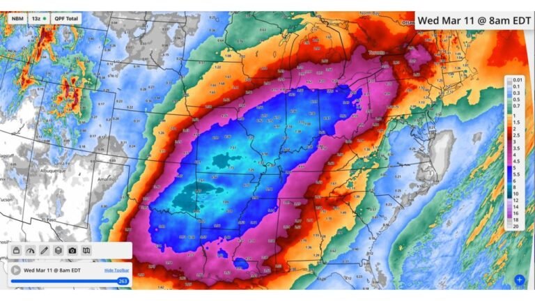
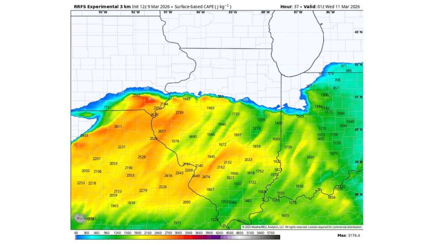
The experimental 3 km RRFS guidance valid around 8 p.m. to 9 p.m. Tuesday depicts clusters of strong storms stretching from:
- Eastern Iowa
- Northern and central Illinois
- Toward northwest Indiana
The simulated reflectivity suggests organized storm structures, particularly across northern Illinois into northern Indiana.
But placement is critical.
Warm Front Position Is the Key
Surface analysis shows a sharp warm front draped roughly west to east across northern Illinois.
South of that boundary, surface-based instability is robust, with:
- CAPE values pushing 2,500 to 3,000+ J/kg
- Dew points in the mid to upper 60s
- Strong low-level wind shear
North of the front, however, the air mass becomes cooler and more stable at the surface.
If storms track north of the warm front, they may become elevated above the surface layer. Elevated storms can still produce:
- Large to very large hail
- Heavy rainfall
- Damaging winds
But their tornado potential is typically reduced compared to surface-based supercells rooted in the warm sector.
Instability Gradient Is Sharp
RRFS data shows a tight instability gradient across Illinois:
- 2,500–3,000+ J/kg CAPE across central Illinois and parts of eastern Iowa
- 1,500–2,000 J/kg across northern Illinois
- Rapid drop-off north of the boundary
Dew points in the mid to upper 60s are widespread south of the front, supporting strong updraft potential.
That means storms forming in the warm sector could still intensify quickly if they remain surface-based.
Tornado Risk Could Be “Slashed” — But Not Eliminated
The model suggests that if most storms lift north of the boundary and become elevated, the tornado risk would be significantly diminished.
However, that outcome is not guaranteed.
If even a few storms remain anchored along or just south of the warm front — especially near cities such as:
- Peoria
- Springfield
- Bloomington
- Joliet
- South and southwest suburbs of Chicago
— then the tornado threat would remain very real.
Hail Threat Remains Strong Regardless
Even in the elevated storm scenario, the environment supports strong updrafts capable of producing:
- Large hail
- Possibly very large hail
High CAPE values and steep lapse rates would allow elevated supercells to generate significant hailstones, even if tornado production becomes less likely.
Still Just One Solution
It’s important to emphasize that this RRFS run represents one possible outcome among several high-resolution models.
Other convection-allowing models (CAMs) may depict different storm tracks and boundary interactions. Small shifts in the warm front position could dramatically change which communities face the highest tornado threat versus a primarily hail and wind setup.
Bottom Line
Tuesday’s severe weather setup across Illinois and eastern Iowa remains highly sensitive to the exact placement of the warm front. The latest RRFS model suggests storms may trend north of the boundary, which would reduce tornado potential but keep the damaging hail risk intact.
The ultimate outcome will depend on how storms interact with that boundary Tuesday afternoon and evening.
CabarrusWeekly.com will continue to track model trends and provide updates as confidence increases in the final severe weather scenario.