Indiana Winter Storm Intensifies as Central and Southern Counties See 1-Inch-Per-Hour Snow Rates and Worsening Travel Conditions
INDIANA — A significant winter storm continues to grip the Hoosier State early Sunday, with moderate to heavy snow falling statewide and the most intense snow bands firmly focused across central and southern Indiana, according to early-morning radar and surface observations.
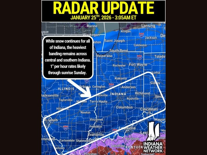
As of 3:05 a.m. ET, snowfall rates in parts of central and especially southern Indiana are exceeding 1 inch per hour, creating rapidly deteriorating road conditions and dangerous travel across both urban corridors and rural areas.
Heaviest Snow Band Locked Over Central and Southern Indiana
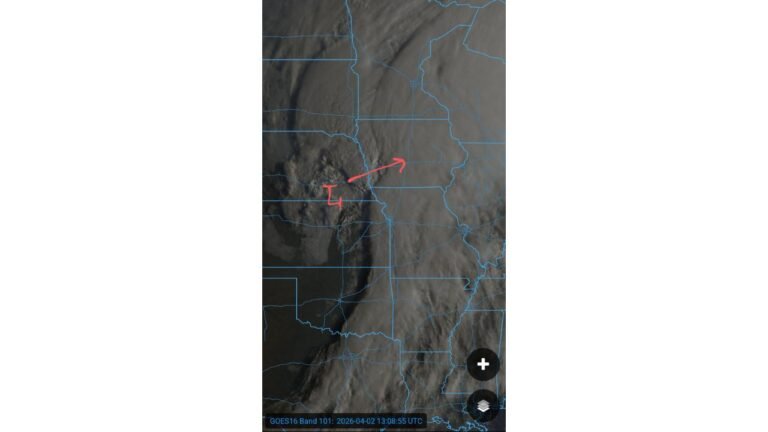
Radar imagery shows a well-organized snow band stretching from west-central Indiana near Terre Haute, eastward through Indianapolis metro-adjacent counties, and into southeastern Indiana toward the Ohio border. Communities within this corridor are experiencing persistent heavy snowfall, with limited breaks in intensity through the pre-dawn hours.
Northern Indiana remains snow-covered as well, but the most impactful rates continue to favor areas south of U.S. 30 and along the I-70 corridor, where accumulation is building quickly on untreated surfaces.
Winds Add to Travel Hazards Despite Modest Gusts
While wind speeds are not extreme, north winds gusting between 15 and 25 mph are already causing blowing and drifting snow, particularly on open rural roads and east–west routes. As snowfall continues through the day Sunday, these impacts are expected to worsen.
Forecast guidance suggests wind gusts may increase to near 30 mph by Sunday evening, which would further reduce visibility and allow drifting snow to redevelop even after plowing efforts.
Conditions Expected to Deteriorate Through Sunday
Snow is expected to continue through much of Sunday, with blowing and drifting becoming more of a concern during daylight hours as accumulations deepen and winds slowly increase. Even areas that temporarily see lighter snowfall may experience rapidly changing conditions as heavier bands rotate overhead.
Drivers should anticipate snow-covered highways, reduced visibility, and icy secondary roads, especially across central and southern Indiana, where the heaviest snowfall rates are ongoing.
Safety and Travel Outlook
With snowfall rates near or above 1 inch per hour in the hardest-hit areas, road crews may struggle to keep up during peak snowfall. Residents are urged to limit travel, allow extra time if driving is unavoidable, and keep emergency supplies in vehicles. Conditions may remain hazardous well into Sunday evening, even as snowfall rates eventually begin to taper.
If you’re seeing heavy snow, drifting, or dangerous travel where you live, share your local conditions with us. Your updates help others stay informed across the region. Visit CabarrusWeekly.com for continued winter storm coverage and updates as this system evolves.