Indiana Winter Storm Threat Intensifies as Northward Track Shift Raises Risk of Heavy Snow and Dangerous Ice from January 24–26
INDIANA — A potentially high-impact winter storm is becoming increasingly likely for Indiana between January 24 and January 26, as forecast models continue to trend northward with the storm track, increasing the risk of impactful snowfall and dangerous winter travel conditions across much of the state.
Strong Arctic High Sets the Stage
For more than a week, meteorologists have been monitoring a powerful surge of moisture and energy moving into the central United States, while at the same time an exceptionally strong Arctic high pressure system pushes south into the Midwest. This combination creates a classic setup for a significant winter storm, especially when cold air is firmly in place before precipitation arrives.
Forecast Models Shift North
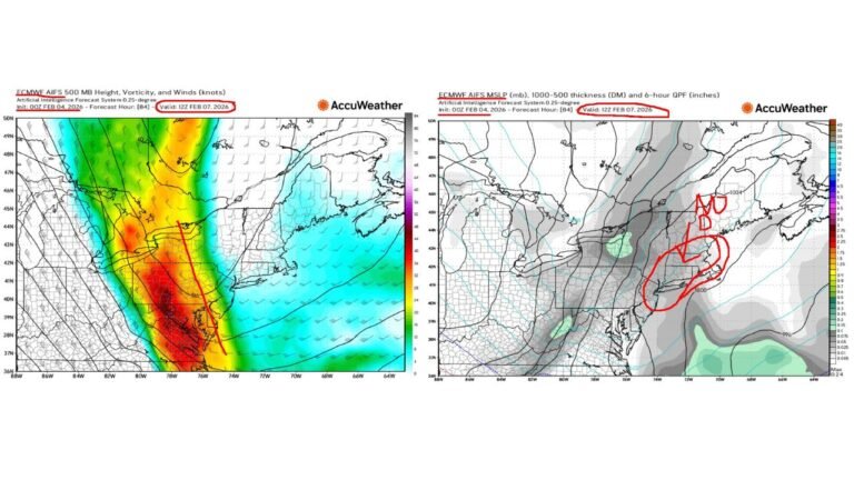
Over the last 24 hours, there has been a notable shift in model guidance, led by the European and Canadian models, with the American model now following the same trend. This shift suggests the storm’s track may move farther north than earlier projections, which has important implications for Indiana.
A weaker Arctic high than initially expected may allow the storm to advance farther north, placing southern, central, and potentially northern Indiana within zones of impactful snowfall.
Snow Chances Increasing Across Indiana
If the current trend holds, southern and central Indiana now have a moderate chance of seeing several inches of snow, while northern Indiana carries at least a low—but growing—chance of meaningful accumulation.
While it is still too early to lock in specific snowfall totals, confidence is rising that parts of Indiana could experience travel-disrupting snow, especially near and north of the storm’s eventual track.
Ice Storm Zone Remains South, But Track Matters
The most severe ice storm risk currently remains south of Indiana, affecting parts of the Mid-South. However, small shifts in the storm path could bring mixed precipitation or brief icing concerns into southern Indiana, particularly near the transition zone between snow and ice.
This is why forecasters continue to emphasize that details matter greatly with this system.
Timing: January 24–26
Based on current guidance, winter impacts would likely begin Friday, January 24, intensify Saturday, and potentially linger into Sunday, January 26, depending on the storm’s speed and final track. Roads could become hazardous quickly once snowfall begins.
What Happens Next
Meteorologists will spend the next 24 to 48 hours refining the storm track, after which snowfall accumulation maps and more localized impact forecasts will be released. Confidence in some form of impactful winter weather is growing, but where the heaviest snow sets up is still being determined.
Bottom Line for Indiana Residents
The signal is strengthening that Indiana will not escape this storm untouched. While exact amounts remain uncertain, the risk of impactful snow is increasing, especially for southern and central Indiana, with northern areas still in play.
Residents should monitor updates closely, prepare for possible travel disruptions, and plan for rapidly changing winter conditions as forecast details become clearer. Stay tuned for continued updates and local impact breakdowns from CabarrusWeekly.com as this winter storm threat evolves.


