Iowa, Illinois and Missouri Face Renewed Severe Storm Threat Friday With Tornado Risk, Large Hail and Damaging Winds Expected
IOWA — Severe weather is expected to ramp back up across the central United States on Friday, with multiple hazards including tornadoes, very large hail, and damaging winds developing through the afternoon and evening hours.
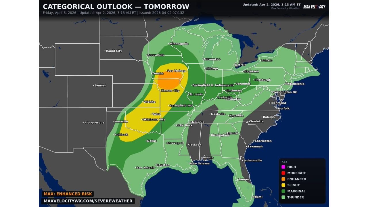
Enhanced Risk Zone Targets Iowa, Missouri and Illinois
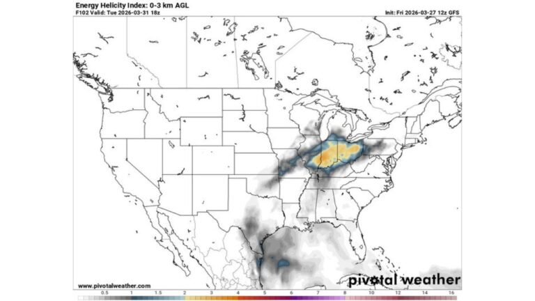
The highest concentration of severe weather is expected across parts of Iowa, Missouri, and Illinois, where conditions are most favorable for organized thunderstorms and rotating supercells.
Cities including Des Moines, Springfield, and St. Louis fall within this zone, where the environment supports strong storm development capable of producing tornadoes and widespread severe impacts.
Tornado Potential Focused in Key Midwest Corridor
Within the broader risk area, the tornado threat is expected to be most pronounced across portions of Iowa, Illinois, and Missouri. Atmospheric conditions in this corridor will favor storm rotation, increasing the likelihood of a few tornadoes as storms intensify.
Residents in these areas should remain alert, as storms could quickly become severe with little warning once they begin organizing.
Large Hail and Damaging Winds Also Major Concerns
In addition to tornado potential, storms are expected to produce very large hail and damaging wind gusts, especially as they mature and begin to cluster.
Some storms may become intense rapidly, leading to hail capable of causing damage to vehicles and property, along with strong winds that could bring down trees and power lines.
Storm Development Expected Through Afternoon and Evening
Storms are expected to develop during the afternoon hours and continue into the evening as they organize into clusters or lines. This timing increases the risk of impacting both daytime and evening activities across the region.
The system is expected to expand in coverage as it progresses, bringing severe weather potential to a broader area beyond the core risk zone.
Broader Risk Extends Across Central and Eastern U.S.
While the highest threat remains focused across Iowa, Missouri, and Illinois, a wider region from the Plains into the Midwest and parts of the Southeast will also see general thunderstorm activity with pockets of severe weather.
Even areas outside the enhanced risk zone may experience strong storms with gusty winds and heavy rain.
What Residents Should Prepare For
Communities across the central U.S. should prepare for another active severe weather day, with conditions capable of producing multiple hazards in a short period of time.
Being weather-aware will be critical, especially in areas under the enhanced risk where storms are more likely to become intense quickly.
Stay with CabarrusWeekly.com for continued updates and share what you’re seeing in your area as storms develop and move through Friday.