Iowa, Kansas, Oklahoma, Missouri, and Texas Face All-Hazards Severe Weather Threat Wednesday With Tornado Risk Peaking at Sunset as Low-Level Jet Intensifies Across Oklahoma City, Wichita, and Kansas City
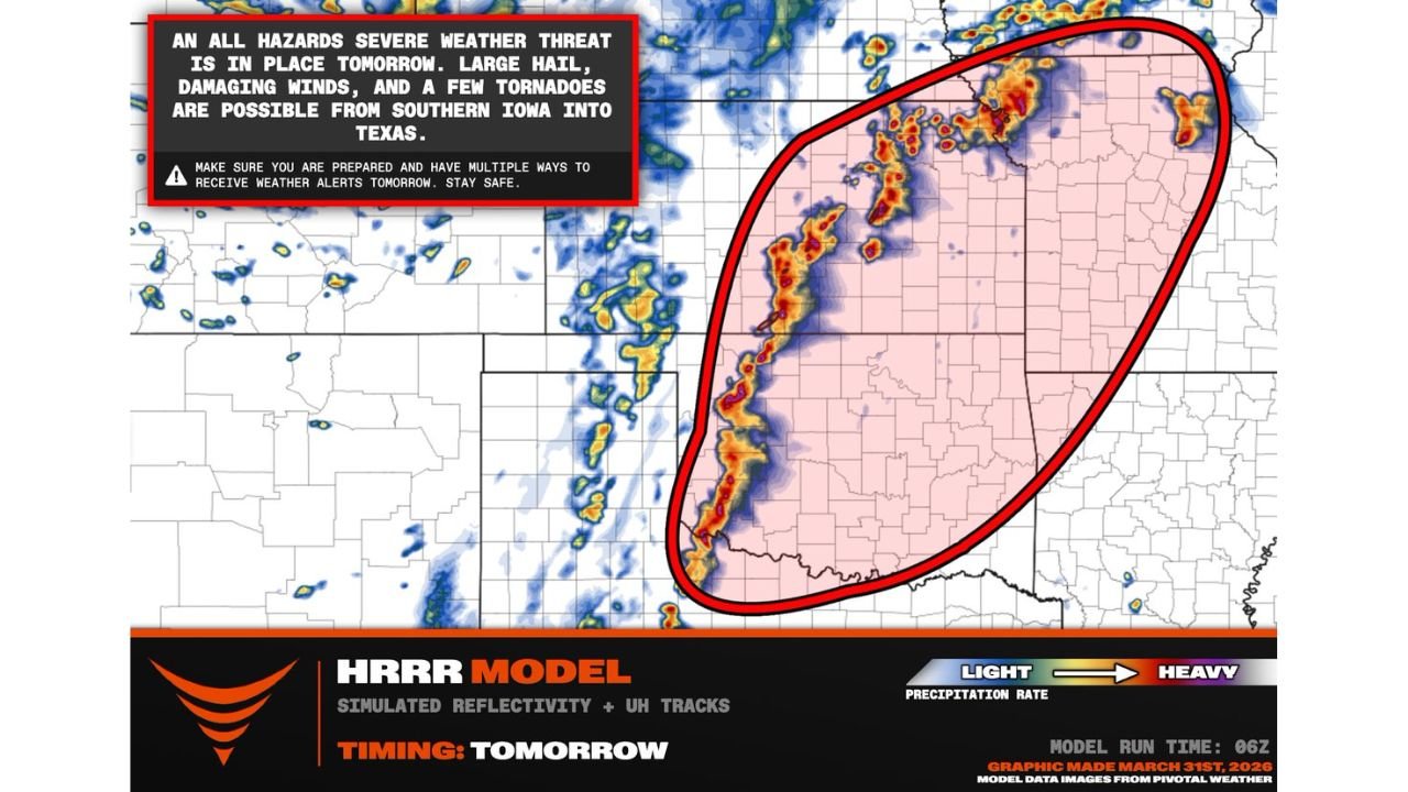
UNITED STATES — An all-hazards severe weather threat is in place across a broad corridor stretching from southern Iowa through Kansas, Oklahoma, Missouri, and into Texas for Wednesday, April 1, 2026. Large hail, damaging winds, and tornadoes are all possible across this entire zone — but the most critical detail in Wednesday’s forecast is the timing of the tornado threat. Forecasters are flagging the window around sunset as the peak danger period — when the low-level jet stream intensifies and tornado-producing supercells reach their most dangerous configuration. Residents across Oklahoma City, Wichita, and Kansas City need to be in full severe weather ready mode well before evening arrives.
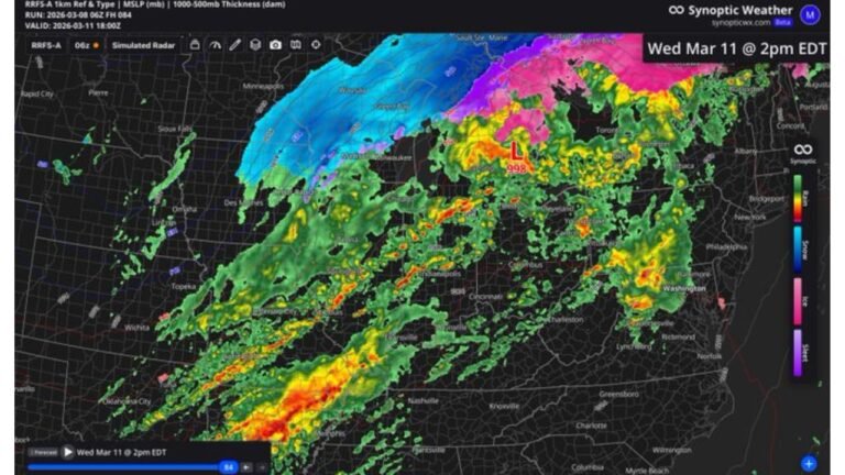
This forecast is based on the HRRR model run March 31, 2026 at 06z, with simulated storm reflectivity and updraft helicity tracks valid Wednesday, April 1, 2026.
The Magic Hour — Why Sunset Is the Most Dangerous Window
Most people assume severe weather is most dangerous during the heat of the afternoon — when the sun is highest and daytime instability peaks. Wednesday’s setup breaks that assumption in an important and potentially life-saving way.
The tornado threat on Wednesday is specifically forecast to ramp up near sunset as the low-level jet stream intensifies. Understanding why this matters requires a brief look at how the atmosphere works during the evening transition.
During the day, surface friction from the ground slows low-level winds significantly. As the sun sets and the surface cools, that friction decreases rapidly — and the low-level jet stream, which carries warm moist air northward from the Gulf of Mexico at altitudes of a few thousand feet, is able to accelerate dramatically. This acceleration increases the wind shear between the surface and the mid-levels of the atmosphere — and wind shear is the rotational ingredient that transforms ordinary thunderstorms into tornado-producing supercells.
On Wednesday, supercells that have been organized but perhaps not yet tornadic during the afternoon hours will encounter this wind shear increase right around sunset — giving them the rotational energy needed to produce their most significant tornadoes. This sunset-to-early-evening window is historically the most productive tornado window for Great Plains severe weather events, and Wednesday is shaping up to be a textbook example.
What the HRRR Storm Simulation Shows
The HRRR model simulated reflectivity and updraft helicity tracks for Wednesday afternoon and evening paint a clear picture of where the storm threat is most concentrated.
A continuous storm line with embedded supercells is forecast to stretch from southern Iowa southward through Kansas and Oklahoma and into northern Texas — a corridor of several hundred miles where storm activity will be ongoing simultaneously. The updraft helicity tracks within this simulation identify the locations where rotating updrafts — the precursor to tornado development — are most likely to occur.
The highest concentration of storm activity and rotation tracks is focused over the Kansas through Oklahoma corridor — centered directly over Wichita, Oklahoma City, and the Kansas City metro area. Storm cells in this zone are the ones most likely to maintain discrete supercell structure through the critical sunset window and into the early evening hours.
The geographic reach of Wednesday’s threat is significant. From southern Iowa and Des Moines in the north to Dallas and northern Texas in the south, the all-hazards severe weather zone covers a swath of the central United States that is home to tens of millions of people.
All-Hazards Threat by Region — Wednesday April 1
| Region | Primary Threats |
|---|---|
| Southern Iowa | Large hail, damaging winds, tornado possible |
| Kansas — Wichita / Kansas City | Tornadoes, very large hail, damaging winds |
| Oklahoma — Oklahoma City / Tulsa | Tornadoes, very large hail, damaging winds |
| Western Missouri — Springfield | Tornadoes, large hail, damaging winds |
| Northern Texas — Dallas area | Large hail, damaging winds, tornado possible |
Four Days of Severe Weather Ahead
Wednesday is not the end of this story — it is the beginning. Storm chase teams are activating for the next four days across the central United States, signaling that forecasters expect the active severe weather pattern to continue well beyond Wednesday’s event.
The same atmospheric pattern that is driving Wednesday’s supercell and tornado threat — Gulf moisture surging northward, upper-level troughs moving through in sequence, and a dryline positioned across the southern Plains — is expected to remain in place through the week. Each day brings a new trigger, a new threat area, and a new window for severe weather development across the Plains and into the Ohio Valley and Southeast.
Residents across the central United States should treat this not as a one-day event to survive and forget about, but as the opening of an extended severe weather season stretch that will require daily attention and preparedness through the week and into the weekend.
Forecast Confidence Level
High confidence on all-hazards severe weather threat from southern Iowa through Texas Wednesday — storm development is locked in across this corridor.
High confidence on the sunset tornado threat peak** — the low-level jet intensification timing is well-established and consistent with historical severe weather behavior across the southern Plains.
High confidence on Oklahoma City, Wichita, and Kansas City as the highest-risk urban centers Wednesday** — the HRRR updraft helicity tracks are concentrated directly over this corridor.
Medium confidence on exact tornado tracks** — while the threat area is well-defined, the specific communities that experience tornadoes cannot be precisely identified at this range. Every location in the risk zone should prepare as if they are in the primary threat area.
What Must Happen Before Sunset Wednesday
Be shelter-ready before 5 PM local time. The sunset window is the peak danger period — do not be in the middle of making shelter plans when the most dangerous storms are approaching. Know your shelter location, have your go-bag ready, and be in a position to act immediately well before evening arrives.
Multiple alert methods are essential Wednesday. A single alert source is not enough for a multi-hour, multi-storm severe weather event. Have your phone alerts enabled, a weather radio accessible, and know where your county’s tornado sirens are located. When the low-level jet fires up around sunset, storm development can be rapid and tornado warnings can be issued with very little lead time.
Avoid being on the road at sunset across the Oklahoma City to Kansas City corridor. The peak tornado window falls exactly during evening commute hours across the most populated part of the risk zone. If you can work from home Wednesday or arrange to stay put through the evening, do so.
Southern Iowa residents — this threat extends further north than many may realize. Des Moines and surrounding communities are within the all-hazards zone Wednesday and should not dismiss the threat simply because the highest tornado probability is centered further south.
Northern Texas and Dallas area residents — while the tornado probability is lower in your area than the Kansas-Oklahoma core, large hail and damaging winds are significant threats. Vehicles, roofs, and outdoor property across the Dallas area face real risk from the hail threat alone Wednesday afternoon.
Do not go storm chasing unless you are professionally trained. An active supercell environment with multiple rotating storms, rapidly changing conditions, and potential for multiple simultaneous tornadoes is not a situation for inexperienced observers. Stay home, stay sheltered, and let trained professionals track these storms.
The Bottom Line
An all-hazards severe weather threat covering southern Iowa through Kansas, Oklahoma, Missouri, and Texas makes Wednesday, April 1 one of the most significant severe weather days of the spring season so far. Large hail, damaging winds, and tornadoes are all possible across this entire corridor — but the most dangerous window arrives at sunset when the low-level jet intensifies and tornado-producing supercells reach peak rotational strength. Oklahoma City, Wichita, and Kansas City sit directly in the highest-risk zone. Be shelter-ready before 5 PM, have multiple alert methods active, and stay off the roads through the evening hours. This is also the beginning of a four-day active severe weather pattern across the central United States — Wednesday is the first chapter, not the last.
Stay ahead of dangerous weather before it reaches your door. Visit cabarrusweekly.com for daily tornado outlooks, severe weather coverage, and storm alerts from across the United States — because knowing early is the difference that matters.