Iowa, Missouri and Illinois Brace for Severe Storms Today With Tornadoes, 75 MPH Winds and Large Hail All Possible
IOWA, MISSOURI AND ILLINOIS — A significant severe weather setup is expected to unfold this afternoon and evening, with multiple hazards including tornadoes, damaging winds, and large hail targeting parts of Iowa, Missouri, and Illinois.
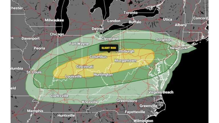
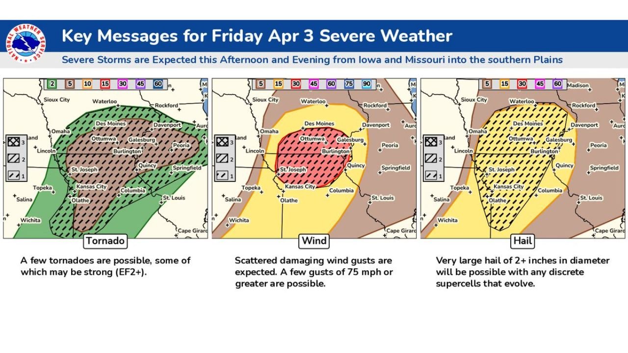
Highest Risk Focused Over Southern Iowa and Northern Missouri
Forecast data highlights a concentrated zone of stronger severe weather potential centered across southern Iowa and northern Missouri, including areas near Des Moines, Ottumwa, Burlington, Kansas City, and surrounding communities.
This region sits within an enhanced risk zone where all severe weather hazards are possible, making it the primary area to monitor as storms begin to develop.
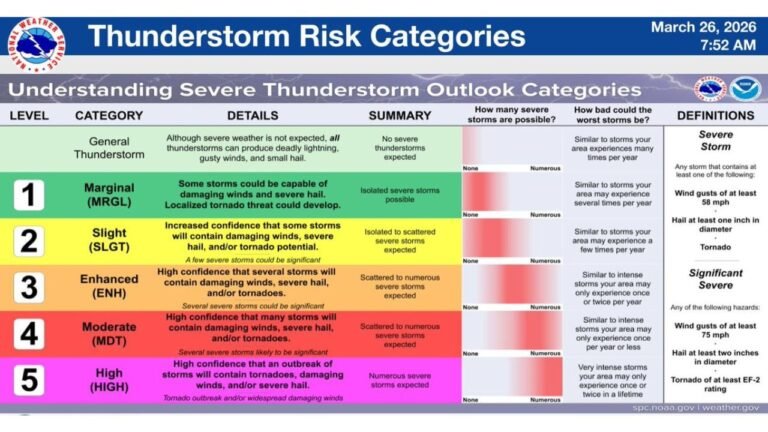
Tornado Threat Includes Potential for Stronger EF2+ Events
Among the primary concerns is the potential for tornado development, including a few that could reach EF2+ intensity.
Storms that remain discrete — meaning isolated rather than clustered — will have the greatest chance to rotate and produce tornadoes. The corridor from northern Missouri into southern Iowa and western Illinois appears most favorable for this risk.
Damaging Winds Could Exceed 75 MPH
As storms organize and evolve through the evening, the threat will increasingly shift toward damaging straight-line winds, with some gusts potentially exceeding 75 mph.
These winds can cause tree damage, power outages, and hazardous travel conditions, especially as storms transition into clusters or lines.
Very Large Hail Possible With Stronger Storms
In addition to tornadoes and wind, very large hail — potentially exceeding 2 inches in diameter — is also a major concern, particularly with early discrete supercell storms.
These hailstones can cause significant damage to vehicles, roofs, and crops, especially in areas where storms remain isolated longer before merging.
Storm Mode Evolves Through the Evening
The setup suggests a transition from discrete supercells in the afternoon to more organized clusters and line segments in the evening.
This evolution is important, as it shifts the dominant threat from tornadoes and hail toward widespread wind damage, while still maintaining some risk for embedded tornadoes.
Preparedness Critical as Multiple Hazards Align
With all major severe weather threats in play, this event represents a multi-hazard setup that requires close attention throughout the day.
Conditions are expected to change rapidly, and storms may intensify quickly once they develop.
Residents across Iowa, Missouri, and Illinois should stay alert for weather updates and be prepared to act quickly if warnings are issued.
If you experience severe weather conditions in your area, share your updates with CabarrusWeekly.com to help keep others informed during this high-impact weather event.