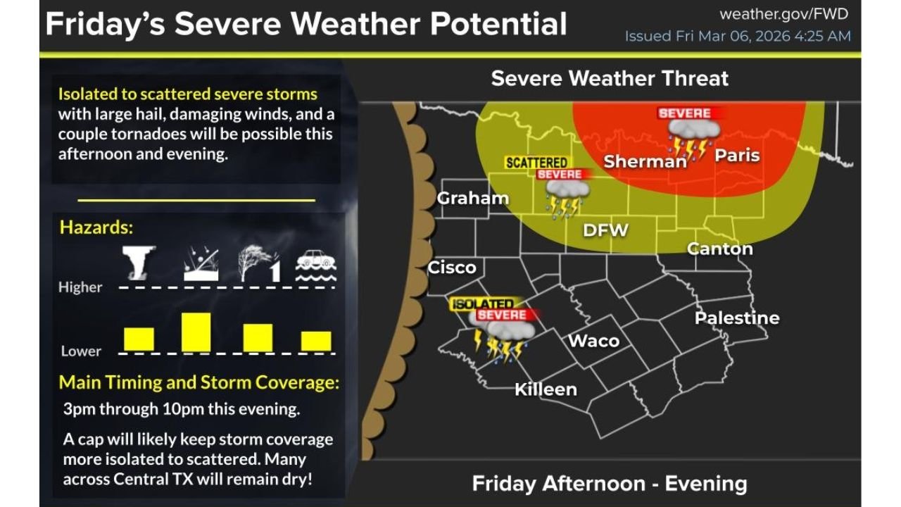
Isolated but Dangerous: Large Hail, Damaging Winds and Possible Tornadoes Target North Texas Along and North of I-20 From DFW to Sherman and Paris
TEXAS — Isolated to scattered severe thunderstorms are expected to develop this afternoon and evening across portions of North and Central Texas, especially along and north of the Interstate 20 corridor, with the highest concern stretching from the Dallas–Fort Worth Metroplex toward Sherman and Paris.
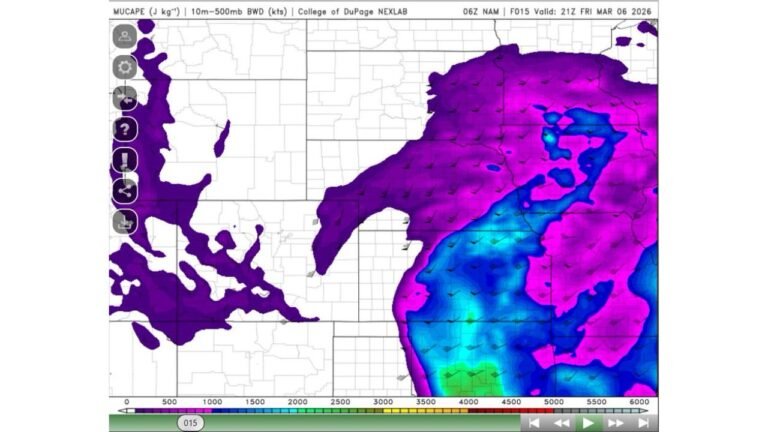
According to the latest severe weather outlook issued early Friday morning, any storm that manages to form could become intense quickly, bringing large hail, damaging wind gusts, and even a tornado.
Highest Threat: Sherman, Paris, and North of DFW
The greatest severe weather potential is highlighted across:
- Sherman
- Paris
- Areas north of the DFW Metroplex
- Surrounding communities along and north of I-20
This zone is marked for scattered severe storms, with stronger probability shading concentrated over far North Texas near the Red River.
The DFW area sits within a broader severe weather threat zone, meaning storms are possible, though coverage may be more limited compared to areas farther north.
Additional Isolated Risk Near Killeen
Farther south and west, an isolated severe storm threat extends toward:
- Killeen
- Portions of Central Texas
- Areas west of Waco
These storms are expected to be more isolated in nature, but any cell that develops could still produce significant hail or strong wind gusts.
Timing: 3 PM to 10 PM
The primary window for storm development runs from 3 p.m. through 10 p.m. Friday evening.
Forecasters note that a capping inversion will likely limit storm coverage. This means many communities — even within the risk area — could remain dry. However, the trade-off is important: fewer storms can sometimes mean stronger, more intense individual supercells.
Main Hazards
If storms form, the main threats include:
- Large hail
- Damaging straight-line winds
- A couple of tornadoes
Steep instability and sufficient wind shear across North Texas will support rotating updrafts in any sustained storm, particularly across the northern counties.
Why This Setup Matters
This is not expected to be a widespread outbreak with storms everywhere. Instead, this is a conditional severe setup — meaning storm coverage may be limited, but impacts from individual storms could be significant.
Residents along and north of I-20, especially in communities from DFW toward Sherman and Paris, should:
- Monitor weather updates throughout the afternoon
- Ensure weather alerts are enabled on mobile devices
- Be prepared to take shelter quickly if warnings are issued
CabarrusWeekly.com will continue monitoring severe weather developments across Texas as storms begin to initiate later this afternoon.