Long Dry Spell Continues Across Alabama Through Next Week As Upper Ridge Blocks Rain With Temperatures Soaring Into Low 90s By Late Week And Drought Conditions Intensifying Across Deep South
ALABAMA — An unusually long and persistent dry weather pattern will continue across Alabama through the weekend and into next week, as a stubborn upper-level ridge keeps all meaningful rain and storm chances locked well to the west and north of the state. With no significant precipitation in sight and afternoon temperatures climbing toward the low 90s by late week, drought conditions are expected to intensify across the Deep South in the days ahead.
Why Alabama Is Staying Dry: Upper Ridge In Control
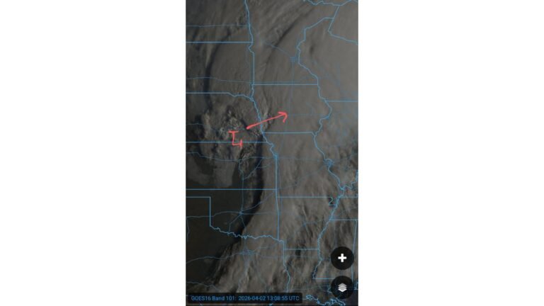
The primary reason for Alabama’s extended dry stretch is a dominant upper-level atmospheric ridge sitting over the region. This high-pressure feature acts as a blocking pattern, effectively diverting rain-producing storm systems well to the west and north — keeping Alabama locked in a warm, sunny, and increasingly dry pattern through at least the middle of next week.
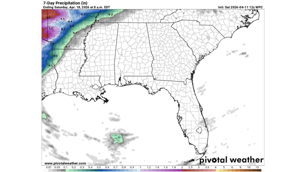
The 7-day precipitation forecast through Saturday, April 18, 2026 tells the story clearly. Rainfall totals across Alabama are forecast at near zero to 0.1 inches at most, while heavy precipitation accumulations of 1.5 to 2.2 inches pile up far to the northwest across Arkansas, Missouri, and surrounding states — completely bypassing Alabama and the broader Deep South.
Temperatures Surging: Birmingham Forecast Through Late April
With clear skies and a dominant ridge in place, afternoon temperatures across Alabama will climb steadily through the coming week. The Birmingham-Shuttlesworth International Airport forecast data through April 21 paints a detailed picture of the warming trend ahead:
- Saturday, April 11 — High 85°F / Low 59°F
- Sunday, April 12 — High 86°F / Low 59°F
- Monday, April 13 — High 84°F / Low 62°F
- Tuesday, April 14 — High 86°F / Low 62°F
- Wednesday, April 15 — High 87°F / Low 63°F
- Thursday, April 16 — High 87°F / Low 64°F
- Friday, April 17 — High 90°F / Low 66°F — peak warmth of the period
- Saturday, April 18 — High 89°F / Low 68°F
- Sunday, April 19 — High 82°F / Low 64°F
- Monday, April 20 — High 80°F / Low 57°F
- Tuesday, April 21 — High 83°F / Low 58°F
The warmest stretch arrives Friday and Saturday, April 17-18, when afternoon highs could touch 90°F in Birmingham — an early taste of summer heat that will feel especially intense given the lack of rainfall and increasing drought stress on the landscape.
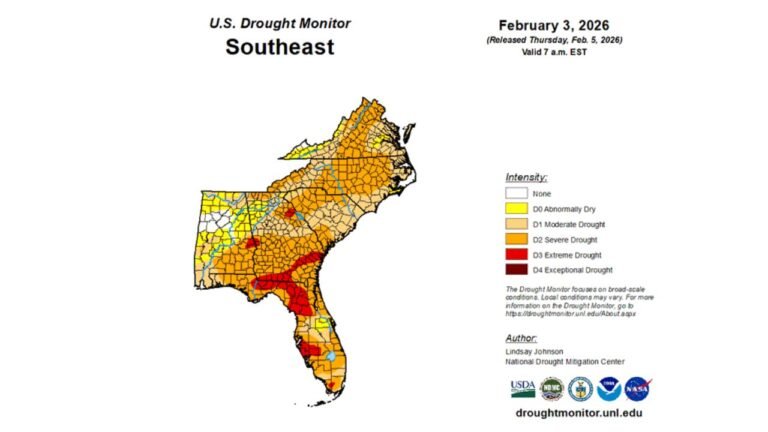
Drought Conditions To Intensify Across Deep South
The combination of zero meaningful rainfall and rapidly rising temperatures creates a dangerous feedback loop for drought development across Alabama and the broader Deep South. As dry conditions persist through next week, forecasters warn that drought conditions will intensify across the region.
The impacts of worsening drought include:
- Increased fire danger as vegetation dries out under warm, sunny conditions
- Stress on agriculture and crops particularly as temperatures surge toward 90°F
- Declining soil moisture with no rain events to provide relief
- Worsening water supply concerns if the dry pattern extends further into late April
Is There Any Hope For Rain? Late Month Pattern Change Possible
There is a glimmer of hope on the longer-range horizon. Global forecast models do give some indication that the upper-level ridge pattern may begin to break down later in the month, with increasing rain chances potentially returning to Alabama toward late April.
However, forecasters are clear that in the short term, no meaningful rain relief is expected. The dry pattern is well-established and will need time to erode before Gulf moisture can return to fuel rainfall across the Deep South.
Residents and agricultural interests across Alabama should plan for at least another week of dry, warm, and increasingly drought-stressed conditions before any pattern change becomes more certain.
What Alabama Residents Should Know
With the dry spell and heat building through next week, here is what to keep in mind:
- Outdoor burn bans may be issued — check local county regulations before burning anything outdoors
- Stay hydrated as afternoon temperatures approach 90°F by late week
- Lawn, garden, and agricultural watering needs will increase significantly through mid to late April
- Monitor long-range forecasts for any signs of the pattern breaking down and rain returning late in the month
Stay with CabarrusWeekly.com for continued coverage of Alabama’s evolving drought and heat pattern as this unusually persistent dry stretch continues through the coming week.