Major March Pattern Flip to Bring Early Midwest–Northeast Winter Threat, Then Surge of Warmth and Repeated Storms Across the Central and Eastern U.S.
UNITED STATES — Forecast guidance is pointing toward a dramatic pattern change as we move into March, beginning with a potential winter storm setup across the Midwest, Ohio Valley, Mid-Atlantic and Northeast before flipping toward widespread warmth and an active, rain-dominated storm track across the central and eastern United States.
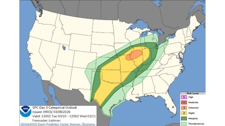
Early March Winter Storm Potential
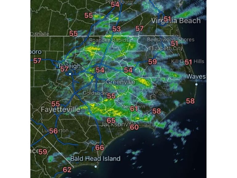
Model guidance indicates the first few days of March could feature a winter storm threat stretching from the Midwest into the Ohio Valley, Mid-Atlantic, and Northeast.
Cold air in place across parts of the Great Lakes and interior Northeast may allow accumulating snow if a surface low tracks favorably along the boundary. However, there remains uncertainty regarding storm strength and exact placement of the heaviest precipitation axis.
Following this system, a brief but sharp shot of Arctic air may push into the Northeast, reinforcing wintry conditions before the larger-scale pattern shift takes hold.
Western Trough, Eastern Ridge Setup
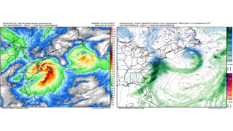
Beyond the early-month winter threat, medium-range height anomaly forecasts show a pronounced trough developing over the Western U.S. while a strong ridge builds over the Eastern U.S.
This configuration supports:
- Repeated low-pressure systems ejecting from the Rockies
- Storms tracking northeast across the Plains and Midwest
- Warmer-than-average temperatures dominating the East
The ridge centered over the eastern half of the country is projected to spike temperatures well above average across the Midwest, Ohio Valley, Mid-Atlantic, Southeast, and parts of the Northeast.
Heavy Rain Corridor Expands from Texas to the Great Lakes
Total precipitation forecasts through mid-March highlight a broad swath of heavier rainfall extending from:
Texas and Oklahoma
North through Arkansas and Missouri
Into Illinois, Indiana, Ohio, Michigan, and western Pennsylvania
This repeated storm track could bring multi-day rainfall events along similar corridors, increasing the potential for flooding concerns, especially where soils become saturated.
Meanwhile, the Western U.S. remains more unsettled with mountain precipitation, but the heaviest and most persistent rainfall signal is centered over the central U.S. into the Great Lakes and Ohio Valley.
Growing Severe Weather Risk
As each shortwave ejects eastward, it pulls warm, moisture-rich Gulf air northward into the Plains and Midwest — a key ingredient for strong to severe thunderstorms.
With above-average temperatures building across the eastern half of the country, the environment becomes increasingly supportive of:
- Thunderstorms along frontal boundaries
- Heavy rainfall rates
- Potential severe weather episodes
The middle to latter portion of the pattern appears especially favorable for an uptick in severe storm potential across parts of the Southern Plains, Mid-South, and Ohio Valley.
Warmth Takes Control Across the East
Temperature anomaly guidance shows widespread above-normal readings across the Midwest, Great Lakes, Ohio Valley, Mid-Atlantic, and Northeast, with much of the Eastern U.S. running well above seasonal averages.
This warmth could accelerate early-season pollen production across the South and contribute to an early taste of spring for many communities.
Longer-Term Outlook
Farther down the road, there are signals that colder air may attempt to reintroduce more of a winter component to storm systems. For now, however, the dominant signal favors a rain-heavy, stormy, and increasingly warm pattern across much of the central and eastern United States.
Residents across the Midwest, Ohio Valley, and Eastern Seaboard should stay alert to evolving forecasts as we transition into what could be a dynamic and impactful March weather regime.
Stay with CabarrusWeekly.com for continuing updates as this pattern shift unfolds.