Major Winter Storm Signal Strengthens for Pennsylvania, Maryland, Virginia, and West Virginia This Weekend as EURO and GFS Agree on Heavy Snow Potential
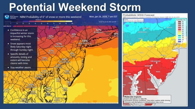
MID-ATLANTIC UNITED STATES — Forecast confidence is increasing that a significant winter storm will impact the Mid-Atlantic region this weekend, with both the European (EURO) and American (GFS) models showing strong agreement that at least one part of the region is likely to see heavy snowfall, even as exact placement remains uncertain.
EURO and GFS Both Show a Strong Snow Signal
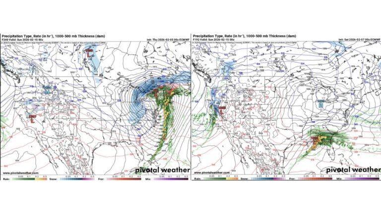
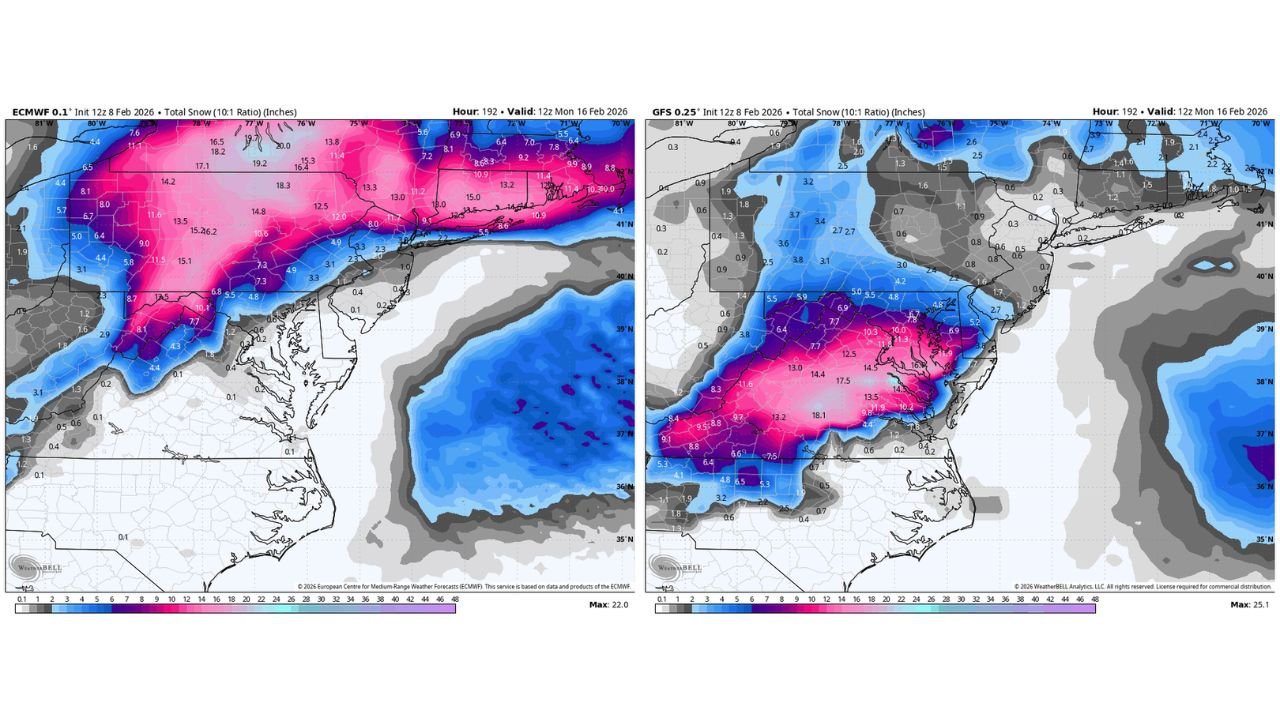
Latest model runs from both the EURO and GFS depict a well-organized winter storm producing a broad swath of accumulating snow across the Mid-Atlantic, a notable sign this close to the event. While the two models differ on precise storm track and snowfall maxima, they agree on the larger message: this is not a fringe or low-end system.
Snowfall output suggests a corridor of heavier totals setting up somewhere between the central Appalachians and interior sections of the Mid-Atlantic, with lighter amounts extending outward from the core band.
Someone Is Likely to See a Significant Snowfall
Even with remaining uncertainty, the overlap between the models makes one outcome increasingly clear — someone in the Mid-Atlantic is going to see a lot of snow. This does not mean every location will be impacted equally, but it does raise confidence that the storm will produce meaningful winter impacts for at least part of the region.
As is typical with these setups, relatively small shifts north or south could dramatically change who ends up under the heaviest snow band.
Interior Locations Currently Favored Over the Immediate Coast
Based on current guidance, interior portions of the Mid-Atlantic appear more favorably positioned for heavy snow, where colder air is more likely to hold. Coastal areas remain more sensitive to storm track and thermal profiles, leaving the door open for mixing or rain closer to the shoreline.
That said, several solutions still show the potential for snow reaching close to major population centers if colder air is able to press south and east quickly enough.
Track and Timing Will Decide the Final Outcome
The key remaining questions revolve around storm track, strength, and how quickly cold air locks in. A slightly farther offshore track would favor heavier snow inland, while a more inland track could shift the rain-snow line northward.
These details are expected to come into clearer focus over the next 24 to 48 hours as higher-resolution guidance begins to resolve the system more clearly.
Confidence Growing, But Details Still Evolving
While it is still too early to lock in exact snowfall totals for any one location, confidence is rising that this weekend’s storm will be impactful somewhere in the Mid-Atlantic. Forecasters will continue refining the forecast as the event approaches, with watches and advisories likely to follow once confidence in placement improves.
If you live in the Mid-Atlantic and are preparing for potential winter weather, we want to hear from you. Share what you’re seeing locally and stay tuned for continued updates at CabarrusWeekly.com.