March 5–10 Stormy Pattern Returns: Widespread Rain and Possible Severe Weather Target the South, Midwest and East
UNITED STATES — A much more active weather pattern is taking shape for March 5 through March 10, with widespread rain, thunderstorms, and the potential for severe weather returning across large portions of the central and eastern United States.
Model ensemble guidance suggests this could be the busiest stretch of weather activity seen in several weeks.
Widespread Rainfall Signal Expands Across the Central and Eastern U.S.
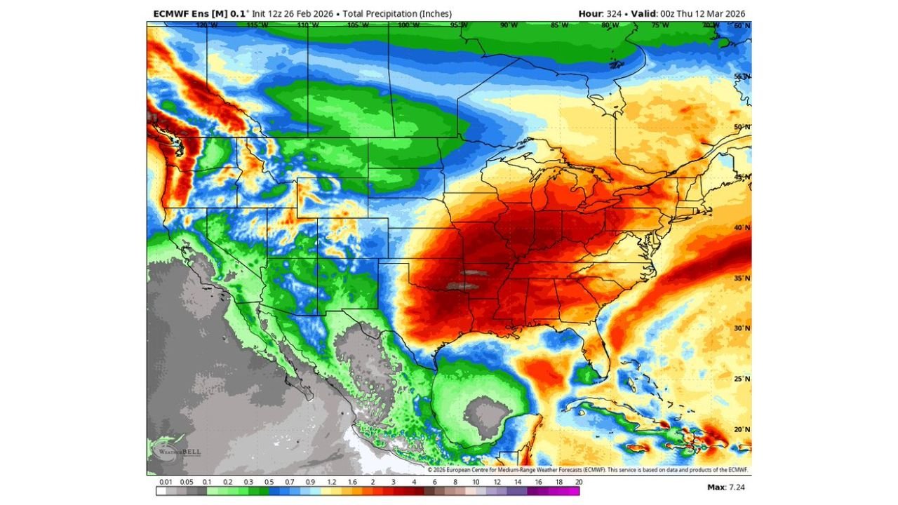
Long-range precipitation guidance shows a broad swath of heavier rainfall stretching from:
• Texas and the Gulf Coast
• The Lower and Middle Mississippi Valley
• The Tennessee and Ohio Valleys
• The Mid-Atlantic and parts of the Northeast
The heaviest precipitation totals appear concentrated from the Deep South into the Ohio Valley, where repeated rounds of rain are possible.
This kind of widespread signal indicates multiple storm systems tracking along a consistent corridor rather than a single isolated event.
Jet Stream Configuration Favors Active Storm Track
Upper-level guidance shows a strong and elongated jet stream arcing from the southern Plains into the Midwest and East.
This setup supports:
• Enhanced upper-level wind energy
• Repeated storm system development
• Stronger frontal boundaries
When this type of pattern locks in, it can promote organized thunderstorms and, at times, severe weather depending on instability and moisture availability.
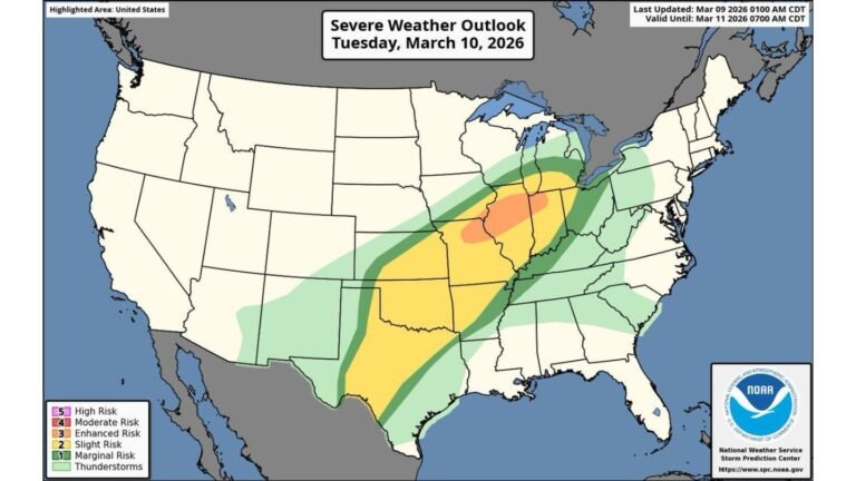
Severe Weather Potential Cannot Be Ruled Out
With Gulf moisture returning northward and a strengthening upper-level pattern in place, portions of the South and lower Midwest could see:
• Strong to severe thunderstorms
• Damaging wind potential
• Heavy downpours
• Isolated tornado risk, depending on storm mode
It is too early to pinpoint exact locations for severe outbreaks, but the broader atmospheric setup is supportive of active storm development.
Timing: March 5 Through March 10
The most active window appears to fall between:
• Wednesday, March 5
• Monday, March 10
During this stretch, multiple waves of energy may move through the central United States and progress eastward.
This suggests rainfall could occur in rounds rather than all at once, increasing total accumulation over several days.
What This Means for North Carolina
For North Carolina and Cabarrus County, this pattern shift signals:
• Increasing rain chances during the March 5–10 window
• Periods of showers and thunderstorms
• Potential for locally heavy rainfall
While it is too soon to define severe storm specifics for the Carolinas, an active central U.S. pattern often translates eastward with time.
Residents should prepare for a more unsettled stretch of weather heading into early to mid-March.
We will continue refining the timing and severity details as newer data becomes available. If you begin seeing increasing rain or storm activity in your area, share your observations with us at CabarrusWeekly.com as we track this developing pattern.