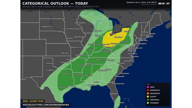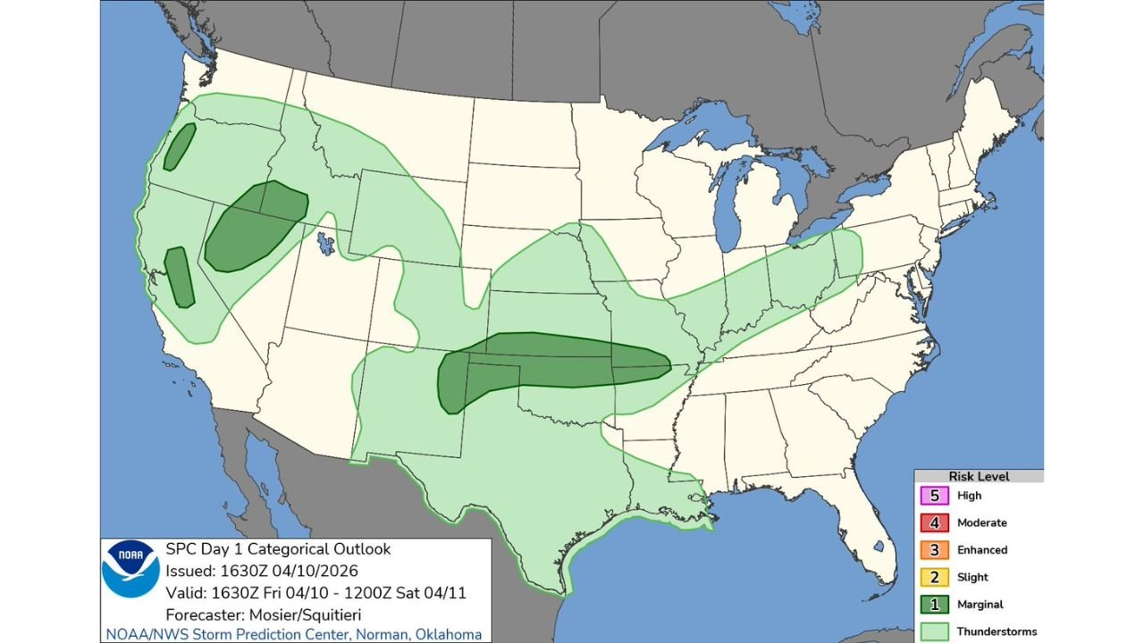
Marginal Severe Storm Risk Spreads Across Plains, Ozarks, Great Basin and Pacific Northwest Bringing Isolated Storm Threat Friday
UNITED STATES — A broad but low-end severe weather setup is developing across multiple regions of the country, with the Storm Prediction Center highlighting a marginal risk stretching from the south-central Plains through the Ozarks and into parts of the West Coast and Great Basin.
Storm Risk Covers a Wide Multi-Region Corridor
Friday’s outlook shows scattered thunderstorm chances across several key regions, including:
- South-central Plains (Texas, Oklahoma, Kansas)
- Ozarks region (Missouri, Arkansas)
- Lower Midwest extending toward parts of Illinois and surrounding states
- Northern California and the Great Basin (Nevada, Utah, Idaho areas)
- Western Oregon and nearby Pacific Northwest locations
This widespread setup indicates multiple pockets of storm development rather than one concentrated severe outbreak zone.
What “Marginal Risk” Means for Residents
A marginal risk (Level 1 out of 5) suggests:
- Isolated severe storms are possible
- Most areas will see non-severe or no storms at all
- Any severe storm that does develop could still produce:
- Gusty winds
- Small hail
- Brief heavy rainfall
While not a high-impact setup, localized issues can still occur quickly, especially during the afternoon and evening hours.
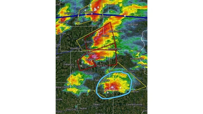
Plains and Ozarks Could See the Most Organized Activity
The most focused zone of storm activity appears across the central Plains into the Ozarks, where:
- Storm coverage may be slightly higher
- Atmospheric conditions could support stronger updrafts compared to other regions
Cities near this corridor may see pop-up storms that briefly intensify before weakening.
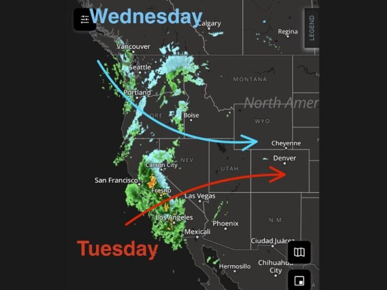
Western U.S. Adds a Different Type of Storm Threat
In contrast, the Great Basin and parts of northern California and Oregon are expected to see:
- More scattered, terrain-driven storms
- Potential for lightning and gusty outflow winds
These storms are typically less organized but can still cause localized disruptions, especially in higher elevations.
Timing and Impacts
Storm development is expected mainly:
- Friday afternoon into early evening
- With activity diminishing after sunset in most areas
Impacts are expected to remain limited overall, but:
- Brief downpours could affect travel
- Lightning may disrupt outdoor plans
- Isolated strong wind gusts could occur under the strongest cells
No Major Outbreak, But Stay Weather-Aware
This setup does not signal a widespread severe weather outbreak, but the large geographic coverage means millions could see at least some storm activity.
Even marginal risk days can produce surprise stronger storms in isolated spots, so staying aware of changing conditions remains important.
Stay with CabarrusWeekly.com for continued updates as weather patterns evolve across the country.