Maryland, Virginia and Washington D.C. Go From 80s and Tornado Warnings to Afternoon Snow in Under 24 Hours as Rare ‘Ana Front’ Crashes Temperatures
UNITED STATES — In one of the more dramatic weather reversals of the season, parts of Maryland are set to plunge from unseasonable warmth and severe weather conditions to snow showers in less than 24 hours.
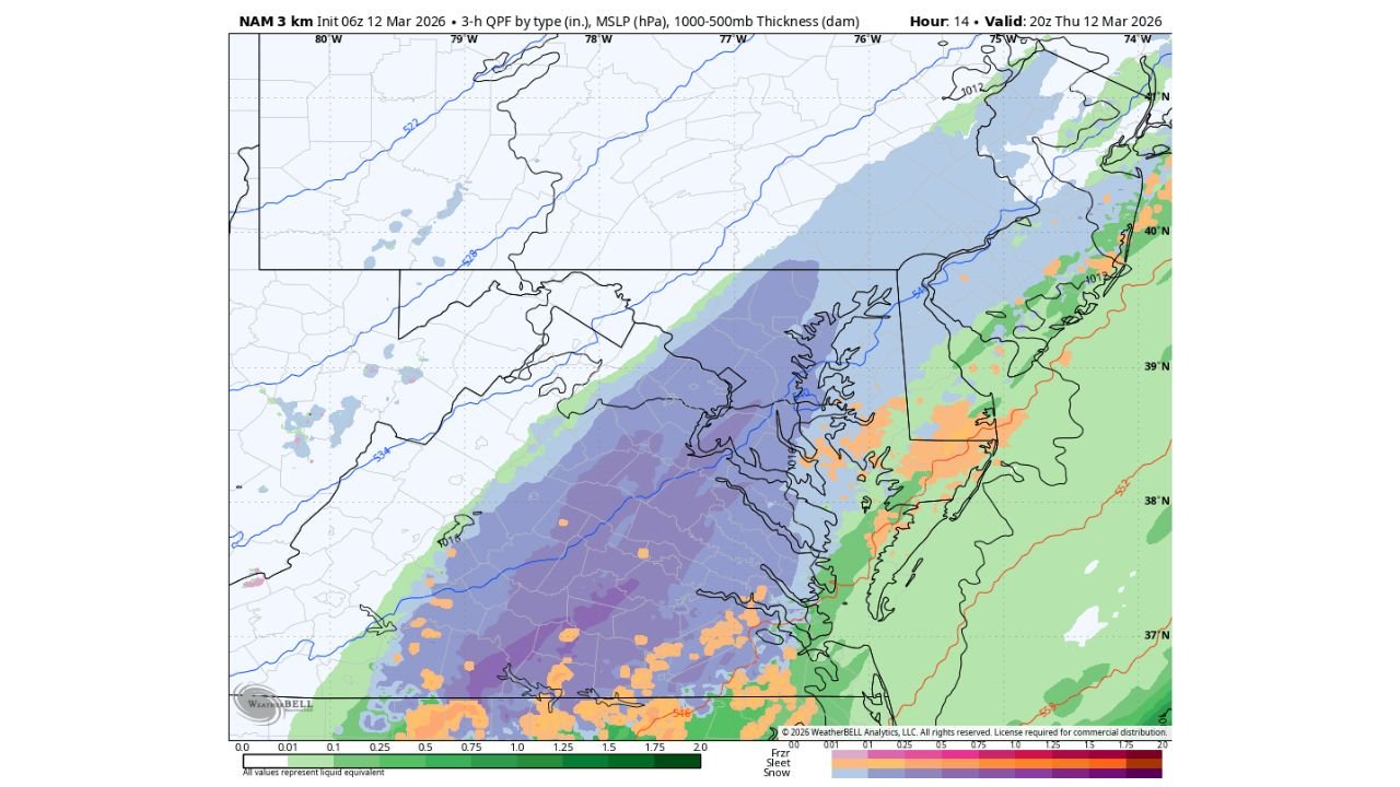
Forecasters indicate temperatures will fall rapidly today across Maryland as a sharp cold front pushes through the region. Rain is expected to mix with snow before changing over to mostly snow by the afternoon in some areas.
A Rapid Temperature Crash
Just hours after experiencing springlike warmth — and even tornado warnings in parts of the region — Maryland will see a dramatic drop in temperatures behind the advancing front.
Unlike typical cold fronts where the heaviest precipitation falls ahead of the boundary, this setup features what meteorologists call an “ana front.”
In an ana front:
- The bulk of precipitation falls behind the cold front
- Cold air deepens after frontal passage
- Rain transitions to snow as temperatures collapse
This dynamic explains how rain can quickly flip to snow even after a warm start to the day.
Snow Develops Behind the Front
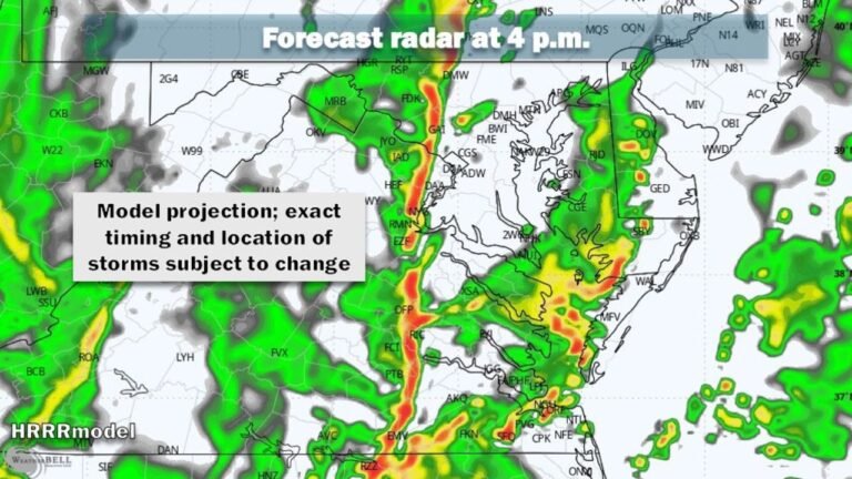
Forecast model guidance shows precipitation spreading across:
- Central Maryland
- The Baltimore metro area
- Washington, D.C.
- Northern and eastern Virginia
- Areas extending toward the Chesapeake Bay
As colder air filters in, rain mixes with snow before transitioning to mainly snow in some inland areas.
Accumulation Expectations
While snow may fall at times during the afternoon and evening, significant accumulation is not expected.
Forecasters suggest:
- Roads are unlikely to see meaningful snow accumulation
- A light dusting may develop on grassy surfaces in isolated spots
- Any snow that falls may struggle to stick due to prior warmth
Ground temperatures and the relatively brief window of cold air should limit impacts.
Why This Setup Is So Unusual
Going from temperatures in the 80s to snow within a day highlights the strength of the air mass change.
The combination of:
- A sharp cold frontal boundary
- Strong upper-level support
- Rapid cold air advection
creates a textbook example of a dramatic March weather swing.
Bottom Line
Maryland, Virginia and Washington D.C. are set for a remarkable weather turnaround — from warm, stormy conditions to a quick changeover to snow within hours, thanks to a powerful ana front.
While snow may mix in and briefly coat grassy areas, road impacts should remain limited.
CabarrusWeekly.com will continue monitoring this sharp temperature plunge and provide updates if accumulation forecasts change.