Maryland, Virginia, North Carolina and Pennsylvania Enter Drier Stretch After Active March as Rain Shifts South Toward Texas and Gulf Coast
UNITED STATES — After an unusually active stretch of severe weather in March, including multiple confirmed tornadoes across Maryland, the weather pattern across the Mid-Atlantic is now turning noticeably quieter, with several days of dry and calmer conditions expected.
At the same time, forecast data shows a shift in rainfall focus toward Texas, the Gulf Coast, and parts of the central U.S., signaling a broader pattern change heading into mid-April.
Mid-Atlantic Finally Gets a Break From Storm Activity
States across the Mid-Atlantic, including:
- Maryland
- Virginia
- North Carolina
- Pennsylvania
are expected to experience a much-needed lull in storm activity.
Recent data suggests:
- Limited precipitation over several consecutive days
- Reduced chances of severe weather
- More stable atmospheric conditions compared to March
This comes after a notably active month, where Maryland alone recorded multiple tornado events, a significant number given that the long-term yearly average is relatively low.
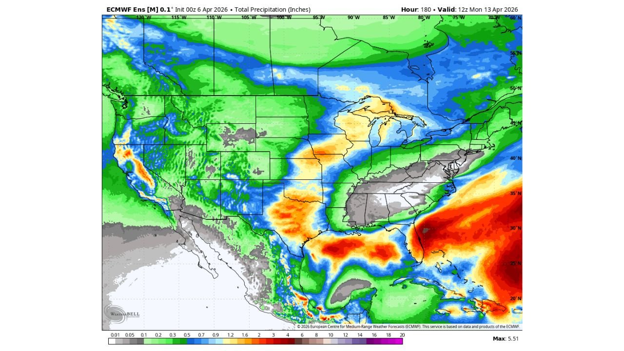
Rainfall Shifts South and West
While the Mid-Atlantic dries out, the precipitation pattern is clearly shifting:
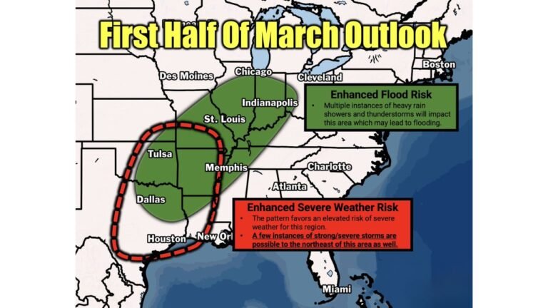
- Heavier rainfall zones develop across Texas and the southern Plains
- Enhanced moisture spreads into the Gulf Coast region, including Louisiana and Mississippi
- Portions of the Lower Mississippi Valley and central U.S. also see increased rain potential
These areas are highlighted by higher rainfall totals, indicating a more active storm track setting up farther south and west.
Southeast Also Sees Limited Rainfall for Now
Across much of the Southeast, including Georgia and the Carolinas:
- Rainfall appears more limited in the short term
- Conditions trend drier compared to recent weeks
- Any precipitation remains spotty and less organized
This reinforces the idea of a temporary calm period across a large portion of the eastern U.S.
Why the Pattern Is Changing
This shift is being driven by:
- A repositioning of storm systems and jet stream energy toward the central and southern U.S.
- Reduced moisture and lift across the Mid-Atlantic
- Increased focus of atmospheric instability over Texas and nearby regions
As a result, storm development is being redirected away from the East Coast, at least temporarily.
Storm Chances Could Return Next Week
Despite the current quiet stretch, this pattern may not last long.
Forecast trends indicate:
- The Mid-Atlantic could see storm chances increase again next week
- The broader U.S. pattern remains active overall, just temporarily shifted
- Additional rounds of rain and possibly severe weather may return
This suggests the current calm period is more of a pause rather than a full transition to long-term quiet conditions.
What This Means for Residents
For now, residents across Maryland, Virginia, North Carolina, and nearby states can expect:
- A break from severe weather concerns
- More manageable and predictable conditions
- Several days suitable for outdoor activities
Meanwhile, those in Texas and the Gulf Coast should remain alert as rain and storm activity increases in their region.
Stay With Cabarrus Weekly for Continued Weather Updates
As the national weather pattern continues to evolve, more updates will follow on shifting storm tracks and regional impacts.
Stay with Cabarrus Weekly for the latest coverage on changing weather patterns across the United States, including when storm activity returns to the East Coast.