Meteorologists Push Back on Viral Snow Hype as Long-Range Model Maps Falsely Suggest Major Winter Storm for Alabama and the Deep South
SOUTHEASTERN UNITED STATES — A wave of viral snow maps circulating on social media has sparked confusion and concern across Alabama and the Deep South, but meteorologists are strongly pushing back, saying the graphics rely on unrealistic long-range model output and do not represent a credible winter storm threat.
Viral Snow Maps Spark Confusion Across the Southeast
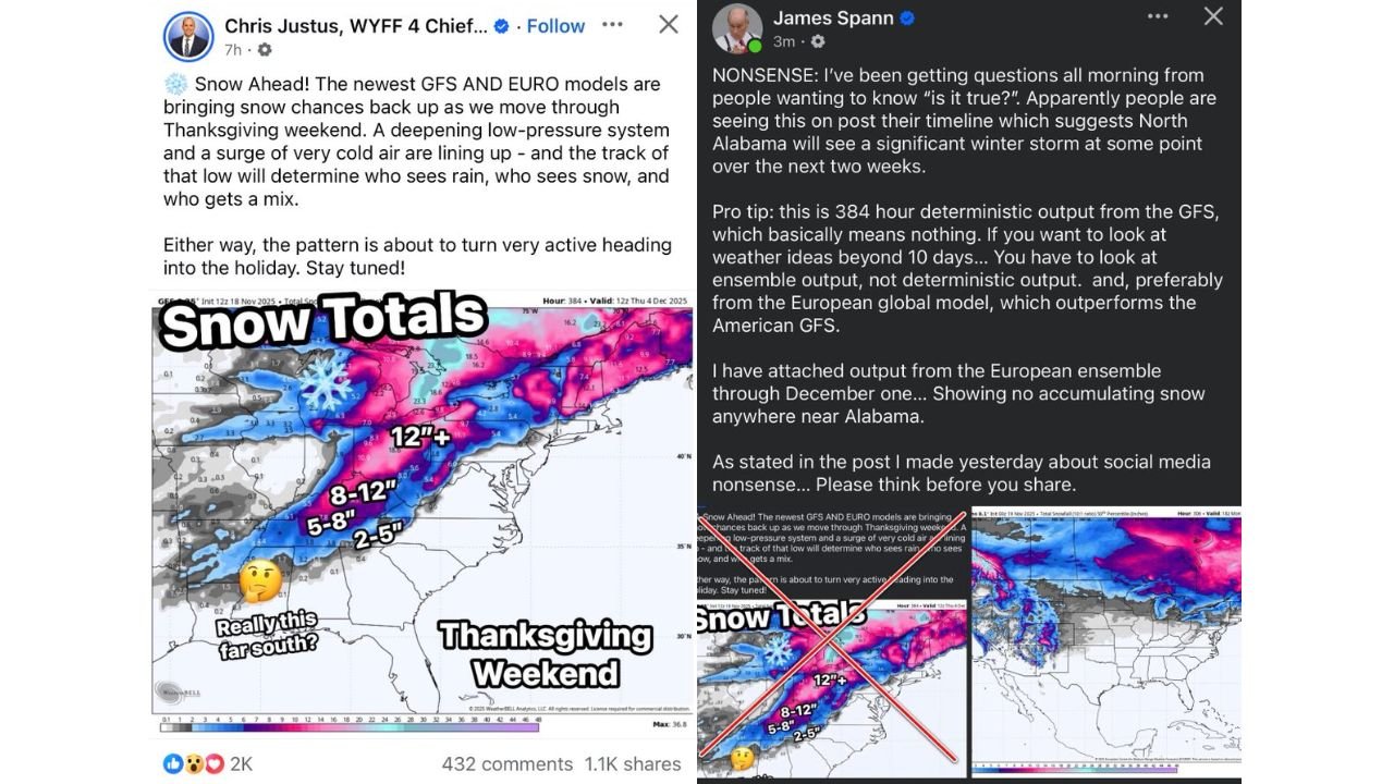
The controversy centers on eye-catching snowfall maps suggesting significant snow reaching as far south as Alabama around the Thanksgiving timeframe. These posts, widely shared online, imply a deep winter storm pushing unusually far into the southern United States, prompting residents to question whether a rare snow event could be on the way.
However, experienced forecasters say the maps being shared are not grounded in reliable forecasting methods, especially given their extreme lead time.
Experts Call Out Misuse of Long-Range Deterministic Models
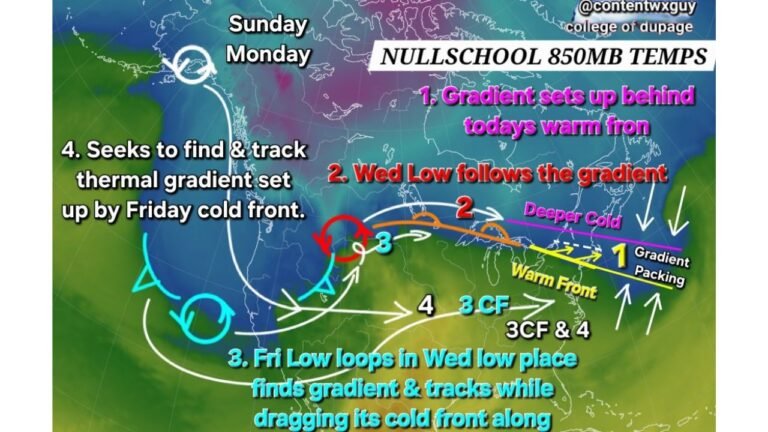
Veteran meteorologists have been blunt in their assessment, noting that the maps in question are based on 384-hour deterministic GFS output, which holds little to no predictive value at that range. Deterministic model runs that far out are known to fluctuate wildly from run to run and are not designed to be used for specific impact forecasts.
Forecasters emphasize that weather ideas beyond 7 to 10 days must be evaluated using ensemble guidance, which looks at trends across many simulations rather than a single dramatic scenario.
Ensemble Data Shows No Snow Signal for Alabama
According to ensemble output from the European model, there is no meaningful signal for accumulating snow anywhere near Alabama or much of the Deep South through the early December period shown in the viral posts. While colder air intrusions are possible as winter approaches, the pattern does not support the kind of deep, phased system required to deliver snow that far south.
Meteorologists point out that the absence of ensemble support is a clear indicator that the viral maps are not representative of a realistic forecast.
Pattern May Turn Active, But Not Every Storm Is a Snowstorm
There is some agreement that the broader pattern heading toward late fall could become more active, with stronger systems moving through the central and eastern United States. However, experts stress that an active pattern does not automatically translate to snow, especially in southern states where cold air supply is often limited.
The distinction between general storminess and a true winter storm is frequently lost in social media posts designed to maximize attention rather than accuracy.
Call for Responsible Weather Sharing
Meteorologists are urging the public to think critically before sharing dramatic weather graphics, particularly those that show precise snowfall totals weeks in advance. These posts can create unnecessary alarm and undermine trust in legitimate forecasts when the scenarios fail to materialize.
As one forecaster noted, both professionals and enthusiasts understand how models work, but responsibility lies in communicating uncertainty honestly rather than amplifying unlikely outcomes for engagement.
If you’ve seen these snow maps circulating in your feed and wondered whether they were real, you’re not alone. We encourage readers to rely on trusted local forecasts and verified meteorologists for accurate information. For continued weather clarity and context, stay connected with CabarrusWeekly.com.