Midday Snow Showers Possible Sunday Across North Carolina as Quick-Hitting System Drops in From the Northwest
NORTH CAROLINA — Residents across central and western North Carolina may see an unexpected touch of snow on Sunday, as a fast-moving disturbance slides in from the northwest during the late morning and midday hours. While this is not expected to be a high-impact winter storm, forecasters say the setup is strong enough that people should be aware of the potential for brief snow showers and light accumulation.
What’s Driving the Snow Chance on Sunday
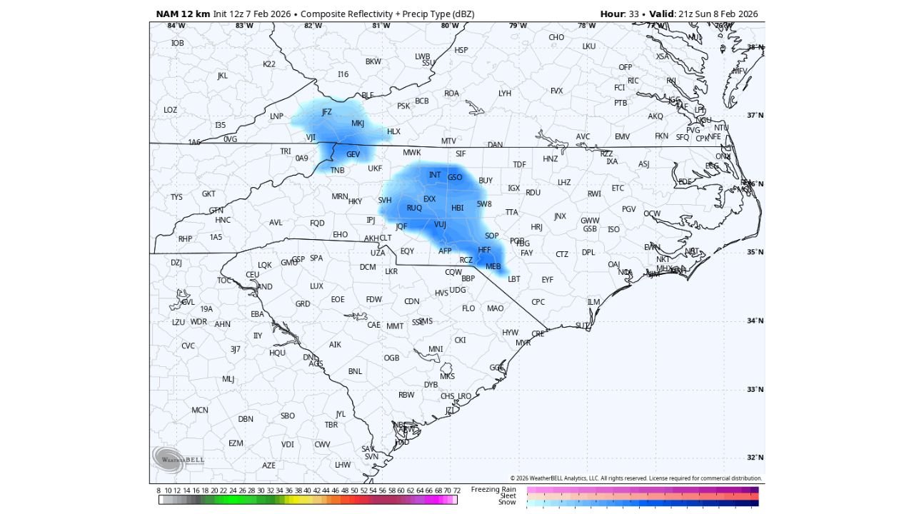
Latest high-resolution guidance shows a narrow band of snow showers developing as colder air filters in behind a passing front. This system lacks deep moisture and strong surface development, but it does feature enough lift and cold air aloft to squeeze out snow as it moves southeast.
The snow showers are expected to drop in from the northwest, affecting parts of western and central North Carolina before weakening later in the afternoon.
Areas Most Likely to See Snow
Based on the current data, the best chance for snow includes:
- The North Carolina foothills
- Portions of the central Piedmont
- Isolated areas eastward into central counties, depending on how far the band holds together
Coverage is expected to be scattered, meaning not everyone will see snow, but some locations could briefly experience moderate bursts.
How Much Snow Are We Talking About?
At this time, significant accumulation is not expected. However:
- A quick coating is possible in spots
- Snow would mainly stick to grassy areas, elevated surfaces, and colder ground
- Road impacts should be minimal due to daytime timing and marginal surface temperatures
Any snow showers would likely last a few hours at most before tapering off.
Timing: When to Watch
- Late morning into early afternoon Sunday is the main window
- Snow showers should diminish as the system moves southeast and weakens
Bottom Line for Cabarrus County and Nearby Areas
This is a low-end but real snow chance, especially for areas that catch a stronger shower. While this is not a setup for major travel problems or widespread disruption, it’s enough of a signal that residents should be aware — particularly if you’re out during the midday hours.
At this point in the season, North Carolinians are seasoned pros when it comes to surprise snowflakes. No need to panic — just stay informed and enjoy the brief wintry moment if it shows up.
CabarrusWeekly.com will continue to monitor updates and provide any changes if the snow potential increases or shifts.