Missouri and Iowa Triple Point Setup Triggers Strong Storm Development With Supercell Potential Before Storms Merge Across Midwest
MISSOURI AND IOWA — A dynamic spring weather setup is taking shape across the central United States, where a classic “triple point” configuration in northwest Missouri and southwest Iowa is expected to act as the focal point for storm development today and tonight.
Triple Point Zone Becomes Storm Initiation Hotspot
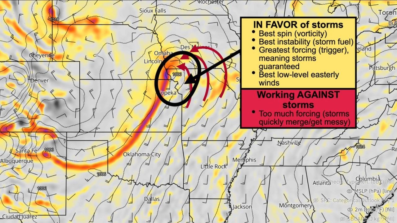
The region where a warm front, cold front, and low-pressure system intersect — known as the triple point — is positioned near northwest Missouri into southwest Iowa, creating an environment highly favorable for storm formation.
This zone provides strong atmospheric forcing, meaning rising air is enhanced, helping storms develop quickly and efficiently. Areas near Kansas City, northern Missouri, and into southern Iowa are most likely to see storms initiate in this zone.
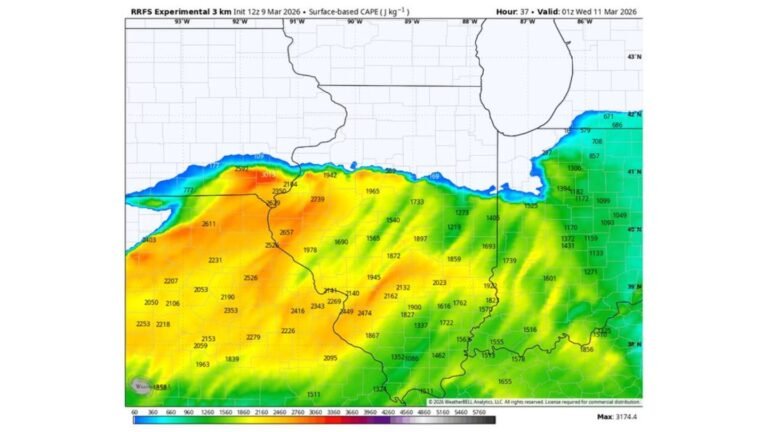
Ingredients Support Strong to Potentially Severe Storms
Forecast analysis highlights several key ingredients aligning over this region. There is ample instability (storm fuel), strong wind dynamics, and enhanced spin in the atmosphere, all of which support organized storm structures.
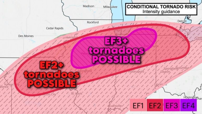
These conditions suggest that initial storms may take on supercell characteristics, capable of producing stronger impacts such as gusty winds, hail, and localized intense rainfall.
Storms May Quickly Merge Into Clusters
Despite the favorable setup for organized storms, one limiting factor stands out — storms are expected to merge quickly into larger clusters or lines.
As forcing increases across the region, individual storms may lose their isolated structure and become more widespread. This transition typically leads to messier storm modes, where the threat shifts from isolated severe storms to broader areas of heavy rain and gusty winds.
Cold Front Drives Activity Eastward
A cold front extending southward through Kansas and Oklahoma will act as the primary driver pushing storms eastward. As storms develop near the triple point, they are expected to expand and track east into Missouri, Illinois, and surrounding Midwest states through the evening and overnight hours.
Cities including Kansas City, Des Moines, and areas toward St. Louis may see rounds of storms as the system evolves, with activity becoming more widespread over time.
Balancing Factors Shape the Overall Threat
While the setup includes some of the strongest ingredients for storm development, there are also factors working against a more intense outbreak.
The same strong forcing that helps storms develop also causes them to merge quickly, reducing the window for long-lived, isolated severe storms. This creates a scenario where storms are likely guaranteed, but their structure becomes less organized as the event progresses.
A Classic Spring Pattern With Rapid Changes
This setup reflects a typical springtime pattern across the Plains and Midwest, where rapid changes in storm structure and intensity can occur over short distances and timeframes.
Residents in Missouri, Iowa, Kansas, and nearby states should remain alert as storms develop, especially during the late afternoon and evening when conditions are most favorable.
As storms begin to develop near the triple point and expand across the region, share your local conditions with CabarrusWeekly.com to help keep others informed during this evolving weather situation.