Missouri Illinois Indiana Ohio Facing Late-Week Severe Storm Threat With Hail Wind and Overnight Tornado Risk
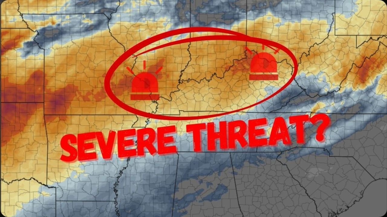
OHIO VALLEY — A new round of severe weather is expected to develop late this week across parts of Missouri, Illinois, Indiana, and Ohio, as an approaching system brings the potential for hail, damaging winds, and even isolated tornadoes—especially during the overnight hours.
After a relatively quieter stretch, the pattern is shifting again, signaling a renewed risk of active and potentially dangerous weather across the region.
Developing System Sets the Stage for Severe Weather
Forecast data shows a trough moving into the central United States, which will:
- Interact with a moist and unstable air mass already in place
- Combine with increasing wind energy aloft
- Create favorable conditions for storm development across the Ohio Valley
This setup is typical of early spring severe weather events, where timing and storm organization will play a critical role.
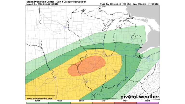
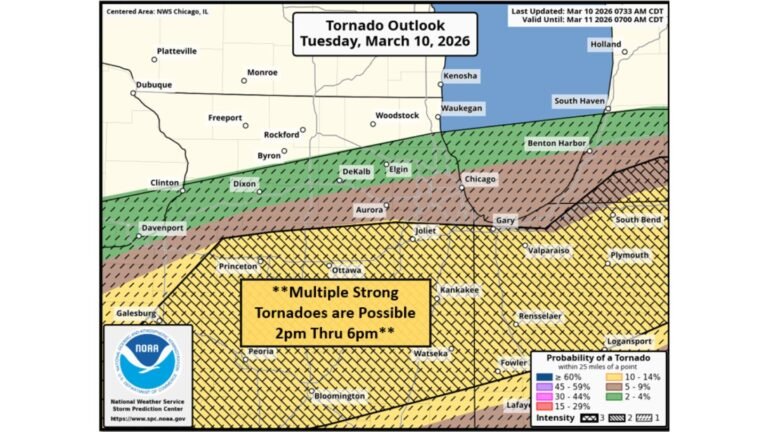
Core Risk Zone Extends From Missouri to Ohio
The area of concern stretches across multiple states, including:
- Missouri
- Illinois
- Indiana
- Ohio
This corridor shows the strongest signal for storm development, with conditions supportive of organized thunderstorms capable of producing severe impacts.
Main Threats Include Hail and Damaging Winds
As storms develop along the system, the primary hazards are expected to be:
- Large hail, especially with stronger storm cores
- Damaging wind gusts, capable of causing localized structural and tree damage
These threats could become more widespread if storms grow into clusters or lines.
Isolated Tornado Risk Cannot Be Ruled Out
While not expected to be the dominant threat, there is still:
- Potential for isolated tornadoes, particularly with stronger, rotating storms
- Increased concern during overnight hours, when visibility is reduced
Nighttime severe weather adds an extra layer of danger, as warnings may be harder to see and respond to quickly.
Timing Suggests Overnight Storm Risk
One of the key concerns with this setup is timing:
- Storms may develop in the evening and continue into the overnight period
- This increases risks for sleeping residents who may not receive alerts immediately
Residents are encouraged to ensure they have multiple ways to receive warnings, including weather alerts and emergency notifications.
Why This Pattern Is Concerning
The combination of:
- Strong upper-level dynamics
- Increasing moisture
- Favorable wind shear
suggests that storms could intensify quickly once they form, leading to pockets of severe weather across the region.
What Residents Should Do Now
People across Missouri, Illinois, Indiana, and Ohio should begin preparing by:
- Reviewing severe weather safety plans
- Ensuring weather alerts are enabled overnight
- Identifying safe shelter locations in advance
Preparation is especially important given the overnight timing of the potential threat.
Final Outlook
As the week progresses, confidence is increasing that parts of the Ohio Valley will see another round of severe weather, with the greatest concern focused on hail, wind damage, and isolated tornado potential.
While exact details will continue to evolve, the setup clearly points to a potentially active and impactful late-week weather event across Missouri, Illinois, Indiana, and Ohio.
Stay with CabarrusWeekly.com for the latest updates as this developing severe weather threat becomes clearer.