Nebraska and Iowa See Stunning 50-Degree Temperature Crash as Cold Front Ends Record Heat Across Central Plains
NEBRASKA, IOWA — A dramatic weather reversal is unfolding across the Central Plains as a powerful cold front has abruptly ended record-breaking March heat, sending temperatures crashing by nearly 50 degrees in just 24 hours.
After days of unseasonable warmth that pushed readings into the 90s across parts of the Plains, a surge of cold air has now taken over, dropping temperatures into the 40s and even 30s in some areas.
From Summer-Like Heat to Late-Winter Chill in Hours
The shift has been nothing short of extreme:
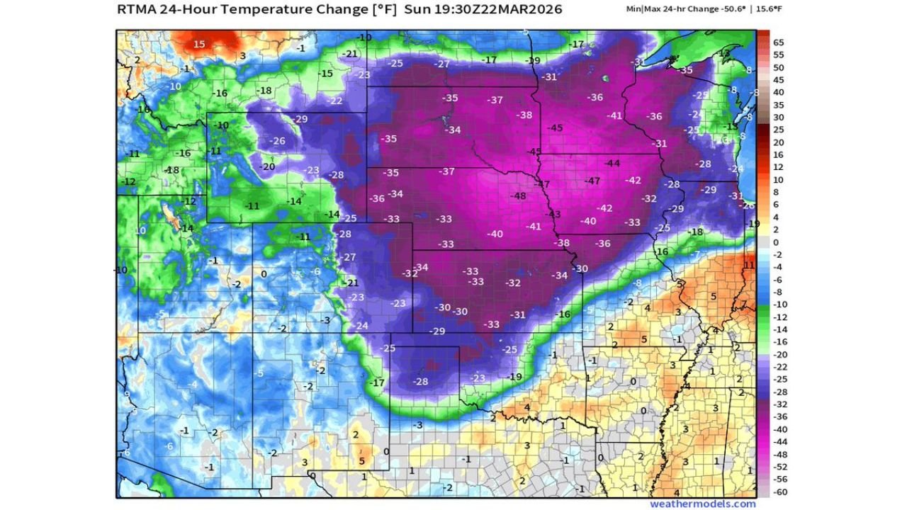
- Nebraska and Iowa saw some of the most dramatic changes
- Temperatures fell from the low to mid-90s down into the 40s
- Widespread drops of 30 to nearly 50 degrees were recorded
This kind of rapid transition highlights the power of strong March cold fronts, especially when they collide with unusually warm air masses.
Cold Front Sweeps South and East
The leading edge of the colder air mass surged southward and eastward across the Plains, creating a sharp boundary between:
- Cold air spilling in from the north and northwest
- Lingering heat across the southern Plains and Mississippi Valley
Behind the front:
- Much of Nebraska, Iowa, South Dakota, and Minnesota dropped into the 30s and 40s
- Winds shifted, bringing in a much cooler and drier air mass
Ahead of the front:
- Areas like Missouri, Arkansas, and parts of the Deep South remained in the 80s and 90s
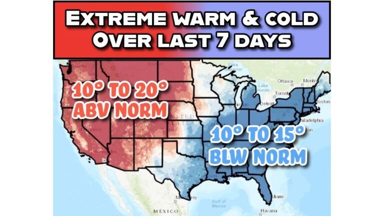
Temperature Gradient Highlights the Clash of Air Masses
Weather maps show a striking contrast across the region:
- Northern Plains: Chilly 30s and 40s
- Central Plains: Rapid cooling underway
- Southern Plains: Still holding onto summer-like heat
This sharp gradient is a classic setup during transitional seasons, where strong fronts can create huge temperature differences over short distances.
Why the Temperature Drop Was So Extreme
Several factors contributed to this dramatic cooldown:
- A strong cold front with deep northern air support
- Pre-existing record warmth across the Plains
- Clear skies and dry air behind the front allowing rapid cooling
When extremely warm air is in place ahead of a front, the eventual cooldown often feels even more intense.
Impacts Felt Across the Region
The sudden change is already being felt across multiple states:
- Residents went from short sleeves to winter jackets within hours
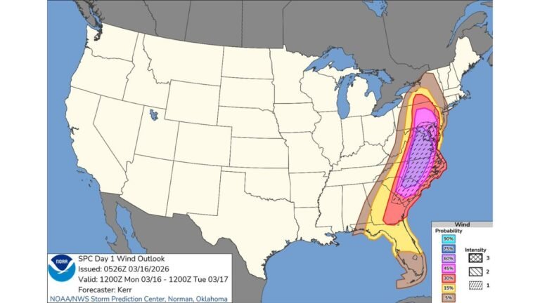
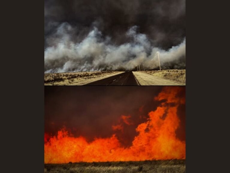
- Increased fire danger earlier in the day quickly shifted to cooler, calmer conditions
- Potential for frost or near-freezing temperatures overnight in some northern areas
Travel and daily routines may also be affected as people adjust to the rapid change.
March’s Volatility on Full Display
This event is a perfect example of how unpredictable March weather can be across the United States:
- Record heat one day
- Near winter-like chill the next
Such swings are especially common in the Central Plains, where cold northern air and warm southern air frequently collide.
What Comes Next
Looking ahead:
- Cooler air will remain in place across the northern and central Plains for the next couple of days
- The cold air mass will gradually shift eastward
- Warmer conditions may begin to return later in the week as the pattern resets
Final Outlook
A powerful cold front has delivered one of the most dramatic temperature swings of the season across Nebraska and Iowa, bringing a sudden end to record March heat and reminding residents just how quickly conditions can change this time of year.
Stay tuned to CabarrusWeekly.com for more real-time weather updates and regional forecasts as this active spring pattern continues to evolve.