New England Storm Resembles Historic Blizzard Pattern as 500mb Setup Brings Strong Winds, Bitter Cold, and Blizzard-Like Conditions
NEW ENGLAND — A formidable winter storm is taking shape across New England, with atmospheric signals pointing to a high-impact event marked by strong winds, bitter cold, and blizzard-like conditions developing from tomorrow into tomorrow night.
500mb Pattern Raises Red Flags Across New England
Meteorological data shows the storm evolving under a 500mb atmospheric setup similar in structure to the historic Blizzard of 1978, a system remembered for its extreme impacts across the Northeast. While this current system is projected to dig slightly farther west than the 1978 benchmark, the overall pattern remains concerning for New England.
Upper-level height anomalies indicate strong blocking and deep troughing, a combination that supports rapid intensification, tightening pressure gradients, and sustained high winds as the storm matures.
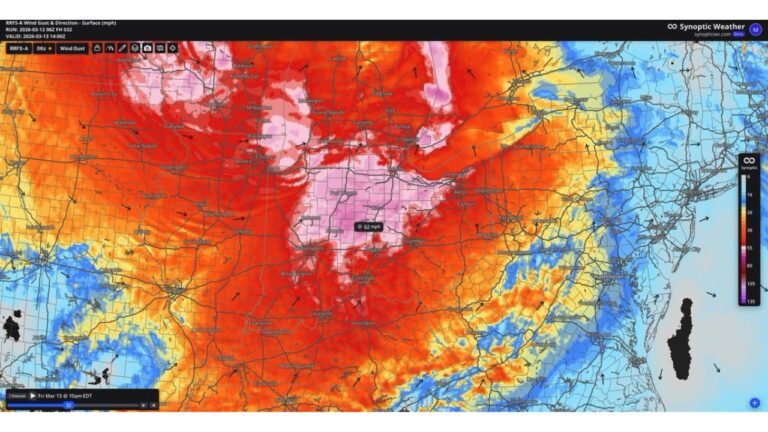
Strong Winds and Bitter Cold Combine for Dangerous Conditions
As the system strengthens, strong to potentially damaging winds are expected across much of New England, particularly along the coast and higher terrain. These winds will coincide with an influx of bitterly cold air, driving wind chills to dangerous levels.
The combination of falling snow, blowing snow, and sharply reduced visibility may result in blizzard-like conditions, even in areas where snowfall totals alone may not meet official blizzard criteria.
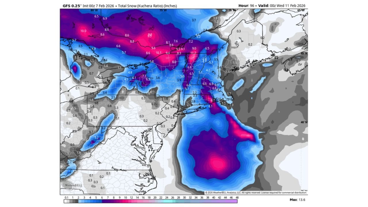
Snowfall Focused in Northern and Coastal Areas
Snowfall guidance highlights significant accumulations across northern New England and interior sections, with coastal areas also facing periods of heavy snow depending on storm track and thermal profiles. Model data suggests snowfall bands capable of producing moderate to locally heavy totals, especially where mesoscale features enhance lift.
As the storm deepens offshore, ocean-enhanced moisture may further intensify snowfall rates near the coast.
Travel and Infrastructure Impacts Likely
With strong winds, heavy snow, and extreme cold occurring simultaneously, hazardous travel conditions are likely to develop quickly. Whiteout conditions may occur at times, particularly during the overnight and early morning hours as winds peak.
Cold temperatures following the storm will also increase the risk of ice-covered roads, frozen infrastructure, and prolonged recovery efforts in the hardest-hit areas.
Timing and Overall Confidence
Confidence continues to increase that New England will experience a high-impact winter storm, with the most severe conditions expected from late tomorrow through tomorrow night. While exact snowfall totals and wind maxima may still shift, the overall signal supports dangerous winter weather across the region.
Residents are urged to closely monitor updates as the storm approaches and to prepare for rapidly deteriorating conditions.
If you’re in New England, we want to hear from you. Share what you’re seeing and how conditions are developing in your area by joining the conversation at CabarrusWeekly.com.