North Carolina and Mid-Atlantic Face Dangerous Severe Weather Threat Today as 60 Million From Florida to New York Enter Storm Risk Zone
NORTH CAROLINA — A powerful line of severe weather is expected to move along the eastern United States today, placing more than 60 million people from Florida to New York under a Level 2 or higher risk for severe storms, according to national storm outlook data.
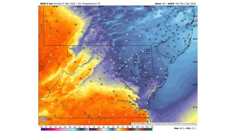
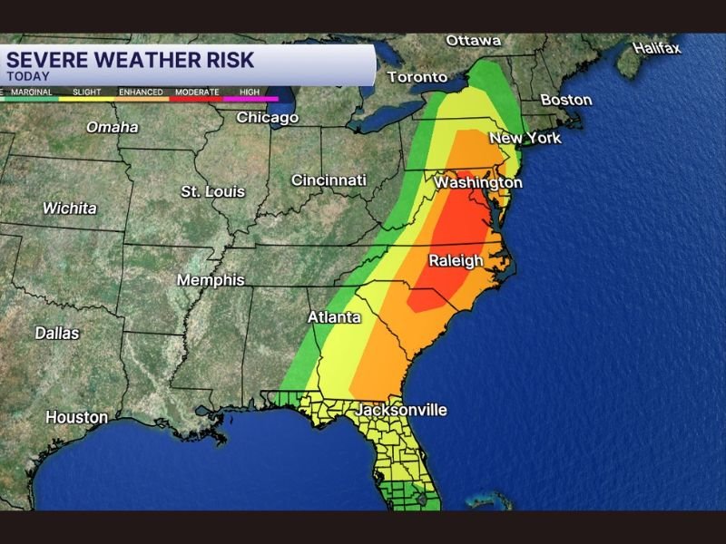
The most dangerous conditions are expected across North Carolina and parts of Virginia, where the storm outlook highlights a moderate risk zone capable of producing tornadoes, destructive wind gusts, and large hail as storms intensify during the afternoon and evening hours. Cities such as Raleigh, Charlotte, Richmond, Washington DC, and New York fall along the corridor where thunderstorms could rapidly strengthen.
North Carolina Sits Near the Core of the Severe Storm Threat
Weather maps show the highest severe weather risk centered across central and eastern North Carolina, including the Raleigh area and surrounding regions. This places communities across the state, including Cabarrus County and the greater Charlotte region, within a corridor where storms could develop quickly and produce dangerous weather.
The risk area then extends north through Virginia and Maryland toward Washington DC, before reaching parts of Pennsylvania and New York later in the day. Meteorologists warn that storms moving through the Carolinas may have the potential to rotate and produce tornadoes, especially during the peak heating hours of the afternoon.
Millions Across the East Coast in the Storm Path
The severe weather zone stretches along much of the East Coast, affecting a wide swath of states including:
- Florida
- Georgia
- South Carolina
- North Carolina
- Virginia
- Maryland
- Pennsylvania
- New York
Major cities within the broader risk area include Atlanta, Raleigh, Washington DC, and New York City, all of which could see thunderstorms capable of producing damaging winds.
Because of the large geographic area involved, the severe weather event could impact transportation, outdoor activities, and evening commutes across multiple states.
Storms Expected to Strengthen Through the Afternoon
Forecasters indicate the most intense storms may begin forming across the Carolinas and Virginia during the afternoon, when atmospheric instability increases.
As the system pushes north along the East Coast, thunderstorms may organize into stronger clusters capable of producing damaging wind gusts and isolated tornadoes. Some storms may also produce large hail, particularly in areas where stronger updrafts develop.
Florida Faces Lower but Still Notable Storm Potential
Although the highest risk area lies farther north, parts of northern Florida and Jacksonville remain within the broader severe weather zone. Storms in this region may still produce strong winds and heavy rainfall, though the overall threat appears lower than in the Carolinas and Mid-Atlantic states.
A Large East Coast Severe Weather Setup
The current storm pattern represents a large-scale weather system affecting the eastern United States, with thunderstorms expected to track from the Southeast toward the Northeast through the day.
With tens of millions of people located within the storm corridor, forecasters are urging residents to stay alert for changing weather conditions and possible warnings as storms develop. Stay with CabarrusWeekly.com for continuing updates on severe weather affecting North Carolina and the East Coast.