North Carolina Faces Multi-Day Soaking Rain Event Through March 8–11 as Repeated Storm Rounds Raise Localized Flood Concerns
NORTH CAROLINA — A prolonged stretch of wet weather is setting up across the Southeast, with rounds of rain and thunderstorms expected from Tuesday, March 3 through at least March 8, and potentially lingering into March 11, according to the latest blended model projections.
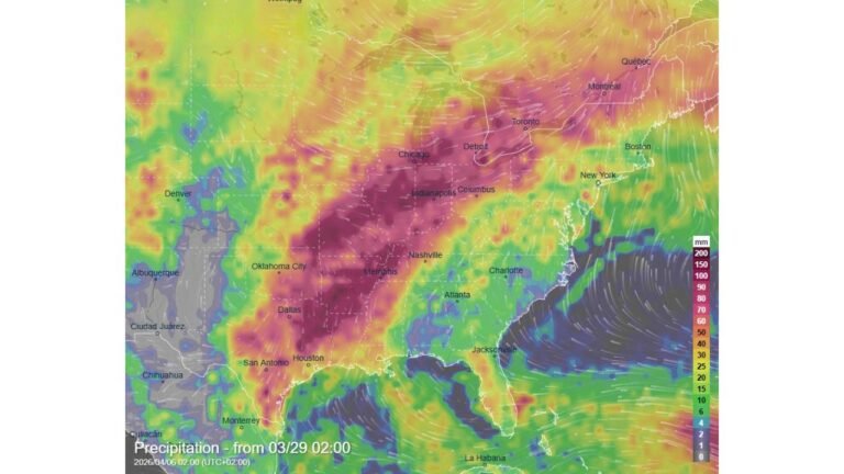
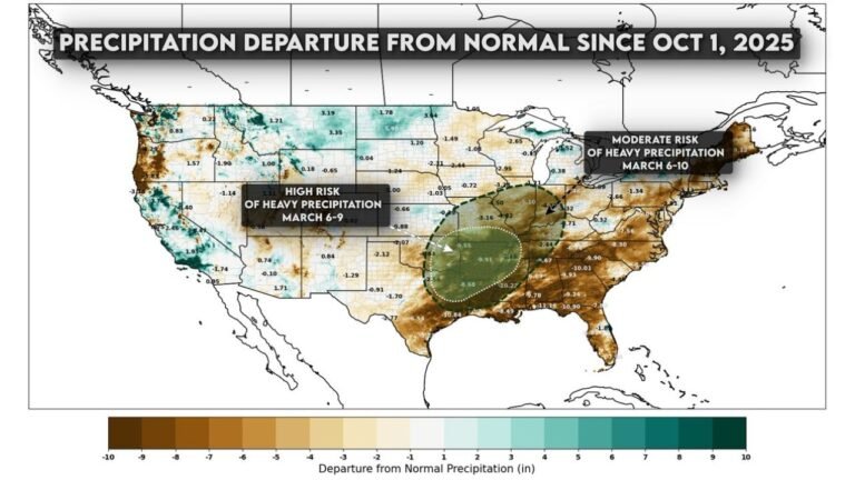
Forecast guidance shows a broad swath of significant rainfall totals developing across the Mid-South and extending east into the Carolinas as multiple systems track across the region.
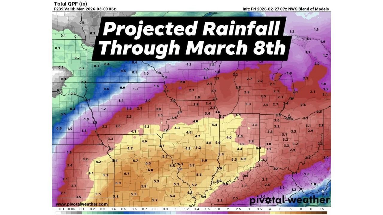
Projected Rainfall Totals Through March 8
Latest total QPF projections through early March 9 indicate widespread 3 to 4 inches of rainfall across much of North Carolina, with some pockets potentially exceeding that depending on where heavier storm bands repeatedly track.
Across the broader region, totals increase dramatically to the west. Parts of Arkansas, Mississippi, and western Tennessee are forecast to receive 5 to 7 inches of rain, with locally higher amounts embedded in heavier thunderstorm clusters. Those heavier totals gradually taper eastward into the Carolinas but still support a wet and unsettled pattern.
For North Carolina specifically, model blends suggest:
Central and southern counties: Around 3 to 4 inches
Western portions of the state: Potentially 2 to 3 inches, depending on storm placement
Eastern North Carolina: Generally 2 to 3+ inches, with localized higher totals possible if stronger storms develop
While these numbers may fluctuate in coming updates, the signal for a widespread soaking rain event remains consistent.
Multiple Rounds of Showers and Thunderstorms
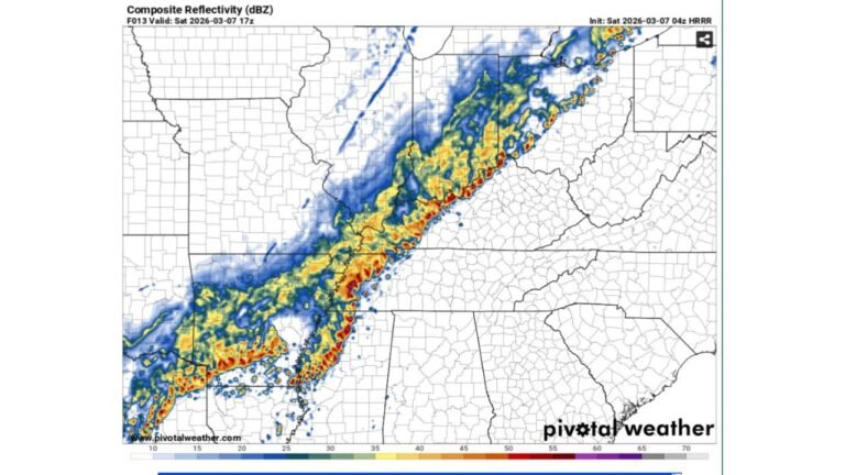
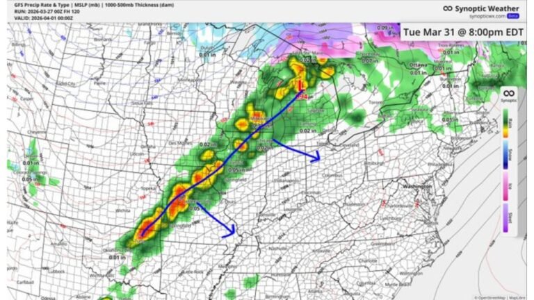
This will not be a single storm system. Instead, forecasters are tracking repeated waves of moisture moving northeast along a persistent storm track, bringing rounds of showers and thunderstorms over several days.
The pattern suggests:
Rain beginning Tuesday, March 3
Periods of heavier showers and thunderstorms mid-week
Additional waves continuing through March 8
Some guidance even hints at unsettled conditions lingering into March 11, especially if the upper-level pattern slows.
If thunderstorms become stronger during peak heating hours, rainfall rates could briefly intensify. That would increase the risk for localized ponding or minor flooding in low-lying and poor drainage areas.
Flood Risk: Low for Now, But Not Zero
At this time, the overall flood threat appears low to moderate, largely because the rainfall is expected to be spread over multiple days rather than falling all at once.
However, several factors could change that outlook:
Training thunderstorms, where storms repeatedly move over the same area
Heavier downpours embedded within larger rain shields
Saturated ground conditions developing later in the week
If any of those elements align, localized flooding issues could develop quickly, particularly in urban areas or along small creeks and streams.
Residents in Cabarrus County and surrounding communities should monitor forecasts closely as rainfall totals become more refined.
What This Means for Cabarrus County
For the Cabarrus County area, the expectation is for several periods of rain between March 3 and March 8, with total amounts likely in the 3 to 4 inch range, possibly higher in isolated spots.
That amount of rain over a five- to seven-day period can lead to:
Water pooling on roadways
Reduced visibility during heavier showers
Minor creek rises
Muddy ground conditions
While this does not currently look like a major flooding event, the extended duration increases the importance of staying weather aware, especially if stronger thunderstorms develop mid-week.
Looking Ahead
The broader weather pattern across the central and eastern United States supports continued storm systems tracking through the region. The Southeast remains positioned along an active corridor of Gulf moisture feed, fueling repeated rainfall chances.
Forecast updates later this week will determine whether rainfall totals trend higher or remain steady. Even small shifts in storm tracks could adjust local totals significantly.
If you experience heavy rain, flooding, or strong thunderstorms in your area, share your reports and photos with us at CabarrusWeekly.com so we can keep the community informed. Stay weather aware as this extended rain event unfolds.