North Carolina, Virginia and Washington DC Region Placed Under Rare Day 3 Enhanced Risk as Damaging Winds and Tornado Threat Build for Monday
NORTH CAROLINA — A rare Day 3 Enhanced Risk has already been issued for parts of the Mid-Atlantic, including Virginia and the Washington, D.C. region, signaling a potentially significant severe weather event heading into Monday.
Enhanced Risk areas this far out are not common for the D.C. region, underscoring growing concern about the strength of this system. While uncertainty remains regarding exact storm evolution, confidence is increasing that damaging winds will be a widespread hazard, with at least a few tornadoes possible.
Squall Line Likely the Main Threat
Current projections suggest the primary hazard for the D.C. metro area and much of Virginia will be tied to an organized squall line advancing eastward along a strong cold front.
This line is expected to produce:
- Widespread damaging wind gusts
- Embedded tornadoes
- Intense, fast-moving storm segments
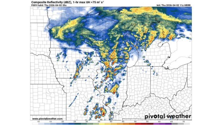
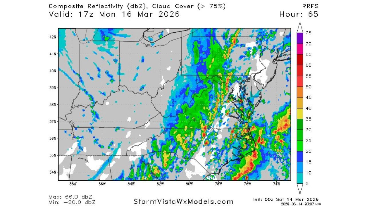
Forecast model reflectivity shows a well-defined line of storms sweeping from the Carolinas through Virginia and into the Mid-Atlantic Monday afternoon and evening.
For North Carolina, particularly central and eastern portions of the state, the timing and organization of this line will be critical.
Tornado Risk Highest Just South of DC
At this time, the most favorable forcing for stronger tornado development appears to be just south of the immediate D.C. region.
The Storm Prediction Center discussion highlights:
- Model differences regarding the speed and position of the cold front
- Questions about how much instability can build ahead of the line
- The potential for strong ascent in a highly sheared environment
Regardless of those uncertainties, damaging winds over a large area appear likely. At least a few tornadoes are possible, and if destabilization is stronger than expected, one or two strong tornadoes could occur — especially across parts of the Carolinas and Virginia during the late afternoon.
North Carolina in a Key Transition Zone
North Carolina sits in a critical corridor between the deeper instability to the south and the stronger forcing lifting northward.
For Cabarrus County and surrounding areas, the main concern remains:
- A fast-moving squall line
- Damaging straight-line winds
- Quick spin-up tornado potential within the line
If the warm sector remains intact long enough and instability is not disrupted by early storms, the tornado risk could trend higher. However, confidence in that higher-end scenario remains moderate at this stage.
Virginia and the DC Metro Under the Microscope
The Enhanced Risk covering much of Virginia and into the D.C. metro area is notable.
Forecasters rarely issue this level of risk three days in advance unless the large-scale setup strongly supports organized severe weather. The combination of strong wind fields aloft, moisture return and frontal forcing makes this a setup that demands close monitoring.
That said, subtle shifts in the cold front’s timing or cloud cover could alter storm intensity and placement.
Bottom Line
North Carolina, Virginia and the Washington, D.C. region are under a rare Day 3 Enhanced Risk for Monday, with widespread damaging winds expected and at least a few tornadoes possible.
While the highest tornado potential may currently appear just south of D.C., even the Mid-Atlantic could see embedded tornadoes within a powerful squall line.
Residents across the Carolinas and Mid-Atlantic should stay alert through the weekend as forecast details become clearer. CabarrusWeekly.com will continue providing updates as new guidance refines the threat.