Ohio, Kentucky, Indiana and West Virginia Brace for Late-Week Rain as Ohio River Basin Sees Minor Flood Risk After Snow Showers
OHIO RIVER VALLEY — Snow showers through Monday will give way to a quieter Tuesday before a stronger weather system arrives Thursday, bringing the potential for widespread rainfall and a small risk of minor flooding across parts of Ohio, Kentucky, Indiana and West Virginia.
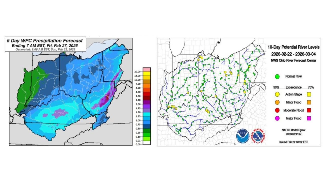
The latest Ohio River Forecast Center water outlook highlights a shifting pattern as the region transitions from light snow to heavier rain later in the week.
Snow Showers Early, Calm Tuesday Before Thursday System
Scattered snow showers are forecast across portions of the Ohio Valley through Monday. Conditions are expected to briefly quiet down Tuesday, offering a short break before the next disturbance strengthens.
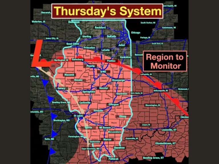
By Thursday, a potent storm system is projected to move through the region, delivering rainfall totals that could exceed one inch, especially across the southern portion of the Ohio River Basin.
Areas south of the Ohio River, including parts of Kentucky and southern Ohio, appear most favored for higher rainfall amounts based on current projections.
Rivers Currently Receding — But That Could Change
River gauges across much of the basin currently show conditions in recession, meaning water levels are slowly falling after previous events. The exception remains the larger waterways, particularly the Ohio River itself, which is still running elevated in spots.
The incoming rainfall later this week is expected to reverse some of that recession trend, pushing river levels upward again.
Minor Flood Risk Less Than 30 Percent
Despite the expected rainfall, forecasters indicate only a modest risk of flooding, with probabilities for minor flooding staying below 30 percent at this time.
The 10-day river outlook suggests most river points remain in the normal flow category, with scattered locations potentially reaching action stage or minor flood stage depending on how rainfall totals materialize.
Moderate or major flooding is not currently indicated in the outlook, but localized issues cannot be ruled out in heavier rain bands.
Southern Basin Most Vulnerable
The precipitation forecast graphic shows the highest rainfall totals centered across the southern half of the Ohio River drainage basin, affecting portions of Kentucky, southern Indiana, southern Ohio and West Virginia.
If rainfall exceeds projections in those areas, smaller streams and low-lying roadways would be most susceptible to minor flooding.
What to Watch Through the Weekend
Key factors to monitor include:
- Exact placement of the heaviest rain bands
- Whether totals exceed the one-inch threshold
- How quickly rivers respond following Thursday’s system
With soil conditions already damp in some locations, additional rainfall could lead to quicker runoff into tributaries.
Residents along the Ohio River and its tributaries should stay alert for updated river forecasts as the system approaches.
For continuing updates on evolving weather and river conditions across the Ohio River Valley, visit CabarrusWeekly.com and share reports from your community.