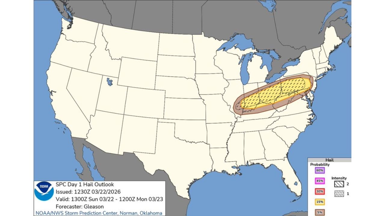
Pennsylvania, Ohio, West Virginia Under Large Hail Threat as Supercells Develop Across Ohio Valley Today
PENNSYLVANIA — A developing severe weather setup is targeting parts of the Ohio Valley and Mid-Atlantic today, with the greatest concern centered on large hail and strong storms, especially across Pennsylvania where conditions appear most favorable.
Forecasters indicate that while the setup is somewhat conditional, the ingredients are in place for storms to rapidly intensify if they are able to develop and organize.
Pennsylvania Emerges as the Core Risk Zone
The highest confidence for severe weather today is across Pennsylvania, where:
- Stronger convective signals are present
- Atmospheric instability is sufficient for storm development
- Model guidance shows multiple supercells forming and expanding quickly
These storms could produce large to very large hail, making Pennsylvania the primary area of concern.
Ohio Valley Faces Conditional but Notable Risk
Across Ohio and West Virginia, the threat remains more uncertain:
- Storm development will depend on whether storms can initiate and sustain growth
- If storms do form, they could still produce localized severe impacts
This “conditional risk” means some areas may see little activity, while others could experience intense, isolated storms.
Large Hail and Damaging Winds Are Main Threats
The overall threat profile today is focused on:
- Large hail as the dominant hazard
- Damaging wind gusts as storms mature and organize
High-resolution models suggest storms could evolve into organized supercells, capable of producing significant hail cores.
Tornado Risk Remains Limited
Despite the severe setup, the tornado threat appears to be:
- Low and minimal compared to other hazards
- Limited by less favorable low-level dynamics
However, isolated spin-ups cannot be completely ruled out if storm structure becomes more organized.
Radar Trends Suggest Rapid Storm Growth Potential
Short-range model simulations show:
- Storms developing in clusters and lines across the region
- Rapid intensification as they move eastward
- Pockets of stronger cells embedded within broader activity
This supports the idea that once storms form, they could strengthen quickly, increasing the risk of severe hail and wind.
What Residents Should Watch For Today
People across Pennsylvania, Ohio, and West Virginia should stay alert for:
- Sudden development of strong thunderstorms
- Hail large enough to damage vehicles and property
- Gusty winds capable of knocking down branches or causing isolated damage
Because the setup is conditional, conditions may change quickly — making it important to monitor updates throughout the day.
Final Outlook
While not every location will see severe weather, the environment supports targeted pockets of intense storms, especially across Pennsylvania.
If storms are able to fully develop, large hail and damaging winds could become significant hazards across parts of the Ohio Valley and Mid-Atlantic today.
Stay tuned to CabarrusWeekly.com for real-time updates as this evolving severe weather situation unfolds.